Property Record
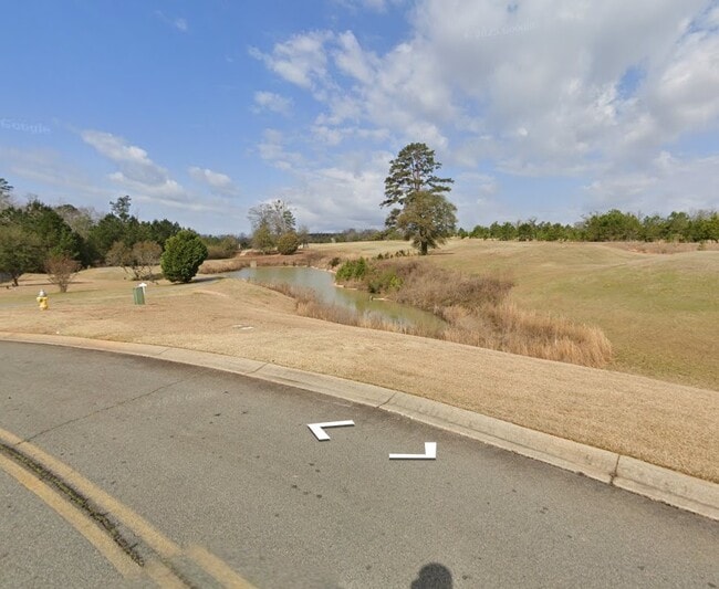
Pebble Beach Dr, Perry, GA 31069


Property Detail
Pebble Beach Dr
0P0530001000
PT PARCEL A 57.185 ACRES 9TH & 10TH LD
Commercialnec
HOUSTON
PUD
Georgia
A Areas with a 1% annual chance of flooding and a 26% chance of flooding over the life of a 30-year mortgage.
57.18 AC
2025
Perry/Warner Robins
2025
Other Market Areas
021206
Warner Robins, GA
6,000 SF
NEARBY LISTINGS FOR SALE OR LEASE
DEMOGRAPHICS near Pebble Beach Dr
1 mile
3 mile
5 mile
2025 Total Population
1,043
11,387
22,506
2030 Population
1,112
12,180
23,962
Pop Growth 2025-2030
+ 6.62%
+ 6.96%
+ 6.47%
Average Age
46
41
40
2025 Total Households
466
4,666
8,782
HH Growth 2025-2030
+ 6.87%
+ 7.12%
+ 6.62%
Median Household Inc
$68,660
$65,419
$72,219
Avg Household Size
2.10
2.30
2.40
2025 Avg HH Vehicles
2.00
2.00
2.00
Median Home Value
$224,590
$203,090
$226,414
Median Year Built
2001
1991
1993
Nearby Places
Map Layers
Map Styles
 Street
 Aerial
Layers
 Traffic
 Biking
Places
Listings with unknown addresses are not visible on the map
- Restaurants
- Banks
- Shops
- Fitness
- Groceries
Nearby Properties
Address
Land Use
TOTAL SIZE
Lot Size
Zoning
Address
Land Use
TOTAL SIZE
Lot Size
Zoning
68,186 SF
559.30 AC
GU
Address
Land Use
TOTAL SIZE
Lot Size
Zoning
525,957 SF
32.75 AC
M2
Address
Land Use
TOTAL SIZE
Lot Size
Zoning
Address
Land Use
TOTAL SIZE
Lot Size
Zoning
158,407 SF
218.84 AC
M2
Address
Land Use
TOTAL SIZE
Lot Size
Zoning
262,500 SF
20 AC
GU
Address
Land Use
TOTAL SIZE
Lot Size
Zoning
120,000 SF
20 AC
M1
Address
Land Use
TOTAL SIZE
Lot Size
Zoning
54,262 SF
38.29 AC
M1
Address
Land Use
TOTAL SIZE
Lot Size
Zoning
151,845 SF
17.55 AC
C2
Address
Land Use
TOTAL SIZE
Lot Size
Zoning
65,040 SF
35.91 AC
M2
Address
Land Use
TOTAL SIZE
Lot Size
Zoning
439.32 AC
M2
Address
Land Use
TOTAL SIZE
Lot Size
Zoning
2,568 SF
10.30 AC
RM-2
Address
Land Use
TOTAL SIZE
Lot Size
Zoning
49,947 SF
4.03 AC
C2
Address
Land Use
TOTAL SIZE
Lot Size
Zoning
439.32 AC
M2
Address
Land Use
TOTAL SIZE
Lot Size
Zoning
19,125 SF
27.94 AC
R1
Address
Land Use
TOTAL SIZE
Lot Size
Zoning
158,300 SF
30 AC
GU
Address
Land Use
TOTAL SIZE
Lot Size
Zoning
442.42 AC
M2
Address
Land Use
TOTAL SIZE
Lot Size
Zoning
52,336 SF
3.07 AC
C1
Address
Land Use
TOTAL SIZE
Lot Size
Zoning
54,120 SF
8.18 AC
C1
Address
Land Use
TOTAL SIZE
Lot Size
Zoning
54,120 SF
8.18 AC
C1
Address
Land Use
TOTAL SIZE
Lot Size
Zoning
44,292 SF
9.70 AC
FBR
Address
Land Use
TOTAL SIZE
Lot Size
Zoning
49,331 SF
5.56 AC
C2
Address
Land Use
TOTAL SIZE
Lot Size
Zoning
78,800 SF
7.93 AC
C2
Address
Land Use
TOTAL SIZE
Lot Size
Zoning
98,871 SF
8.09 AC
C2
Address
Land Use
TOTAL SIZE
Lot Size
Zoning
134,145 SF
3.08 AC
M2
Address
Land Use
TOTAL SIZE
Lot Size
Zoning
41,985 SF
1.65 AC
C1/C2
Address
Land Use
TOTAL SIZE
Lot Size
Zoning
51,780 SF
2.50 AC
C1
Address
Land Use
TOTAL SIZE
Lot Size
Zoning
68,762 SF
2 AC
C2
Address
Land Use
TOTAL SIZE
Lot Size
Zoning
134,145 SF
3.08 AC
M2
Address
Land Use
TOTAL SIZE
Lot Size
Zoning
4,052 SF
15.17 AC
RM-2
Address
Land Use
TOTAL SIZE
Lot Size
Zoning
218.84 AC
M2
The World's #1 Commercial Real Estate Marketplace
Connect with us
© 2026 CoStar Group
The information above has been obtained from sources believed reliable. While we do not doubt its accuracy we have not verified it and make no guarantee, warranty or representation about it. It is your responsibility to independently confirm its accuracy and completeness. Any projections, opinions, assumptions, or estimates used are for example only and do not represent the current or future performance of the property. The value of this transaction to you depends on tax and other factors which should be evaluated by your tax, financial, and legal advisors. You and your advisors should conduct a careful, independent investigation of the property to determine to your satisfaction the suitability of the property for your needs.