Property Record
2409 Penfield Rd, Penfield, NY 14526
NEARBY LISTINGS FOR SALE OR LEASE
Property Detail
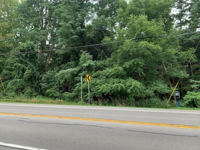
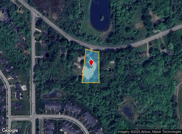
2409 Penfield Rd
Rochester, NY
Thomas Reynolds Subdivision
264200-140-020-0001-052-000
0014-13-04
Sfr
Monroe
X
New York
36055C0243G
52.000
2025
1 AC
2024
Southeast
011505
Rochester
2,154 SF
DEMOGRAPHICS near 2409 Penfield Rd
1 mile
3 mile
5 mile
2024 Total Population
4,436
38,389
90,121
2029 Population
4,374
37,847
88,873
Pop Growth 2024-2029
(1.40%)
(1.41%)
(1.38%)
Average Age
43
44
44
2024 Total Households
1,639
15,887
37,609
HH Growth 2024-2029
(1.59%)
(1.54%)
(1.47%)
Median Household Inc
$107,572
$90,900
$90,114
Avg Household Size
2.60
2.40
2.30
2024 Avg HH Vehicles
2.00
2.00
2.00
Median Home Value
$285,534
$248,822
$243,343
Median Year Built
1986
1978
1975
Nearby Places
Map Layers
Map Styles
 Street
 Aerial
Transit
 Traffic
 Biking
Places
Listings with unknown addresses are not visible on the map
- Restaurants
- Banks
- Shops
- Fitness
- Groceries
PUBLIC TRANSPORTATION
AIRPORT
Frederick Douglass/Greater Rochester International
Drive
Walk
Distance
Frederick Douglass/Greater Rochester International
25 min
14.7 mi
SALE & LEASE HISTORY
LISTING DATE
SALE/LEASE

Dec 01, 2020
For Sale
Nearby Properties
Address
Land Use
TOTAL SIZE
Lot Size
Zoning
Address
Land Use
TOTAL SIZE
Lot Size
Zoning
640 SF
84.10 AC
RA-2
Address
Land Use
TOTAL SIZE
Lot Size
Zoning
3,752 SF
36.50 AC
MR
Address
Land Use
TOTAL SIZE
Lot Size
Zoning
146,539 SF
18.59 AC
RES A
Address
Land Use
TOTAL SIZE
Lot Size
Zoning
251,359 SF
46.83 AC
GB
Address
Land Use
TOTAL SIZE
Lot Size
Zoning
364,800 SF
28.40 AC
R-1-15
Address
Land Use
TOTAL SIZE
Lot Size
Zoning
65,750 SF
42.60 AC
APT
Address
Land Use
TOTAL SIZE
Lot Size
Zoning
193,120 SF
10.83 AC
INDUSTRIAL
Address
Land Use
TOTAL SIZE
Lot Size
Zoning
105,768 SF
51.10 AC
R-B
Address
Land Use
TOTAL SIZE
Lot Size
Zoning
64,733 SF
10.53 AC
GB
Address
Land Use
TOTAL SIZE
Lot Size
Zoning
74,490 SF
16.20 AC
MIXED USE
Address
Land Use
TOTAL SIZE
Lot Size
Zoning
88,859 SF
82.38 AC
RES B
Address
Land Use
TOTAL SIZE
Lot Size
Zoning
58,632 SF
4.70 AC
MUD
Address
Land Use
TOTAL SIZE
Lot Size
Zoning
4,210 SF
14.85 AC
PDD
Address
Land Use
TOTAL SIZE
Lot Size
Zoning
114,692 SF
27.10 AC
RES B
Address
Land Use
TOTAL SIZE
Lot Size
Zoning
48,582 SF
18.08 AC
APT
Address
Land Use
TOTAL SIZE
Lot Size
Zoning
105,674 SF
9.02 AC
MUD
Address
Land Use
TOTAL SIZE
Lot Size
Zoning
95,800 SF
7.26 AC
MR
Address
Land Use
TOTAL SIZE
Lot Size
Zoning
86,200 SF
4.76 AC
PD
Address
Land Use
TOTAL SIZE
Lot Size
Zoning
123,630 SF
11.72 AC
GB
Address
Land Use
TOTAL SIZE
Lot Size
Zoning
85,838 SF
3.70 AC
R-C
Address
Land Use
TOTAL SIZE
Lot Size
Zoning
36,327 SF
2.24 AC
MUD
Address
Land Use
TOTAL SIZE
Lot Size
Zoning
287,176 SF
22.11 AC
M-1
Address
Land Use
TOTAL SIZE
Lot Size
Zoning
71,551 SF
9.80 AC
R-1-15
Address
Land Use
TOTAL SIZE
Lot Size
Zoning
145,246 SF
13.12 AC
M-1
Address
Land Use
TOTAL SIZE
Lot Size
Zoning
1,856 SF
17 AC
PD
Address
Land Use
TOTAL SIZE
Lot Size
Zoning
4,530 SF
13.42 AC
APT
Address
Land Use
TOTAL SIZE
Lot Size
Zoning
73,161 SF
8.01 AC
FC
Address
Land Use
TOTAL SIZE
Lot Size
Zoning
52,520 SF
8.89 AC
GB
Address
Land Use
TOTAL SIZE
Lot Size
Zoning
6,000 SF
10.75 AC
APT
Address
Land Use
TOTAL SIZE
Lot Size
Zoning
68,443 SF
17.12 AC
R-1-20
The World's #1 Commercial Real Estate Marketplace
Connect with us
© 2026 CoStar Group
The information above has been obtained from sources believed reliable. While we do not doubt its accuracy we have not verified it and make no guarantee, warranty or representation about it. It is your responsibility to independently confirm its accuracy and completeness. Any projections, opinions, assumptions, or estimates used are for example only and do not represent the current or future performance of the property. The value of this transaction to you depends on tax and other factors which should be evaluated by your tax, financial, and legal advisors. You and your advisors should conduct a careful, independent investigation of the property to determine to your satisfaction the suitability of the property for your needs.