Property Record
Peniel Rd, Columbus, NC 28722

This Property Is For Sale
Property Detail
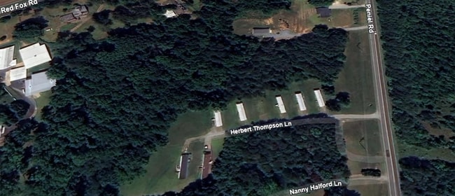
Peniel Rd
P86-60
7.95 AC, 100C 100C COUNTY RURAL
Realpropertynec
POLK
MX
North Carolina
B and X Area of moderate flood hazard, usually the area between the limits of the 100-year and 500-year floods.
7.95 AC
2025
North Carolina West/Cherokee Area
2025
Other Market Areas
920104
NEARBY LISTINGS FOR SALE OR LEASE
DEMOGRAPHICS near Peniel Rd
1 mile
3 mile
5 mile
2025 Total Population
546
4,777
12,189
2030 Population
558
4,892
12,830
Pop Growth 2025-2030
+ 2.20%
+ 2.41%
+ 5.26%
Average Age
49
49
48
2025 Total Households
228
2,061
5,343
HH Growth 2025-2030
+ 2.63%
+ 2.47%
+ 5.33%
Median Household Inc
$71,911
$63,970
$56,455
Avg Household Size
2.30
2.20
2.20
2025 Avg HH Vehicles
2.00
2.00
2.00
Median Home Value
$420,408
$348,076
$306,814
Median Year Built
1991
1990
1985
Nearby Places
Map Layers
Map Styles
 Street
 Aerial
Transit
 Traffic
 Biking
Places
Listings with unknown addresses are not visible on the map
- Restaurants
- Banks
- Shops
- Fitness
- Groceries
PUBLIC TRANSPORTATION
AIRPORT
Asheville Regional
Drive
Walk
Distance
Asheville Regional
40 min
30.5 mi
Greenville Spartanburg International
Drive
Walk
Distance
Greenville Spartanburg International
49 min
37.2 mi
Freight Ports
North Charleston Terminal
Drive
Walk
Distance
North Charleston Terminal
245 min
217.9 mi
Nearby Properties
Address
Land Use
TOTAL SIZE
Lot Size
Zoning
Address
Land Use
TOTAL SIZE
Lot Size
Zoning
68,155 SF
63.56 AC
MX
Address
Land Use
TOTAL SIZE
Lot Size
Zoning
63.34 AC
MX
Address
Land Use
TOTAL SIZE
Lot Size
Zoning
11.67 AC
Address
Land Use
TOTAL SIZE
Lot Size
Zoning
11,382 SF
5.75 AC
M
Address
Land Use
TOTAL SIZE
Lot Size
Zoning
7,703 SF
190.87 AC
RE5
Address
Land Use
TOTAL SIZE
Lot Size
Zoning
6.73 AC
Address
Land Use
TOTAL SIZE
Lot Size
Zoning
2,966 SF
11.53 AC
MX
Address
Land Use
TOTAL SIZE
Lot Size
Zoning
5,442 SF
1.66 AC
M
Address
Land Use
TOTAL SIZE
Lot Size
Zoning
9,745 SF
10.01 AC
Address
Land Use
TOTAL SIZE
Lot Size
Zoning
11,925 SF
1.93 AC
M
Address
Land Use
TOTAL SIZE
Lot Size
Zoning
9,076 SF
1.50 AC
M
Address
Land Use
TOTAL SIZE
Lot Size
Zoning
36,300 SF
6.62 AC
M
Address
Land Use
TOTAL SIZE
Lot Size
Zoning
12.90 AC
Address
Land Use
TOTAL SIZE
Lot Size
Zoning
3.24 AC
M
Address
Land Use
TOTAL SIZE
Lot Size
Zoning
15,980 SF
8.92 AC
MX
Address
Land Use
TOTAL SIZE
Lot Size
Zoning
10,125 SF
2.07 AC
M
Address
Land Use
TOTAL SIZE
Lot Size
Zoning
8.38 AC
Address
Land Use
TOTAL SIZE
Lot Size
Zoning
74,862 SF
7.93 AC
I
Address
Land Use
TOTAL SIZE
Lot Size
Zoning
8,870 SF
0.83 AC
MX
Address
Land Use
TOTAL SIZE
Lot Size
Zoning
2,290 SF
23.19 AC
RE5
Address
Land Use
TOTAL SIZE
Lot Size
Zoning
112,000 SF
14.97 AC
I
Address
Land Use
TOTAL SIZE
Lot Size
Zoning
5,000 SF
1.24 AC
M
Address
Land Use
TOTAL SIZE
Lot Size
Zoning
19,759 SF
6 AC
MX
Address
Land Use
TOTAL SIZE
Lot Size
Zoning
1,232 SF
2.01 AC
M
Address
Land Use
TOTAL SIZE
Lot Size
Zoning
4,506 SF
1.05 AC
M
Address
Land Use
TOTAL SIZE
Lot Size
Zoning
24.54 AC
MX
Address
Land Use
TOTAL SIZE
Lot Size
Zoning
30,144 SF
6.10 AC
M
Address
Land Use
TOTAL SIZE
Lot Size
Zoning
2,800 SF
6.51 AC
MX
Address
Land Use
TOTAL SIZE
Lot Size
Zoning
7,828 SF
0.28 AC
M
Address
Land Use
TOTAL SIZE
Lot Size
Zoning
3,556 SF
1.36 AC
M
The World's #1 Commercial Real Estate Marketplace
Connect with us
© 2026 CoStar Group
The information above has been obtained from sources believed reliable. While we do not doubt its accuracy we have not verified it and make no guarantee, warranty or representation about it. It is your responsibility to independently confirm its accuracy and completeness. Any projections, opinions, assumptions, or estimates used are for example only and do not represent the current or future performance of the property. The value of this transaction to you depends on tax and other factors which should be evaluated by your tax, financial, and legal advisors. You and your advisors should conduct a careful, independent investigation of the property to determine to your satisfaction the suitability of the property for your needs.