No Photo
Property Record
Peppers Ferry Rd, Christiansburg, VA 24073

NEARBY LISTINGS FOR SALE OR LEASE
Property Detail
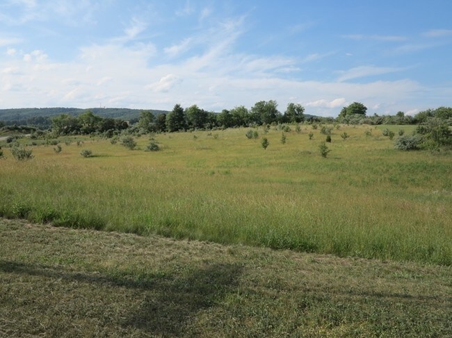
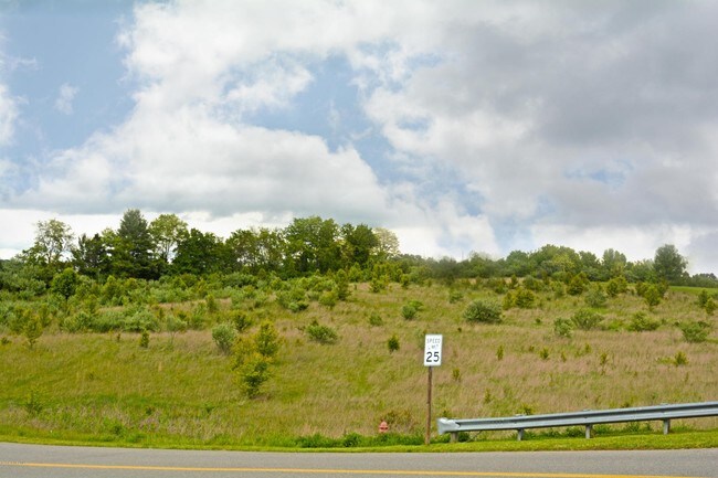
Peppers Ferry Rd
110779
PEPPERS FERRY ROAD PARCEL A
Multifamilydwelling
Montgomery
X
Virginia
51121C0140C
7.95 AC
2025
Blacksburg & Wytheville
2025
Other Market Areas
021101
Blacksburg-Christiansburg-Radford, VA
DEMOGRAPHICS near Peppers Ferry Rd
1 Mile
3 Mile
5 Mile
2024 Total Population
4,581
20,784
50,192
2029 Population
4,524
20,571
49,684
Pop Growth 2024-2029
(1.24%)
(1.02%)
(1.01%)
Average Age
41
41
38
2024 Total Households
1,850
9,051
21,801
HH Growth 2024-2029
(1.19%)
(0.99%)
(1.03%)
Median Household Inc
$86,936
$62,660
$58,435
Avg Household Size
2.40
2.20
2.20
2024 Avg HH Vehicles
2.00
2.00
2.00
Median Home Value
$257,812
$242,846
$262,485
Median Year Built
1996
1992
1988
Nearby Places
Map Layers
Map Styles
 Street
 Aerial
- Restaurants
- Banks
- Shops
- Fitness
- Groceries
PUBLIC TRANSPORTATION
AIRPORT
Roanoke/Blacksburg Regional (Woodrum Field)
DRIVE
WALK
Distance
Roanoke/Blacksburg Regional (Woodrum Field)
41 min
36.8 mi
Freight Ports
Virginia Port Authority - Richmond
DRIVE
WALK
Distance
Virginia Port Authority - Richmond
1 min
167.4 mi
SALE & LEASE HISTORY
LISTING DATE
SALE/LEASE

Sep 24, 2016
For Sale
Sep 24, 2016
For Sale
Feb 20, 2018
For Sale
Aug 04, 2017
For Sale
Aug 03, 2017
For Sale
Nearby Properties
Address
Land Use
TOTAL SIZE
Lot Size
Zoning
Address
Land Use
TOTAL SIZE
Lot Size
Zoning
96,768 SF
20.18 AC
RM1
Address
Land Use
TOTAL SIZE
Lot Size
Zoning
189,259 SF
31.06 AC
R&D
Address
Land Use
TOTAL SIZE
Lot Size
Zoning
33.70 AC
A1
Address
Land Use
TOTAL SIZE
Lot Size
Zoning
151,388 SF
18.29 AC
B3
Address
Land Use
TOTAL SIZE
Lot Size
Zoning
151,450 SF
13.88 AC
B3
Address
Land Use
TOTAL SIZE
Lot Size
Zoning
538,247 SF
54.60 AC
B3
Address
Land Use
TOTAL SIZE
Lot Size
Zoning
66,896 SF
4 AC
O
Address
Land Use
TOTAL SIZE
Lot Size
Zoning
200,004 SF
23.11 AC
B3
Address
Land Use
TOTAL SIZE
Lot Size
Zoning
3.86 AC
Address
Land Use
TOTAL SIZE
Lot Size
Zoning
124,503 SF
11.30 AC
B3
Address
Land Use
TOTAL SIZE
Lot Size
Zoning
49,525 SF
11.07 AC
B3
Address
Land Use
TOTAL SIZE
Lot Size
Zoning
108,510 SF
11.89 AC
B3
Address
Land Use
TOTAL SIZE
Lot Size
Zoning
99,595 SF
11.92 AC
B3
Address
Land Use
TOTAL SIZE
Lot Size
Zoning
61,328 SF
2.33 AC
B3
Address
Land Use
TOTAL SIZE
Lot Size
Zoning
52,475 SF
19.11 AC
B3
Address
Land Use
TOTAL SIZE
Lot Size
Zoning
Address
Land Use
TOTAL SIZE
Lot Size
Zoning
40,363 SF
12.30 AC
B3
Address
Land Use
TOTAL SIZE
Lot Size
Zoning
423,796 SF
53.92 AC
I2
Address
Land Use
TOTAL SIZE
Lot Size
Zoning
133,000 SF
9.67 AC
I2
Address
Land Use
TOTAL SIZE
Lot Size
Zoning
2,040 SF
45.31 AC
PMR
Address
Land Use
TOTAL SIZE
Lot Size
Zoning
75,776 SF
4.66 AC
RM1
Address
Land Use
TOTAL SIZE
Lot Size
Zoning
43,200 SF
2.30 AC
B3
Address
Land Use
TOTAL SIZE
Lot Size
Zoning
48,678 SF
0.03 AC
A1
Address
Land Use
TOTAL SIZE
Lot Size
Zoning
1,712 SF
131.68 AC
A1
Address
Land Use
TOTAL SIZE
Lot Size
Zoning
63,600 SF
14.50 AC
RM1
Address
Land Use
TOTAL SIZE
Lot Size
Zoning
95,224 SF
7.96 AC
B3
Address
Land Use
TOTAL SIZE
Lot Size
Zoning
50,627 SF
3.04 AC
B3
Address
Land Use
TOTAL SIZE
Lot Size
Zoning
18,200 SF
1.97 AC
B3
The World's #1 Commercial Real Estate Marketplace
Connect with us
© 2025 CoStar Group
The information above has been obtained from sources believed reliable. While we do not doubt its accuracy we have not verified it and make no guarantee, warranty or representation about it. It is your responsibility to independently confirm its accuracy and completeness. Any projections, opinions, assumptions, or estimates used are for example only and do not represent the current or future performance of the property. The value of this transaction to you depends on tax and other factors which should be evaluated by your tax, financial, and legal advisors. You and your advisors should conduct a careful, independent investigation of the property to determine to your satisfaction the suitability of the property for your needs.