Property Record
Perry Rd, Grand Blanc, MI 48439
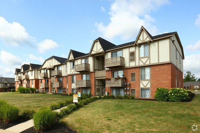
Property Detail
Perry Rd
56-13-100-001
A PARCEL OF LAND BEG N 88 DEG 34 MIN E 676.53 FT & S 0 DEG 07 MIN 40 SEC W 1487.91 FT FROM NE COR OF SEC 14 T6N R7E TH S 0
Commercialnec
GENESEE
HDMF
Michigan
B and X Area of moderate flood hazard, usually the area between the limits of the 100-year and 500-year floods.
16.62 AC
2025
Grand Blanc/Goodrich
2025
Detroit
011210
Flint, MI
95,524 SF
NEARBY LISTINGS FOR SALE OR LEASE
-
-
View all Grand Blanc listings for sale on LoopNet.com
DEMOGRAPHICS near Perry Rd
1 mile
3 mile
5 mile
2025 Total Population
4,751
29,434
60,998
2030 Population
4,677
28,861
59,889
Pop Growth 2025-2030
(1.56%)
(1.95%)
(1.82%)
Average Age
40
42
41
2025 Total Households
1,953
11,559
24,451
HH Growth 2025-2030
(1.48%)
(1.96%)
(1.85%)
Median Household Inc
$108,228
$101,627
$85,951
Avg Household Size
2.30
2.50
2.40
2025 Avg HH Vehicles
2.00
2.00
2.00
Median Home Value
$281,995
$268,125
$250,952
Median Year Built
1978
1981
1979
Nearby Places
Map Layers
Map Styles
 Street
 Aerial
Layers
 Traffic
 Biking
Places
Listings with unknown addresses are not visible on the map
- Restaurants
- Banks
- Shops
- Fitness
- Groceries
PUBLIC TRANSPORTATION
COMMUTER RAIL
Flint Amtrak Station (Blue Water - Amtrak)
Drive
Walk
Distance
Flint Amtrak Station (Blue Water - Amtrak)
18 min
9.1 mi
AIRPORT
Bishop International
Drive
Walk
Distance
Bishop International
30 min
11.0 mi
Freight Ports
Port of Toledo
Drive
Walk
Distance
Port of Toledo
137 min
105.0 mi
Nearby Properties
Address
Land Use
TOTAL SIZE
Lot Size
Zoning
Address
Land Use
TOTAL SIZE
Lot Size
Zoning
55,378 SF
23 AC
PO
Address
Land Use
TOTAL SIZE
Lot Size
Zoning
507,562 SF
39.37 AC
HDM
Address
Land Use
TOTAL SIZE
Lot Size
Zoning
155,220 SF
33.46 AC
GC
Address
Land Use
TOTAL SIZE
Lot Size
Zoning
22.13 AC
MDM
Address
Land Use
TOTAL SIZE
Lot Size
Zoning
612,305 SF
116.49 AC
I-2
Address
Land Use
TOTAL SIZE
Lot Size
Zoning
Address
Land Use
TOTAL SIZE
Lot Size
Zoning
157,756 SF
21.17 AC
MDM
Address
Land Use
TOTAL SIZE
Lot Size
Zoning
76,856 SF
28.13 AC
I-1
Address
Land Use
TOTAL SIZE
Lot Size
Zoning
78,517 SF
16.80 AC
GC
Address
Land Use
TOTAL SIZE
Lot Size
Zoning
125,825 SF
13.01 AC
B-2
Address
Land Use
TOTAL SIZE
Lot Size
Zoning
674,049 SF
24.02 AC
I-2
Address
Land Use
TOTAL SIZE
Lot Size
Zoning
64,897 SF
1.86 AC
GC
Address
Land Use
TOTAL SIZE
Lot Size
Zoning
59,043 SF
8.19 AC
MDM
Address
Land Use
TOTAL SIZE
Lot Size
Zoning
36,638 SF
10.01 AC
GC
Address
Land Use
TOTAL SIZE
Lot Size
Zoning
88,701 SF
10.27 AC
GC
Address
Land Use
TOTAL SIZE
Lot Size
Zoning
137,169 SF
18.50 AC
GC
Address
Land Use
TOTAL SIZE
Lot Size
Zoning
210.33 AC
MHP
Address
Land Use
TOTAL SIZE
Lot Size
Zoning
48,275 SF
8.69 AC
OS
Address
Land Use
TOTAL SIZE
Lot Size
Zoning
199,920 SF
20.47 AC
I-1
Address
Land Use
TOTAL SIZE
Lot Size
Zoning
66,576 SF
5.98 AC
OS-1
Address
Land Use
TOTAL SIZE
Lot Size
Zoning
91,726 SF
7.28 AC
HDM
Address
Land Use
TOTAL SIZE
Lot Size
Zoning
41,853 SF
4.54 AC
OS
Address
Land Use
TOTAL SIZE
Lot Size
Zoning
42,672 SF
I-1
Address
Land Use
TOTAL SIZE
Lot Size
Zoning
22,026 SF
2.59 AC
GC
Address
Land Use
TOTAL SIZE
Lot Size
Zoning
82,400 SF
5.90 AC
PUD
Address
Land Use
TOTAL SIZE
Lot Size
Zoning
38,393 SF
5.61 AC
GC
Address
Land Use
TOTAL SIZE
Lot Size
Zoning
132,480 SF
10.99 AC
HDMF
Address
Land Use
TOTAL SIZE
Lot Size
Zoning
61,102 SF
4.40 AC
B-2
Address
Land Use
TOTAL SIZE
Lot Size
Zoning
107,184 SF
4.67 AC
HDMF
Address
Land Use
TOTAL SIZE
Lot Size
Zoning
115,108 SF
9.40 AC
HDMF
The World's #1 Commercial Real Estate Marketplace
Connect with us
© 2026 CoStar Group
The information above has been obtained from sources believed reliable. While we do not doubt its accuracy we have not verified it and make no guarantee, warranty or representation about it. It is your responsibility to independently confirm its accuracy and completeness. Any projections, opinions, assumptions, or estimates used are for example only and do not represent the current or future performance of the property. The value of this transaction to you depends on tax and other factors which should be evaluated by your tax, financial, and legal advisors. You and your advisors should conduct a careful, independent investigation of the property to determine to your satisfaction the suitability of the property for your needs.