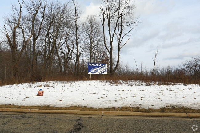
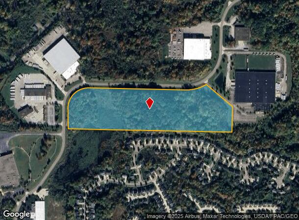
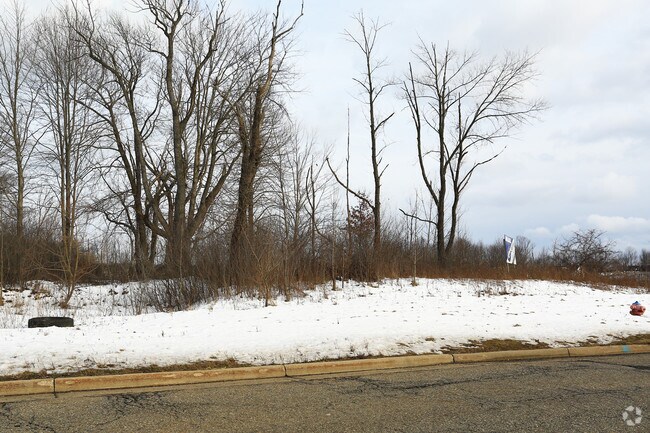
Property Record
Philipp Pw Pkwy, Streetsboro, OH 44241
NEARBY LISTINGS FOR SALE OR LEASE
Property Detail
Philipp Pw Pkwy
Akron, OH
Frost Road Commerce Center Ii
35-003-00-00-002-004
FROST ROAD COMMERCE CENTER II BLOCK 4
Industrialacreage
Portage
X
Ohio
39133C0038D
3
2024
21.95 AC
2024
Portage County
600401
Cleveland
DEMOGRAPHICS near Philipp Pw Pkwy
1 mile
3 mile
5 mile
2024 Total Population
3,797
25,340
57,272
2029 Population
3,841
25,628
57,546
Pop Growth 2024-2029
+ 1.16%
+ 1.14%
+ 0.48%
Average Age
39
42
42
2024 Total Households
1,666
10,116
22,086
HH Growth 2024-2029
+ 1.02%
+ 1.15%
+ 0.56%
Median Household Inc
$67,659
$89,915
$107,563
Avg Household Size
2.20
2.40
2.50
2024 Avg HH Vehicles
2.00
2.00
2.00
Median Home Value
$166,438
$265,047
$318,497
Median Year Built
1996
1987
1987
Nearby Places
Map Layers
Map Styles
 Street
 Aerial
Transit
 Traffic
 Biking
Places
Listings with unknown addresses are not visible on the map
- Restaurants
- Banks
- Shops
- Fitness
- Groceries
PUBLIC TRANSPORTATION
AIRPORT
Cleveland-Hopkins International
Drive
Walk
Distance
Cleveland-Hopkins International
49 min
34.4 mi
Akron-Canton Regional
Drive
Walk
Distance
Akron-Canton Regional
50 min
36.5 mi
SALE & LEASE HISTORY
LISTING DATE
SALE/LEASE

Sep 25, 2016
For Lease
Sep 24, 2016
For Sale
Nearby Properties
Address
Land Use
TOTAL SIZE
Lot Size
Zoning
Address
Land Use
TOTAL SIZE
Lot Size
Zoning
670,026 SF
53.79 AC
Address
Land Use
TOTAL SIZE
Lot Size
Zoning
650,506 SF
57.86 AC
Address
Land Use
TOTAL SIZE
Lot Size
Zoning
435,216 SF
31.88 AC
Address
Land Use
TOTAL SIZE
Lot Size
Zoning
344,124 SF
54.69 AC
Address
Land Use
TOTAL SIZE
Lot Size
Zoning
409,569 SF
82.25 AC
Address
Land Use
TOTAL SIZE
Lot Size
Zoning
616,306 SF
78.38 AC
Address
Land Use
TOTAL SIZE
Lot Size
Zoning
257,381 SF
28.99 AC
Address
Land Use
TOTAL SIZE
Lot Size
Zoning
441,158 SF
74.07 AC
Address
Land Use
TOTAL SIZE
Lot Size
Zoning
368,060 SF
27.87 AC
Address
Land Use
TOTAL SIZE
Lot Size
Zoning
73,295 SF
12.75 AC
Address
Land Use
TOTAL SIZE
Lot Size
Zoning
418,878 SF
51.63 AC
Address
Land Use
TOTAL SIZE
Lot Size
Zoning
348,301 SF
27.65 AC
Address
Land Use
TOTAL SIZE
Lot Size
Zoning
340,850 SF
29.70 AC
Address
Land Use
TOTAL SIZE
Lot Size
Zoning
155,932 SF
12.94 AC
Address
Land Use
TOTAL SIZE
Lot Size
Zoning
73,753 SF
17 AC
Address
Land Use
TOTAL SIZE
Lot Size
Zoning
30.10 AC
Address
Land Use
TOTAL SIZE
Lot Size
Zoning
146,121 SF
9 AC
Address
Land Use
TOTAL SIZE
Lot Size
Zoning
104,415 SF
46.30 AC
Address
Land Use
TOTAL SIZE
Lot Size
Zoning
142,748 SF
10.11 AC
Address
Land Use
TOTAL SIZE
Lot Size
Zoning
1,850 SF
111.87 AC
Address
Land Use
TOTAL SIZE
Lot Size
Zoning
206,907 SF
1.11 AC
Address
Land Use
TOTAL SIZE
Lot Size
Zoning
156,150 SF
14.68 AC
Address
Land Use
TOTAL SIZE
Lot Size
Zoning
149,850 SF
24.08 AC
Address
Land Use
TOTAL SIZE
Lot Size
Zoning
22,052 SF
12.52 AC
Address
Land Use
TOTAL SIZE
Lot Size
Zoning
170,490 SF
17.74 AC
Address
Land Use
TOTAL SIZE
Lot Size
Zoning
251,864 SF
22.07 AC
Address
Land Use
TOTAL SIZE
Lot Size
Zoning
88,934 SF
19.65 AC
Address
Land Use
TOTAL SIZE
Lot Size
Zoning
142,832 SF
20.95 AC
Address
Land Use
TOTAL SIZE
Lot Size
Zoning
194,632 SF
19.41 AC
Address
Land Use
TOTAL SIZE
Lot Size
Zoning
88,898 SF
5.98 AC
The World's #1 Commercial Real Estate Marketplace
Connect with us
© 2026 CoStar Group
The information above has been obtained from sources believed reliable. While we do not doubt its accuracy we have not verified it and make no guarantee, warranty or representation about it. It is your responsibility to independently confirm its accuracy and completeness. Any projections, opinions, assumptions, or estimates used are for example only and do not represent the current or future performance of the property. The value of this transaction to you depends on tax and other factors which should be evaluated by your tax, financial, and legal advisors. You and your advisors should conduct a careful, independent investigation of the property to determine to your satisfaction the suitability of the property for your needs.