Property Record
3006 S Phillips Rd, Lanett, AL 36863
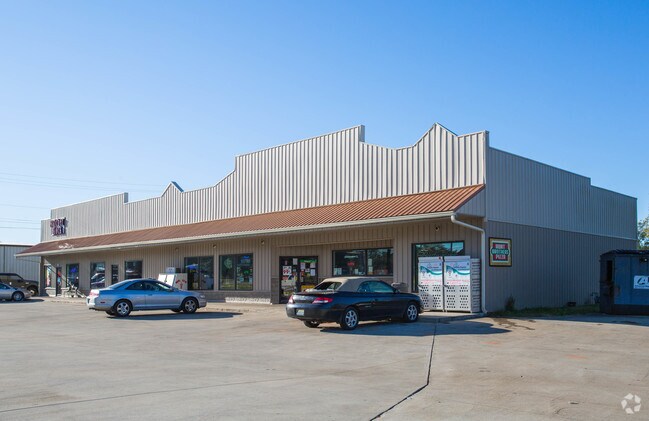


Property Detail
3006 S Phillips Rd
17-02-03-3-003-036.001
BEG AT INT OF SE MARGIN OF CUSSETA ROAD & SW MARGIN OF PHILLIPS ROAD, RUN SE'LY ALONG PHILLIPS ROAD 84.6', SE'LY ALONG ROAD 1
Storesoffices
Chambers
B and X Area of moderate flood hazard, usually the area between the limits of the 100-year and 500-year floods.
Alabama
2025
1.68 AC
2024
Chambers County
954800
Columbus GA
7,062 SF
LaGrange, GA-AL
NEARBY LISTINGS FOR SALE OR LEASE
-
-
View all Lanett listings for lease on LoopNet.com
DEMOGRAPHICS near 3006 S Phillips Rd
1 mile
3 mile
5 mile
2025 Total Population
1,417
10,846
23,351
2030 Population
1,390
10,654
23,131
Pop Growth 2025-2030
(1.91%)
(1.77%)
(0.94%)
Average Age
42
42
41
2025 Total Households
578
4,521
9,432
HH Growth 2025-2030
(1.90%)
(1.75%)
(0.94%)
Median Household Inc
$50,268
$51,494
$51,027
Avg Household Size
2.40
2.30
2.40
2025 Avg HH Vehicles
2.00
2.00
2.00
Median Home Value
$126,071
$120,739
$130,278
Median Year Built
1976
1976
1974
Nearby Places
Map Layers
Map Styles
 Street
 Aerial
Transit
 Traffic
 Biking
Places
Listings with unknown addresses are not visible on the map
- Restaurants
- Banks
- Shops
- Fitness
- Groceries
PUBLIC TRANSPORTATION
AIRPORT
Columbus
Drive
Walk
Distance
Columbus
51 min
39.3 mi
Freight Ports
Port of Panama City
Drive
Walk
Distance
Port of Panama City
276 min
213.1 mi
SALE & LEASE HISTORY
LISTING DATE
SALE/LEASE

Nov 03, 2017
For Lease
Nearby Properties
Address
Land Use
TOTAL SIZE
Lot Size
Zoning
Address
Land Use
TOTAL SIZE
Lot Size
Zoning
23,004 SF
38.40 AC
Address
Land Use
TOTAL SIZE
Lot Size
Zoning
13,920 SF
58.66 AC
Address
Land Use
TOTAL SIZE
Lot Size
Zoning
375,360 SF
20.30 AC
Address
Land Use
TOTAL SIZE
Lot Size
Zoning
9,750 SF
236.40 AC
Address
Land Use
TOTAL SIZE
Lot Size
Zoning
6,990 SF
15.99 AC
Address
Land Use
TOTAL SIZE
Lot Size
Zoning
28,768 SF
9.40 AC
Address
Land Use
TOTAL SIZE
Lot Size
Zoning
64.60 AC
Address
Land Use
TOTAL SIZE
Lot Size
Zoning
507,508 SF
110 AC
Address
Land Use
TOTAL SIZE
Lot Size
Zoning
146,616 SF
9.10 AC
Address
Land Use
TOTAL SIZE
Lot Size
Zoning
7,872 SF
8.41 AC
Address
Land Use
TOTAL SIZE
Lot Size
Zoning
72,300 SF
2.77 AC
Address
Land Use
TOTAL SIZE
Lot Size
Zoning
8,264 SF
7.88 AC
Address
Land Use
TOTAL SIZE
Lot Size
Zoning
25,588 SF
28.85 AC
Address
Land Use
TOTAL SIZE
Lot Size
Zoning
113,361 SF
8.31 AC
Address
Land Use
TOTAL SIZE
Lot Size
Zoning
3,360 SF
3.50 AC
Address
Land Use
TOTAL SIZE
Lot Size
Zoning
43,794 SF
3.11 AC
Address
Land Use
TOTAL SIZE
Lot Size
Zoning
1 SF
13 AC
Address
Land Use
TOTAL SIZE
Lot Size
Zoning
32,997 SF
1.88 AC
Address
Land Use
TOTAL SIZE
Lot Size
Zoning
52,000 SF
1.01 AC
Address
Land Use
TOTAL SIZE
Lot Size
Zoning
15,762 SF
7.23 AC
Address
Land Use
TOTAL SIZE
Lot Size
Zoning
7,072 SF
2.69 AC
Address
Land Use
TOTAL SIZE
Lot Size
Zoning
1 SF
10 AC
Address
Land Use
TOTAL SIZE
Lot Size
Zoning
15.20 AC
Address
Land Use
TOTAL SIZE
Lot Size
Zoning
1,504 SF
5.40 AC
Address
Land Use
TOTAL SIZE
Lot Size
Zoning
1 SF
10.50 AC
Address
Land Use
TOTAL SIZE
Lot Size
Zoning
31,581 SF
2.76 AC
Address
Land Use
TOTAL SIZE
Lot Size
Zoning
10,465 SF
0.14 AC
Address
Land Use
TOTAL SIZE
Lot Size
Zoning
1 SF
15 AC
Address
Land Use
TOTAL SIZE
Lot Size
Zoning
20,500 SF
4.40 AC
Address
Land Use
TOTAL SIZE
Lot Size
Zoning
30,003 SF
12.70 AC
The World's #1 Commercial Real Estate Marketplace
Connect with us
© 2026 CoStar Group
The information above has been obtained from sources believed reliable. While we do not doubt its accuracy we have not verified it and make no guarantee, warranty or representation about it. It is your responsibility to independently confirm its accuracy and completeness. Any projections, opinions, assumptions, or estimates used are for example only and do not represent the current or future performance of the property. The value of this transaction to you depends on tax and other factors which should be evaluated by your tax, financial, and legal advisors. You and your advisors should conduct a careful, independent investigation of the property to determine to your satisfaction the suitability of the property for your needs.