Property Record
Pile St, Ramona, CA 92065

NEARBY LISTINGS FOR SALE OR LEASE
-
-
View all Ramona listings for lease on LoopNet.com
Property Detail
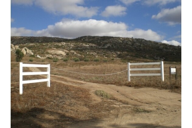
Pile St
279-150-26
SEC 1-13-1E S H DOC05-1100195 IN
Vacantlandnec
San Diego
X
California
06073C1129G
97.46 AC
2024
Outlying SD County N
2025
San Diego
020813
San Diego-Chula Vista-Carlsbad, CA
DEMOGRAPHICS near Pile St
1 Mile
3 Mile
5 Mile
2024 Total Population
1,040
9,106
26,104
2029 Population
1,030
8,971
25,653
Pop Growth 2024-2029
(0.96%)
(1.48%)
(1.73%)
Average Age
44
40
40
2024 Total Households
365
2,951
8,675
HH Growth 2024-2029
(1.10%)
(1.69%)
(1.95%)
Median Household Inc
$96,484
$97,302
$103,563
Avg Household Size
2.80
3.00
2.90
2024 Avg HH Vehicles
3.00
3.00
3.00
Median Home Value
$788,659
$710,681
$699,906
Median Year Built
1991
1980
1983
Nearby Places
Map Layers
Map Styles
 Street
 Aerial
- Restaurants
- Banks
- Shops
- Fitness
- Groceries
SALE & LEASE HISTORY
LISTING DATE
SALE/LEASE

Oct 09, 2017
For Lease
Nearby Properties
Address
Land Use
TOTAL SIZE
Lot Size
Zoning
Address
Land Use
TOTAL SIZE
Lot Size
Zoning
56,184 SF
2.40 AC
RMV4
Address
Land Use
TOTAL SIZE
Lot Size
Zoning
74,828 SF
4.49 AC
M52
Address
Land Use
TOTAL SIZE
Lot Size
Zoning
6,703 SF
76.20 AC
A72
Address
Land Use
TOTAL SIZE
Lot Size
Zoning
56,070 SF
3.60 AC
M54
Address
Land Use
TOTAL SIZE
Lot Size
Zoning
81,935 SF
2.93 AC
RMV4
Address
Land Use
TOTAL SIZE
Lot Size
Zoning
16,767 SF
8.25 AC
A70
Address
Land Use
TOTAL SIZE
Lot Size
Zoning
25,000 SF
0.15 AC
RMV5
Address
Land Use
TOTAL SIZE
Lot Size
Zoning
34,500 SF
4.52 AC
M54
Address
Land Use
TOTAL SIZE
Lot Size
Zoning
6,108 SF
18.99 AC
A70
Address
Land Use
TOTAL SIZE
Lot Size
Zoning
15,200 SF
0.16 AC
RMV5
Address
Land Use
TOTAL SIZE
Lot Size
Zoning
5,439 SF
97 AC
A72
Address
Land Use
TOTAL SIZE
Lot Size
Zoning
12,805 SF
0.41 AC
RMV4
Address
Land Use
TOTAL SIZE
Lot Size
Zoning
14,104 SF
0.34 AC
RMV4
Address
Land Use
TOTAL SIZE
Lot Size
Zoning
41,370 SF
2.61 AC
M52
Address
Land Use
TOTAL SIZE
Lot Size
Zoning
73.68 AC
A72
Address
Land Use
TOTAL SIZE
Lot Size
Zoning
1.57 AC
RMV4
Address
Land Use
TOTAL SIZE
Lot Size
Zoning
0.51 AC
C
Address
Land Use
TOTAL SIZE
Lot Size
Zoning
2.91 AC
RS
Address
Land Use
TOTAL SIZE
Lot Size
Zoning
2,500 SF
1.18 AC
A70
Address
Land Use
TOTAL SIZE
Lot Size
Zoning
7,432 SF
0.37 AC
RMV4
Address
Land Use
TOTAL SIZE
Lot Size
Zoning
4,680 SF
0.33 AC
RMV5
Address
Land Use
TOTAL SIZE
Lot Size
Zoning
7,012 SF
0.32 AC
RMV5
Address
Land Use
TOTAL SIZE
Lot Size
Zoning
7,029 SF
8.70 AC
A70
Address
Land Use
TOTAL SIZE
Lot Size
Zoning
21.67 AC
A72
Address
Land Use
TOTAL SIZE
Lot Size
Zoning
7,722 SF
0.34 AC
RMV5
Address
Land Use
TOTAL SIZE
Lot Size
Zoning
2,721 SF
121.67 AC
A72
Address
Land Use
TOTAL SIZE
Lot Size
Zoning
15,840 SF
0.83 AC
RMV4
Address
Land Use
TOTAL SIZE
Lot Size
Zoning
2,326 SF
0.61 AC
RMV5
Address
Land Use
TOTAL SIZE
Lot Size
Zoning
2,516 SF
78.82 AC
A72
Address
Land Use
TOTAL SIZE
Lot Size
Zoning
1,024 SF
37.50 AC
A72
The World's #1 Commercial Real Estate Marketplace
Connect with us
© 2026 CoStar Group
The information above has been obtained from sources believed reliable. While we do not doubt its accuracy we have not verified it and make no guarantee, warranty or representation about it. It is your responsibility to independently confirm its accuracy and completeness. Any projections, opinions, assumptions, or estimates used are for example only and do not represent the current or future performance of the property. The value of this transaction to you depends on tax and other factors which should be evaluated by your tax, financial, and legal advisors. You and your advisors should conduct a careful, independent investigation of the property to determine to your satisfaction the suitability of the property for your needs.