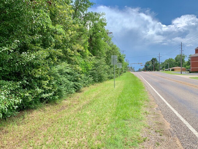
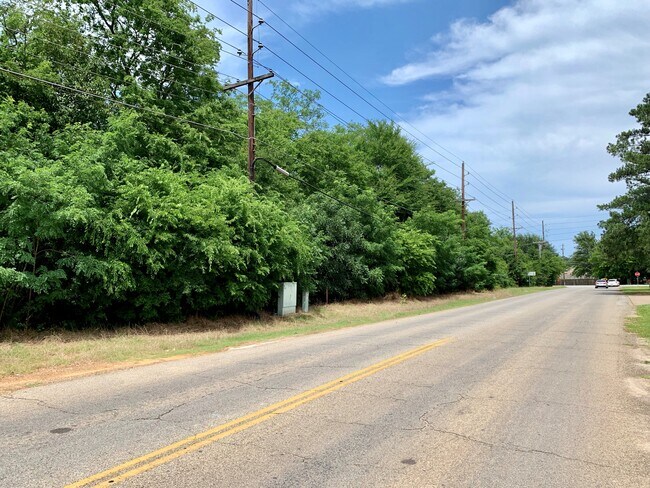
Property Record
Pine Tree Rd, Longview, TX 75604

Property Detail
Pine Tree Rd
Longview, TX
AB 177 WM ROBINSON SUR TR 53 SEC 6
25973
GREGG
Agriculturalland
Texas
B and X Area of moderate flood hazard, usually the area between the limits of the 100-year and 500-year floods.
53
2025
5.14 AC
2025
Longview
000700
Other Market Areas
NEARBY LISTINGS FOR SALE OR LEASE
-
-
-
No Photo
-
-
-
View all Longview listings for sale on LoopNet.com
DEMOGRAPHICS near Pine Tree Rd
1 mile
3 mile
5 mile
2025 Total Population
6,977
36,551
66,714
2030 Population
7,083
36,979
67,944
Pop Growth 2025-2030
+ 1.52%
+ 1.17%
+ 1.84%
Average Age
37
38
39
2025 Total Households
2,641
14,076
26,619
HH Growth 2025-2030
+ 1.51%
+ 1.10%
+ 1.90%
Median Household Inc
$62,981
$70,281
$69,352
Avg Household Size
2.60
2.50
2.40
2025 Avg HH Vehicles
2.00
2.00
2.00
Median Home Value
$209,083
$227,917
$224,892
Median Year Built
1978
1979
1980
Nearby Places
Map Layers
Map Styles
 Street
 Aerial
Layers
 Traffic
 Biking
Places
Listings with unknown addresses are not visible on the map
- Restaurants
- Banks
- Shops
- Fitness
- Groceries
PUBLIC TRANSPORTATION
COMMUTER RAIL
Longview (Texas Eagle - Amtrak)
Drive
Walk
Distance
Longview (Texas Eagle - Amtrak)
12 min
7.0 mi
Freight Ports
Port of Shreveport
Drive
Walk
Distance
Port of Shreveport
93 min
79.2 mi
SALE & LEASE HISTORY
LISTING DATE
SALE/LEASE

Oct 25, 2019
For Sale
Nearby Properties
Address
Land Use
TOTAL SIZE
Lot Size
Zoning
Address
Land Use
TOTAL SIZE
Lot Size
Zoning
Address
Land Use
TOTAL SIZE
Lot Size
Zoning
77,400 SF
39.90 AC
Address
Land Use
TOTAL SIZE
Lot Size
Zoning
58.68 AC
Address
Land Use
TOTAL SIZE
Lot Size
Zoning
10,000 SF
26.40 AC
Address
Land Use
TOTAL SIZE
Lot Size
Zoning
21,435 SF
15.50 AC
Address
Land Use
TOTAL SIZE
Lot Size
Zoning
Address
Land Use
TOTAL SIZE
Lot Size
Zoning
106,831 SF
17.63 AC
Address
Land Use
TOTAL SIZE
Lot Size
Zoning
156,960 SF
12.43 AC
Address
Land Use
TOTAL SIZE
Lot Size
Zoning
10.42 AC
Address
Land Use
TOTAL SIZE
Lot Size
Zoning
9.86 AC
Address
Land Use
TOTAL SIZE
Lot Size
Zoning
77,400 SF
22.68 AC
B
Address
Land Use
TOTAL SIZE
Lot Size
Zoning
192,536 SF
6.93 AC
Address
Land Use
TOTAL SIZE
Lot Size
Zoning
192,536 SF
6 AC
Address
Land Use
TOTAL SIZE
Lot Size
Zoning
33,600 SF
3.35 AC
Address
Land Use
TOTAL SIZE
Lot Size
Zoning
87,800 SF
9.46 AC
Address
Land Use
TOTAL SIZE
Lot Size
Zoning
6.63 AC
Address
Land Use
TOTAL SIZE
Lot Size
Zoning
56,560 SF
4.47 AC
Address
Land Use
TOTAL SIZE
Lot Size
Zoning
1.87 AC
Address
Land Use
TOTAL SIZE
Lot Size
Zoning
5.13 AC
Address
Land Use
TOTAL SIZE
Lot Size
Zoning
39,428 SF
6 AC
Address
Land Use
TOTAL SIZE
Lot Size
Zoning
66,151 SF
4.32 AC
Address
Land Use
TOTAL SIZE
Lot Size
Zoning
204,331 SF
25.04 AC
Address
Land Use
TOTAL SIZE
Lot Size
Zoning
5.03 AC
Address
Land Use
TOTAL SIZE
Lot Size
Zoning
87,164 SF
5.31 AC
Address
Land Use
TOTAL SIZE
Lot Size
Zoning
42,308 SF
10.26 AC
Address
Land Use
TOTAL SIZE
Lot Size
Zoning
6.49 AC
Address
Land Use
TOTAL SIZE
Lot Size
Zoning
155,686 SF
47.53 AC
Address
Land Use
TOTAL SIZE
Lot Size
Zoning
20,250 SF
7.09 AC
Address
Land Use
TOTAL SIZE
Lot Size
Zoning
90,160 SF
4.63 AC
Address
Land Use
TOTAL SIZE
Lot Size
Zoning
29,628 SF
5.81 AC
The World's #1 Commercial Real Estate Marketplace
Connect with us
© 2026 CoStar Group
The information above has been obtained from sources believed reliable. While we do not doubt its accuracy we have not verified it and make no guarantee, warranty or representation about it. It is your responsibility to independently confirm its accuracy and completeness. Any projections, opinions, assumptions, or estimates used are for example only and do not represent the current or future performance of the property. The value of this transaction to you depends on tax and other factors which should be evaluated by your tax, financial, and legal advisors. You and your advisors should conduct a careful, independent investigation of the property to determine to your satisfaction the suitability of the property for your needs.