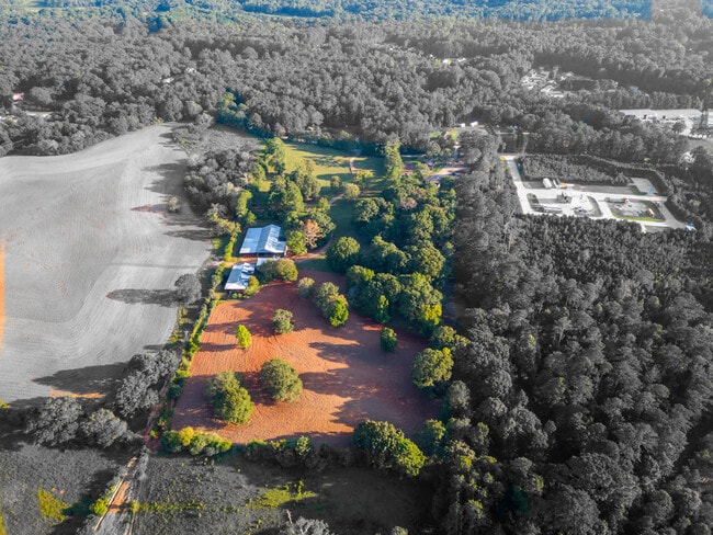
Property Record
Piper Rd, Covington, GA 30014

Property Detail
Piper Rd
0083000000016000
16.177AC PIPER RD
Agriculturalland
NEWTON
AR
Georgia
B and X Area of moderate flood hazard, usually the area between the limits of the 100-year and 500-year floods.
16.18 AC
2025
Newton County
2025
Atlanta
100302
Atlanta-Sandy Springs-Roswell, GA
NEARBY LISTINGS FOR SALE OR LEASE
DEMOGRAPHICS near Piper Rd
1 mile
3 mile
5 mile
2025 Total Population
5,251
21,583
47,164
2030 Population
5,763
23,640
51,576
Pop Growth 2025-2030
+ 9.75%
+ 9.53%
+ 9.35%
Average Age
37
38
38
2025 Total Households
1,794
8,068
17,049
HH Growth 2025-2030
+ 9.92%
+ 9.66%
+ 9.48%
Median Household Inc
$85,736
$75,749
$73,636
Avg Household Size
2.80
2.60
2.70
2025 Avg HH Vehicles
2.00
2.00
2.00
Median Home Value
$278,236
$285,474
$264,689
Median Year Built
2001
1996
1995
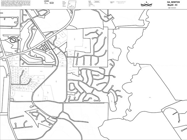
Nearby Places
Map Layers
Map Styles
 Street
 Aerial
Transit
 Traffic
 Biking
Places
Listings with unknown addresses are not visible on the map
- Restaurants
- Banks
- Shops
- Fitness
- Groceries
SALE & LEASE HISTORY
LISTING DATE
SALE/LEASE

Dec 01, 2023
For Sale
Nearby Properties
Address
Land Use
TOTAL SIZE
Lot Size
Zoning
Address
Land Use
TOTAL SIZE
Lot Size
Zoning
207,237 SF
10.61 AC
E1
Address
Land Use
TOTAL SIZE
Lot Size
Zoning
258,254 SF
15.08 AC
C1
Address
Land Use
TOTAL SIZE
Lot Size
Zoning
6,664 SF
17.75 AC
Address
Land Use
TOTAL SIZE
Lot Size
Zoning
45,900 AC
Address
Land Use
TOTAL SIZE
Lot Size
Zoning
88,944 SF
0.98 AC
E1
Address
Land Use
TOTAL SIZE
Lot Size
Zoning
28,884 SF
38.23 AC
C1
Address
Land Use
TOTAL SIZE
Lot Size
Zoning
10,000 SF
0.01 AC
Address
Land Use
TOTAL SIZE
Lot Size
Zoning
1,627 SF
16.62 AC
C1
Address
Land Use
TOTAL SIZE
Lot Size
Zoning
14,080 SF
10 AC
C1
Address
Land Use
TOTAL SIZE
Lot Size
Zoning
28,790 SF
3.70 AC
E1
Address
Land Use
TOTAL SIZE
Lot Size
Zoning
48,144 SF
1.50 AC
E1
Address
Land Use
TOTAL SIZE
Lot Size
Zoning
159,034 SF
68.30 AC
E6
Address
Land Use
TOTAL SIZE
Lot Size
Zoning
31,376 SF
3.50 AC
PUD
Address
Land Use
TOTAL SIZE
Lot Size
Zoning
41,772 SF
28.03 AC
E6
Address
Land Use
TOTAL SIZE
Lot Size
Zoning
28,512 SF
0.52 AC
Address
Land Use
TOTAL SIZE
Lot Size
Zoning
69,487 SF
18.83 AC
C1
Address
Land Use
TOTAL SIZE
Lot Size
Zoning
3,128 SF
5.68 AC
C1
Address
Land Use
TOTAL SIZE
Lot Size
Zoning
27,492 SF
0.47 AC
Address
Land Use
TOTAL SIZE
Lot Size
Zoning
74,713 SF
2.83 AC
Address
Land Use
TOTAL SIZE
Lot Size
Zoning
101,010 SF
42.72 AC
E6
Address
Land Use
TOTAL SIZE
Lot Size
Zoning
61,638 SF
0.64 AC
Address
Land Use
TOTAL SIZE
Lot Size
Zoning
63,914 SF
7.04 AC
COMMERCIAL
Address
Land Use
TOTAL SIZE
Lot Size
Zoning
150,006 SF
8.89 AC
Address
Land Use
TOTAL SIZE
Lot Size
Zoning
25,100 SF
5.47 AC
Address
Land Use
TOTAL SIZE
Lot Size
Zoning
84,356 SF
10.12 AC
Address
Land Use
TOTAL SIZE
Lot Size
Zoning
61,534 SF
7.08 AC
C1
Address
Land Use
TOTAL SIZE
Lot Size
Zoning
84,501 SF
4.12 AC
Address
Land Use
TOTAL SIZE
Lot Size
Zoning
12,812 SF
0.17 AC
E1
Address
Land Use
TOTAL SIZE
Lot Size
Zoning
17,048 SF
6.50 AC
C1
Address
Land Use
TOTAL SIZE
Lot Size
Zoning
44,330 SF
1.09 AC
E2
The World's #1 Commercial Real Estate Marketplace
Connect with us
© 2026 CoStar Group
The information above has been obtained from sources believed reliable. While we do not doubt its accuracy we have not verified it and make no guarantee, warranty or representation about it. It is your responsibility to independently confirm its accuracy and completeness. Any projections, opinions, assumptions, or estimates used are for example only and do not represent the current or future performance of the property. The value of this transaction to you depends on tax and other factors which should be evaluated by your tax, financial, and legal advisors. You and your advisors should conduct a careful, independent investigation of the property to determine to your satisfaction the suitability of the property for your needs.