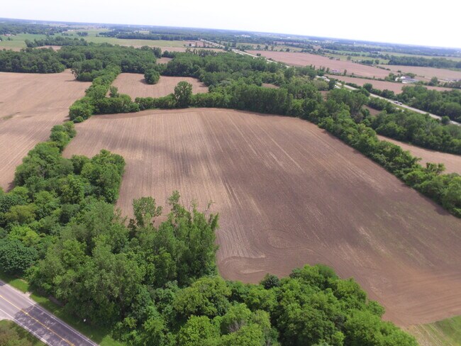
Property Record
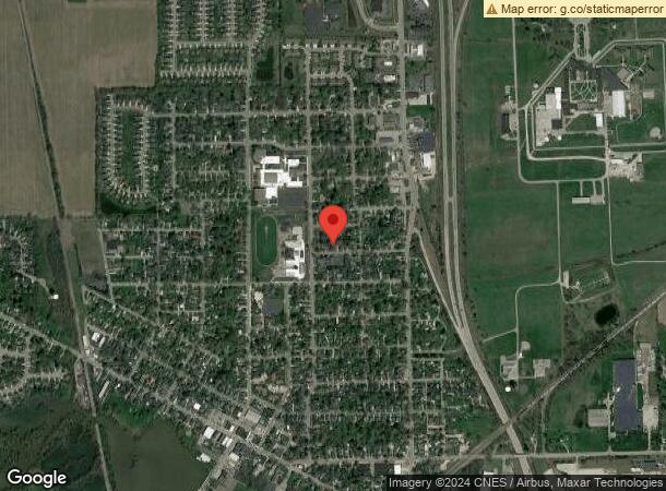
Plank Rd, Milan, MI 48160

Property Detail
Plank Rd
Monroe, MI
COMM AT A 3/4" IRON PIN WITH A 2" ALUMINUM CAP STAMPED WASHTENAW REMONUMENTED CORNER PLSS 41902" IN A MONUMENT BOX AT THE NE
53-030-017-40
MONROE
Commercialacreage
Michigan
2025
Monroe County
2025
Detroit
421100
NEARBY LISTINGS FOR SALE OR LEASE
-
-
View all Milan listings for sale on LoopNet.com
DEMOGRAPHICS near Plank Rd
1 mile
3 mile
5 mile
2025 Total Population
2,036
8,944
12,762
2030 Population
2,065
9,031
12,878
Pop Growth 2025-2030
+ 1.42%
+ 0.97%
+ 0.91%
Average Age
39
41
42
2025 Total Households
750
3,000
4,435
HH Growth 2025-2030
+ 1.33%
+ 0.90%
+ 0.83%
Median Household Inc
$102,289
$91,842
$92,856
Avg Household Size
2.70
2.50
2.50
2025 Avg HH Vehicles
2.00
2.00
2.00
Median Home Value
$255,848
$253,915
$264,512
Median Year Built
1962
1966
1966
Nearby Places
Map Layers
Map Styles
 Street
 Aerial
Layers
 Traffic
 Biking
Places
Listings with unknown addresses are not visible on the map
- Restaurants
- Banks
- Shops
- Fitness
- Groceries
PUBLIC TRANSPORTATION
AIRPORT
Detroit Metro Wayne County
Drive
Walk
Distance
Detroit Metro Wayne County
36 min
29.7 mi
Freight Ports
Port of Toledo
Drive
Walk
Distance
Port of Toledo
58 min
44.1 mi
SALE & LEASE HISTORY
LISTING DATE
SALE/LEASE

Sep 15, 2023
For Sale
Nearby Properties
Address
Land Use
TOTAL SIZE
Lot Size
Zoning
Address
Land Use
TOTAL SIZE
Lot Size
Zoning
1,207,496 SF
92.13 AC
Address
Land Use
TOTAL SIZE
Lot Size
Zoning
352,751 SF
58.19 AC
Address
Land Use
TOTAL SIZE
Lot Size
Zoning
45,200 SF
7.48 AC
Address
Land Use
TOTAL SIZE
Lot Size
Zoning
23,850 SF
17.80 AC
Address
Land Use
TOTAL SIZE
Lot Size
Zoning
165,904 SF
9.25 AC
Address
Land Use
TOTAL SIZE
Lot Size
Zoning
73,840 SF
7.22 AC
Address
Land Use
TOTAL SIZE
Lot Size
Zoning
41,003 SF
5.99 AC
Address
Land Use
TOTAL SIZE
Lot Size
Zoning
179,682 SF
28.59 AC
LI
Address
Land Use
TOTAL SIZE
Lot Size
Zoning
67,834 SF
5.99 AC
GB
Address
Land Use
TOTAL SIZE
Lot Size
Zoning
864 SF
4 AC
R3
Address
Land Use
TOTAL SIZE
Lot Size
Zoning
22,644 SF
2.48 AC
O
Address
Land Use
TOTAL SIZE
Lot Size
Zoning
406.15 AC
BLANK
Address
Land Use
TOTAL SIZE
Lot Size
Zoning
31,338 SF
1.72 AC
HS
Address
Land Use
TOTAL SIZE
Lot Size
Zoning
14,364 SF
4.05 AC
HS-W/C
Address
Land Use
TOTAL SIZE
Lot Size
Zoning
51,438 SF
9.87 AC
Address
Land Use
TOTAL SIZE
Lot Size
Zoning
80,848 SF
7.05 AC
Address
Land Use
TOTAL SIZE
Lot Size
Zoning
38,848 SF
4.97 AC
Address
Land Use
TOTAL SIZE
Lot Size
Zoning
20,100 SF
80 AC
Address
Land Use
TOTAL SIZE
Lot Size
Zoning
24.61 AC
MHP
Address
Land Use
TOTAL SIZE
Lot Size
Zoning
5,310 SF
1.57 AC
GB-W/C
Address
Land Use
TOTAL SIZE
Lot Size
Zoning
10,800 SF
1.58 AC
GB
Address
Land Use
TOTAL SIZE
Lot Size
Zoning
10,905 SF
1.28 AC
GB-W/C
Address
Land Use
TOTAL SIZE
Lot Size
Zoning
18,940 SF
1.35 AC
R3
Address
Land Use
TOTAL SIZE
Lot Size
Zoning
10,838 SF
2 AC
R3-M-PUD
Address
Land Use
TOTAL SIZE
Lot Size
Zoning
23,980 SF
5.17 AC
Address
Land Use
TOTAL SIZE
Lot Size
Zoning
Address
Land Use
TOTAL SIZE
Lot Size
Zoning
37,810 SF
3.74 AC
Address
Land Use
TOTAL SIZE
Lot Size
Zoning
5,253 SF
1.72 AC
HS
Address
Land Use
TOTAL SIZE
Lot Size
Zoning
2,250 SF
63.52 AC
BLANK
The World's #1 Commercial Real Estate Marketplace
Connect with us
© 2026 CoStar Group
The information above has been obtained from sources believed reliable. While we do not doubt its accuracy we have not verified it and make no guarantee, warranty or representation about it. It is your responsibility to independently confirm its accuracy and completeness. Any projections, opinions, assumptions, or estimates used are for example only and do not represent the current or future performance of the property. The value of this transaction to you depends on tax and other factors which should be evaluated by your tax, financial, and legal advisors. You and your advisors should conduct a careful, independent investigation of the property to determine to your satisfaction the suitability of the property for your needs.