Property Record
Portugee Rd, Sandston, VA 23150

NEARBY LISTINGS FOR SALE OR LEASE
-
-
View all Sandston listings for sale on LoopNet.com
Property Detail
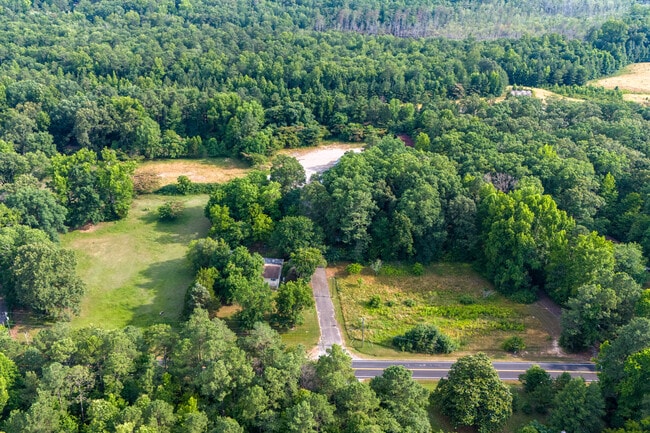
Portugee Rd
838-703-8134
01960A0000 0039; S OF PORTUGEE ROAD AC 1 46 A1 18
Industrialacreage
Henrico
X
Virginia
51087C0235D
1.06 AC
2025
Airport
2025
Richmond VA
201404
Richmond, VA
DEMOGRAPHICS near Portugee Rd
1 Mile
3 Mile
5 Mile
2024 Total Population
480
6,529
29,681
2029 Population
483
6,505
29,779
Pop Growth 2024-2029
+ 0.63%
(0.37%)
+ 0.33%
Average Age
47
43
42
2024 Total Households
192
2,648
11,864
HH Growth 2024-2029
+ 0.52%
(0.42%)
+ 0.19%
Median Household Inc
$79,573
$74,921
$76,726
Avg Household Size
2.40
2.40
2.40
2024 Avg HH Vehicles
3.00
2.00
2.00
Median Home Value
$282,894
$243,128
$238,961
Median Year Built
1982
1977
1982
Nearby Places
Map Layers
Map Styles
 Street
 Aerial
- Restaurants
- Banks
- Shops
- Fitness
- Groceries
PUBLIC TRANSPORTATION
AIRPORT
Richmond International
DRIVE
WALK
Distance
Richmond International
10 min
3.7 mi
Freight Ports
Virginia Port Authority - Richmond
DRIVE
WALK
Distance
Virginia Port Authority - Richmond
27 min
16.8 mi
SALE & LEASE HISTORY
LISTING DATE
SALE/LEASE

Jun 24, 2024
For Sale
Nearby Properties
Address
Land Use
TOTAL SIZE
Lot Size
Zoning
Address
Land Use
TOTAL SIZE
Lot Size
Zoning
320,459 SF
172.05 AC
M-2
Address
Land Use
TOTAL SIZE
Lot Size
Zoning
976,550 SF
129.27 AC
M-2
Address
Land Use
TOTAL SIZE
Lot Size
Zoning
385,896 SF
128.24 AC
M-2
Address
Land Use
TOTAL SIZE
Lot Size
Zoning
382,408 SF
65 AC
M-2
Address
Land Use
TOTAL SIZE
Lot Size
Zoning
341,614 SF
16.10 AC
M-2
Address
Land Use
TOTAL SIZE
Lot Size
Zoning
339,884 SF
22.48 AC
M-2
Address
Land Use
TOTAL SIZE
Lot Size
Zoning
995,854 SF
97.55 AC
M-2
Address
Land Use
TOTAL SIZE
Lot Size
Zoning
257,938 SF
93.42 AC
M-2
Address
Land Use
TOTAL SIZE
Lot Size
Zoning
716,824 SF
60.89 AC
M-2C
Address
Land Use
TOTAL SIZE
Lot Size
Zoning
345,600 SF
64.05 AC
M-2
Address
Land Use
TOTAL SIZE
Lot Size
Zoning
Address
Land Use
TOTAL SIZE
Lot Size
Zoning
117,522 SF
67.74 AC
A-1
Address
Land Use
TOTAL SIZE
Lot Size
Zoning
181,200 SF
14.74 AC
R-5
Address
Land Use
TOTAL SIZE
Lot Size
Zoning
54,328 SF
22.75 AC
M-2
Address
Land Use
TOTAL SIZE
Lot Size
Zoning
212,576 SF
94.90 AC
MIXE
Address
Land Use
TOTAL SIZE
Lot Size
Zoning
5,918 SF
41.66 AC
M-2
Address
Land Use
TOTAL SIZE
Lot Size
Zoning
120,860 SF
15.03 AC
M1-C
Address
Land Use
TOTAL SIZE
Lot Size
Zoning
42,755 SF
103.73 AC
M-1
Address
Land Use
TOTAL SIZE
Lot Size
Zoning
50,190 SF
14.43 AC
R-3
Address
Land Use
TOTAL SIZE
Lot Size
Zoning
50,854 SF
38.96 AC
MIXE
Address
Land Use
TOTAL SIZE
Lot Size
Zoning
21,938 SF
20.89 AC
A-1
Address
Land Use
TOTAL SIZE
Lot Size
Zoning
78,027 SF
19.82 AC
MIXE
Address
Land Use
TOTAL SIZE
Lot Size
Zoning
Address
Land Use
TOTAL SIZE
Lot Size
Zoning
19,280 SF
45.21 AC
M-1C
Address
Land Use
TOTAL SIZE
Lot Size
Zoning
270,416 SF
M-2
Address
Land Use
TOTAL SIZE
Lot Size
Zoning
227.62 AC
M-1
Address
Land Use
TOTAL SIZE
Lot Size
Zoning
320,152 SF
M-2
Address
Land Use
TOTAL SIZE
Lot Size
Zoning
1,106 SF
120 AC
A-1
Address
Land Use
TOTAL SIZE
Lot Size
Zoning
27,360 SF
109.01 AC
A-1
Address
Land Use
TOTAL SIZE
Lot Size
Zoning
1,748 SF
99.24 AC
A-1
The World's #1 Commercial Real Estate Marketplace
Connect with us
© 2026 CoStar Group
The information above has been obtained from sources believed reliable. While we do not doubt its accuracy we have not verified it and make no guarantee, warranty or representation about it. It is your responsibility to independently confirm its accuracy and completeness. Any projections, opinions, assumptions, or estimates used are for example only and do not represent the current or future performance of the property. The value of this transaction to you depends on tax and other factors which should be evaluated by your tax, financial, and legal advisors. You and your advisors should conduct a careful, independent investigation of the property to determine to your satisfaction the suitability of the property for your needs.