Property Record
Prairie Ridge Blvd, Pleasant Prairie, WI 53158


This Property Is For Sale
NEARBY LISTINGS FOR SALE OR LEASE
-
-
-
-
-
-
No Photo
-
-
View all Pleasant Prairie listings for sale on LoopNet.com
Property Detail
Prairie Ridge Blvd
Chicago-Naperville-Elgin, IL-IN-WI
Csm# 2744
91-4-122-081-0133
LOT 1 CSM #2744 DOC 1721909 FKA PARCEL 1 CSM #2175 DOC #1174606 F/K/A OUTLOT 17 PRAIRIE RIDGE SUB PLAT #5745 DOC #1088727 PT
Commercialacreage
Kenosha
X
Wisconsin
55059C0183D
1
2024
2.81 AC
2024
Kenosha East
002606
Chicago
DEMOGRAPHICS near Prairie Ridge Blvd
1 Mile
3 Mile
5 Mile
2024 Total Population
8,118
33,868
95,383
2029 Population
8,160
33,800
94,474
Pop Growth 2024-2029
+ 0.52%
(0.20%)
(0.95%)
Average Age
40
40
39
2024 Total Households
3,195
13,148
36,964
HH Growth 2024-2029
+ 0.53%
(0.24%)
(0.99%)
Median Household Inc
$91,375
$77,946
$69,778
Avg Household Size
2.50
2.50
2.50
2024 Avg HH Vehicles
2.00
2.00
2.00
Median Home Value
$294,771
$257,568
$216,189
Median Year Built
2001
1989
1972
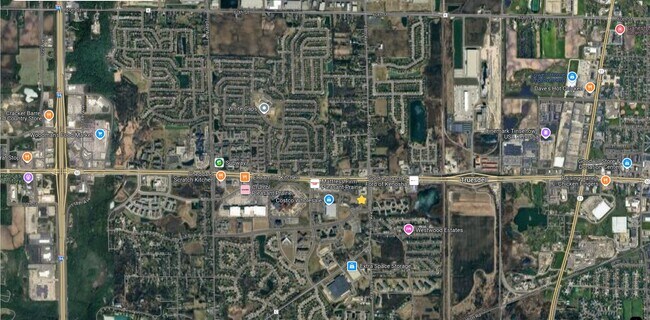
Nearby Places
Map Layers
Map Styles
 Street
 Aerial
- Restaurants
- Banks
- Shops
- Fitness
- Groceries
PUBLIC TRANSPORTATION
COMMUTER RAIL
Kenosha Station (Union Pacific North Line - Northeast Illinois Regional Commuter Railroad (Metra))
DRIVE
WALK
Distance
Kenosha Station (Union Pacific North Line - Northeast Illinois Regional Commuter Railroad (Metra))
12 min
6.2 mi
AIRPORT
General Mitchell International
DRIVE
WALK
Distance
General Mitchell International
38 min
30.3 mi
Freight Ports
Port Milwaukee
DRIVE
WALK
Distance
Port Milwaukee
42 min
34.2 mi
Nearby Properties
Address
Land Use
TOTAL SIZE
Lot Size
Zoning
Address
Land Use
TOTAL SIZE
Lot Size
Zoning
159,194 SF
136.60 AC
Address
Land Use
TOTAL SIZE
Lot Size
Zoning
271,533 SF
125.41 AC
Address
Land Use
TOTAL SIZE
Lot Size
Zoning
176,386 SF
58.38 AC
Address
Land Use
TOTAL SIZE
Lot Size
Zoning
603,010 SF
51.30 AC
Address
Land Use
TOTAL SIZE
Lot Size
Zoning
731,186 SF
81.94 AC
M2
Address
Land Use
TOTAL SIZE
Lot Size
Zoning
12,876 SF
30.13 AC
Address
Land Use
TOTAL SIZE
Lot Size
Zoning
77.22 AC
Address
Land Use
TOTAL SIZE
Lot Size
Zoning
69,139 SF
12.40 AC
Address
Land Use
TOTAL SIZE
Lot Size
Zoning
57.67 AC
Address
Land Use
TOTAL SIZE
Lot Size
Zoning
606,510 SF
36.02 AC
Address
Land Use
TOTAL SIZE
Lot Size
Zoning
424,072 SF
29.14 AC
Address
Land Use
TOTAL SIZE
Lot Size
Zoning
16.01 AC
Address
Land Use
TOTAL SIZE
Lot Size
Zoning
47.82 AC
Address
Land Use
TOTAL SIZE
Lot Size
Zoning
850,230 SF
39.46 AC
M2
Address
Land Use
TOTAL SIZE
Lot Size
Zoning
626,520 SF
35.19 AC
M2
Address
Land Use
TOTAL SIZE
Lot Size
Zoning
193,366 SF
11.63 AC
Address
Land Use
TOTAL SIZE
Lot Size
Zoning
13.10 AC
Address
Land Use
TOTAL SIZE
Lot Size
Zoning
215,460 SF
40.08 AC
Address
Land Use
TOTAL SIZE
Lot Size
Zoning
20.33 AC
M2
Address
Land Use
TOTAL SIZE
Lot Size
Zoning
35,092 SF
26.34 AC
B2
Address
Land Use
TOTAL SIZE
Lot Size
Zoning
31,809 SF
11.36 AC
BASE
Address
Land Use
TOTAL SIZE
Lot Size
Zoning
50,145 SF
12.76 AC
Address
Land Use
TOTAL SIZE
Lot Size
Zoning
4,643 SF
60 AC
Address
Land Use
TOTAL SIZE
Lot Size
Zoning
200,637 SF
12.01 AC
Address
Land Use
TOTAL SIZE
Lot Size
Zoning
15.32 AC
Address
Land Use
TOTAL SIZE
Lot Size
Zoning
253,256 SF
15.22 AC
Address
Land Use
TOTAL SIZE
Lot Size
Zoning
256,810 SF
15.02 AC
Address
Land Use
TOTAL SIZE
Lot Size
Zoning
55,140 SF
21 AC
FW
Address
Land Use
TOTAL SIZE
Lot Size
Zoning
48,284 SF
4.99 AC
Address
Land Use
TOTAL SIZE
Lot Size
Zoning
31.07 AC
The World's #1 Commercial Real Estate Marketplace
Connect with us
© 2026 CoStar Group
The information above has been obtained from sources believed reliable. While we do not doubt its accuracy we have not verified it and make no guarantee, warranty or representation about it. It is your responsibility to independently confirm its accuracy and completeness. Any projections, opinions, assumptions, or estimates used are for example only and do not represent the current or future performance of the property. The value of this transaction to you depends on tax and other factors which should be evaluated by your tax, financial, and legal advisors. You and your advisors should conduct a careful, independent investigation of the property to determine to your satisfaction the suitability of the property for your needs.