Property Record
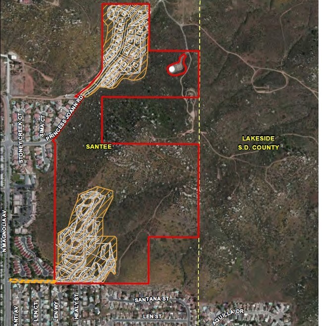
Princess Joann Rd, Santee, CA 92071

Property Detail
Princess Joann Rd
San Diego-Chula Vista-Carlsbad, CA
BLK 16 LOT 10 TR 000767
378-460-42
SAN DIEGO
Residentialacreage
California
HL
10
B and X Area of moderate flood hazard, usually the area between the limits of the 100-year and 500-year floods.
17.12 AC
2024
East County
2025
San Diego
016614
NEARBY LISTINGS FOR SALE OR LEASE
DEMOGRAPHICS near Princess Joann Rd
1 mile
3 mile
5 mile
2024 Total Population
7,238
61,011
145,438
2029 Population
7,142
60,790
145,057
Pop Growth 2024-2029
(1.33%)
(0.36%)
(0.26%)
Average Age
40
40
40
2024 Total Households
2,450
21,116
50,189
HH Growth 2024-2029
(1.51%)
(0.48%)
(0.40%)
Median Household Inc
$125,665
$108,499
$102,188
Avg Household Size
2.90
2.80
2.80
2024 Avg HH Vehicles
3.00
2.00
2.00
Median Home Value
$737,771
$723,478
$705,086
Median Year Built
1976
1978
1977
Nearby Places
Map Layers
Map Styles
 Street
 Aerial
Transit
 Traffic
 Biking
Places
Listings with unknown addresses are not visible on the map
- Restaurants
- Banks
- Shops
- Fitness
- Groceries
PUBLIC TRANSPORTATION
AIRPORT
San Diego International
Drive
Walk
Distance
San Diego International
32 min
20.8 mi
Freight Ports
Port of San Diego
Drive
Walk
Distance
Port of San Diego
30 min
20.9 mi
SALE & LEASE HISTORY
LISTING DATE
SALE/LEASE

Sep 24, 2016
For Sale
Oct 21, 2016
For Sale
Nearby Properties
Address
Land Use
TOTAL SIZE
Lot Size
Zoning
Address
Land Use
TOTAL SIZE
Lot Size
Zoning
6.82 AC
TC
Address
Land Use
TOTAL SIZE
Lot Size
Zoning
85,848 SF
5.03 AC
GC
Address
Land Use
TOTAL SIZE
Lot Size
Zoning
10.23 AC
R22
Address
Land Use
TOTAL SIZE
Lot Size
Zoning
5.45 AC
R14
Address
Land Use
TOTAL SIZE
Lot Size
Zoning
3.80 AC
NC/R14
Address
Land Use
TOTAL SIZE
Lot Size
Zoning
4.93 AC
C36
Address
Land Use
TOTAL SIZE
Lot Size
Zoning
4.75 AC
C-6
Address
Land Use
TOTAL SIZE
Lot Size
Zoning
3.33 AC
R22
Address
Land Use
TOTAL SIZE
Lot Size
Zoning
10.79 AC
TC
Address
Land Use
TOTAL SIZE
Lot Size
Zoning
79,662 SF
8.21 AC
S88
Address
Land Use
TOTAL SIZE
Lot Size
Zoning
8.72 AC
R14
Address
Land Use
TOTAL SIZE
Lot Size
Zoning
4.61 AC
R7
Address
Land Use
TOTAL SIZE
Lot Size
Zoning
76,977 SF
8.24 AC
TC
Address
Land Use
TOTAL SIZE
Lot Size
Zoning
22.15 AC
TC
Address
Land Use
TOTAL SIZE
Lot Size
Zoning
10.50 AC
TC
Address
Land Use
TOTAL SIZE
Lot Size
Zoning
87,704 SF
3.74 AC
RU
Address
Land Use
TOTAL SIZE
Lot Size
Zoning
93,339 SF
5.16 AC
IL/GC
Address
Land Use
TOTAL SIZE
Lot Size
Zoning
75,498 SF
6.77 AC
TC
Address
Land Use
TOTAL SIZE
Lot Size
Zoning
9.93 AC
S88
Address
Land Use
TOTAL SIZE
Lot Size
Zoning
55,170 SF
5.11 AC
GC
Address
Land Use
TOTAL SIZE
Lot Size
Zoning
81,578 SF
4.95 AC
R14
Address
Land Use
TOTAL SIZE
Lot Size
Zoning
14 AC
TC
Address
Land Use
TOTAL SIZE
Lot Size
Zoning
10.51 AC
GC
Address
Land Use
TOTAL SIZE
Lot Size
Zoning
8.04 AC
TC
Address
Land Use
TOTAL SIZE
Lot Size
Zoning
90,405 SF
5.44 AC
IL
Address
Land Use
TOTAL SIZE
Lot Size
Zoning
95,375 SF
6.90 AC
GC
Address
Land Use
TOTAL SIZE
Lot Size
Zoning
57,840 SF
5.59 AC
R7
Address
Land Use
TOTAL SIZE
Lot Size
Zoning
74,746 SF
4.74 AC
R22
Address
Land Use
TOTAL SIZE
Lot Size
Zoning
7.66 AC
S88
Address
Land Use
TOTAL SIZE
Lot Size
Zoning
90,936 SF
3.70 AC
C34
The World's #1 Commercial Real Estate Marketplace
Connect with us
© 2026 CoStar Group
The information above has been obtained from sources believed reliable. While we do not doubt its accuracy we have not verified it and make no guarantee, warranty or representation about it. It is your responsibility to independently confirm its accuracy and completeness. Any projections, opinions, assumptions, or estimates used are for example only and do not represent the current or future performance of the property. The value of this transaction to you depends on tax and other factors which should be evaluated by your tax, financial, and legal advisors. You and your advisors should conduct a careful, independent investigation of the property to determine to your satisfaction the suitability of the property for your needs.