Property Record
Providence Rd, Statham, GA 30666

NEARBY LISTINGS FOR SALE OR LEASE
Property Detail
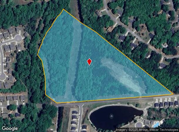
Providence Rd
Atlanta-Sandy Springs-Roswell, GA
Roxeywood Park Unit One
ST05-131
PROVIDENCE RD
Residentialacreage
Barrow
X
Georgia
13013C0155D
18 AC
2024
Barrow County
2024
Atlanta
180402
DEMOGRAPHICS near Providence Rd
1 Mile
3 Mile
5 Mile
2024 Total Population
2,557
12,588
27,675
2029 Population
3,013
14,743
32,107
Pop Growth 2024-2029
+ 17.83%
+ 17.12%
+ 16.01%
Average Age
37
38
38
2024 Total Households
905
4,444
9,646
HH Growth 2024-2029
+ 17.90%
+ 17.33%
+ 16.07%
Median Household Inc
$66,079
$70,019
$76,675
Avg Household Size
2.80
2.80
2.80
2024 Avg HH Vehicles
2.00
2.00
2.00
Median Home Value
$188,227
$242,819
$263,622
Median Year Built
2003
2003
2003
Nearby Places
Map Layers
Map Styles
 Street
 Aerial
- Restaurants
- Banks
- Shops
- Fitness
- Groceries
SALE & LEASE HISTORY
LISTING DATE
SALE/LEASE

Sep 24, 2016
For Sale
Oct 11, 2016
For Sale
Jan 06, 2017
For Sale
Dec 01, 2016
For Sale
Nearby Properties
Address
Land Use
TOTAL SIZE
Lot Size
Zoning
Address
Land Use
TOTAL SIZE
Lot Size
Zoning
160,000 SF
29.40 AC
O-I
Address
Land Use
TOTAL SIZE
Lot Size
Zoning
30,056 SF
311.70 AC
R-2
Address
Land Use
TOTAL SIZE
Lot Size
Zoning
224,093 SF
17.60 AC
LI
Address
Land Use
TOTAL SIZE
Lot Size
Zoning
11,060 SF
5.42 AC
Address
Land Use
TOTAL SIZE
Lot Size
Zoning
33,704 SF
14.20 AC
O-I
Address
Land Use
TOTAL SIZE
Lot Size
Zoning
41,916 SF
16.10 AC
LI
Address
Land Use
TOTAL SIZE
Lot Size
Zoning
2,800 SF
5.30 AC
O-I
Address
Land Use
TOTAL SIZE
Lot Size
Zoning
25,044 SF
9.20 AC
M-1
Address
Land Use
TOTAL SIZE
Lot Size
Zoning
22,142 SF
26.70 AC
AG
Address
Land Use
TOTAL SIZE
Lot Size
Zoning
82,500 SF
10.27 AC
001
Address
Land Use
TOTAL SIZE
Lot Size
Zoning
24,222 SF
3.80 AC
O-I
Address
Land Use
TOTAL SIZE
Lot Size
Zoning
20,891 SF
3.10 AC
HB
Address
Land Use
TOTAL SIZE
Lot Size
Zoning
1,421 SF
6.10 AC
R-2
Address
Land Use
TOTAL SIZE
Lot Size
Zoning
7,500 SF
3 AC
LI
Address
Land Use
TOTAL SIZE
Lot Size
Zoning
984 SF
2.10 AC
HB
Address
Land Use
TOTAL SIZE
Lot Size
Zoning
64,733 SF
1.60 AC
CB
Address
Land Use
TOTAL SIZE
Lot Size
Zoning
18,865 SF
0.50 AC
HR
Address
Land Use
TOTAL SIZE
Lot Size
Zoning
10,000 SF
2.60 AC
LI
Address
Land Use
TOTAL SIZE
Lot Size
Zoning
50.40 AC
AG
Address
Land Use
TOTAL SIZE
Lot Size
Zoning
86.10 AC
LI/HB
Address
Land Use
TOTAL SIZE
Lot Size
Zoning
29,485 SF
4.97 AC
001
Address
Land Use
TOTAL SIZE
Lot Size
Zoning
109.60 AC
PUD
Address
Land Use
TOTAL SIZE
Lot Size
Zoning
45.81 AC
001
Address
Land Use
TOTAL SIZE
Lot Size
Zoning
12,000 SF
5 AC
LI
Address
Land Use
TOTAL SIZE
Lot Size
Zoning
4,738 SF
9.80 AC
AG
Address
Land Use
TOTAL SIZE
Lot Size
Zoning
10,800 SF
5 AC
LI
Address
Land Use
TOTAL SIZE
Lot Size
Zoning
58.05 AC
AG
Address
Land Use
TOTAL SIZE
Lot Size
Zoning
9,170 SF
4 AC
C-2
Address
Land Use
TOTAL SIZE
Lot Size
Zoning
35,220 SF
5.40 AC
LI
Address
Land Use
TOTAL SIZE
Lot Size
Zoning
52.83 AC
A-1;TB
The World's #1 Commercial Real Estate Marketplace
Connect with us
© 2025 CoStar Group
The information above has been obtained from sources believed reliable. While we do not doubt its accuracy we have not verified it and make no guarantee, warranty or representation about it. It is your responsibility to independently confirm its accuracy and completeness. Any projections, opinions, assumptions, or estimates used are for example only and do not represent the current or future performance of the property. The value of this transaction to you depends on tax and other factors which should be evaluated by your tax, financial, and legal advisors. You and your advisors should conduct a careful, independent investigation of the property to determine to your satisfaction the suitability of the property for your needs.