Property Record
Prue Rd, San Antonio, TX 78240
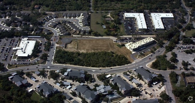

Property Detail
Prue Rd
San Antonio-New Braunfels, TX
NCB 14705 BLK 5 LOT 20 (GREAT HEART-PRUE) 2024 RESURVEY PER DEED 20230045358///2020 NEW PER PLAT 20001/991 FILED 4-22-19 CR 46991//2019 RESURVEY PER DEED 20180176236 CR 45367 2016-REMINS ACCT PER SPLIT PER DEED 17094/1457. EXE 2-19-15. LR/GIS/6-8-15.
14705-005-0200
BEXAR
Publicschool
Texas
B and X Area of moderate flood hazard, usually the area between the limits of the 100-year and 500-year floods.
20
0
10.89 AC
2025
Northwest
181503
San Antonio
22,495 SF
NEARBY LISTINGS FOR SALE OR LEASE
-
-
View all San Antonio listings for sale on LoopNet.com
DEMOGRAPHICS near Prue Rd
1 mile
3 mile
5 mile
2025 Total Population
14,337
137,590
333,468
2030 Population
15,170
144,588
350,147
Pop Growth 2025-2030
+ 5.81%
+ 5.09%
+ 5.00%
Average Age
35
37
38
2025 Total Households
7,154
62,769
143,253
HH Growth 2025-2030
+ 6.07%
+ 5.34%
+ 5.30%
Median Household Inc
$61,455
$63,326
$63,934
Avg Household Size
2.00
2.10
2.30
2025 Avg HH Vehicles
1.00
2.00
2.00
Median Home Value
$293,540
$307,312
$306,375
Median Year Built
1994
1989
1988
Nearby Places
Map Layers
Map Styles
 Street
 Aerial
Layers
 Traffic
 Biking
Places
Listings with unknown addresses are not visible on the map
- Restaurants
- Banks
- Shops
- Fitness
- Groceries
PUBLIC TRANSPORTATION
AIRPORT
San Antonio International
Drive
Walk
Distance
San Antonio International
14 min
9.5 mi
Freight Ports
Calhoun Port
Drive
Walk
Distance
Calhoun Port
196 min
160.3 mi
Nearby Properties
Address
Land Use
TOTAL SIZE
Lot Size
Zoning
Address
Land Use
TOTAL SIZE
Lot Size
Zoning
1,414,945 SF
16.77 AC
Address
Land Use
TOTAL SIZE
Lot Size
Zoning
4,465,972 SF
231.60 AC
Address
Land Use
TOTAL SIZE
Lot Size
Zoning
499,480 SF
19.57 AC
Address
Land Use
TOTAL SIZE
Lot Size
Zoning
609,267 SF
30.47 AC
Address
Land Use
TOTAL SIZE
Lot Size
Zoning
227,586 SF
25.46 AC
Address
Land Use
TOTAL SIZE
Lot Size
Zoning
462,227 SF
31.21 AC
Address
Land Use
TOTAL SIZE
Lot Size
Zoning
429,561 SF
25.70 AC
Address
Land Use
TOTAL SIZE
Lot Size
Zoning
300,264 SF
27.81 AC
Address
Land Use
TOTAL SIZE
Lot Size
Zoning
331,715 SF
9.04 AC
Address
Land Use
TOTAL SIZE
Lot Size
Zoning
97.47 AC
Address
Land Use
TOTAL SIZE
Lot Size
Zoning
389,048 SF
16.25 AC
Address
Land Use
TOTAL SIZE
Lot Size
Zoning
320,406 SF
12.11 AC
Address
Land Use
TOTAL SIZE
Lot Size
Zoning
395,039 SF
31 AC
Address
Land Use
TOTAL SIZE
Lot Size
Zoning
352,231 SF
19.54 AC
Address
Land Use
TOTAL SIZE
Lot Size
Zoning
238,999 SF
8.43 AC
Address
Land Use
TOTAL SIZE
Lot Size
Zoning
724,148 SF
18.70 AC
Address
Land Use
TOTAL SIZE
Lot Size
Zoning
278,352 SF
10 AC
Address
Land Use
TOTAL SIZE
Lot Size
Zoning
306,959 SF
15.24 AC
Address
Land Use
TOTAL SIZE
Lot Size
Zoning
482,412 SF
22.97 AC
Address
Land Use
TOTAL SIZE
Lot Size
Zoning
152,266 SF
18.72 AC
Address
Land Use
TOTAL SIZE
Lot Size
Zoning
183,249 SF
21.94 AC
Address
Land Use
TOTAL SIZE
Lot Size
Zoning
520,686 SF
53.63 AC
Address
Land Use
TOTAL SIZE
Lot Size
Zoning
349,074 SF
27.84 AC
Address
Land Use
TOTAL SIZE
Lot Size
Zoning
280,198 SF
15.96 AC
Address
Land Use
TOTAL SIZE
Lot Size
Zoning
331,778 SF
20.62 AC
Address
Land Use
TOTAL SIZE
Lot Size
Zoning
301,817 SF
12.22 AC
Address
Land Use
TOTAL SIZE
Lot Size
Zoning
284,890 SF
18.83 AC
Address
Land Use
TOTAL SIZE
Lot Size
Zoning
121,989 SF
18.03 AC
Address
Land Use
TOTAL SIZE
Lot Size
Zoning
171,316 SF
14.20 AC
Address
Land Use
TOTAL SIZE
Lot Size
Zoning
277,688 SF
16.42 AC
The World's #1 Commercial Real Estate Marketplace
Connect with us
© 2026 CoStar Group
The information above has been obtained from sources believed reliable. While we do not doubt its accuracy we have not verified it and make no guarantee, warranty or representation about it. It is your responsibility to independently confirm its accuracy and completeness. Any projections, opinions, assumptions, or estimates used are for example only and do not represent the current or future performance of the property. The value of this transaction to you depends on tax and other factors which should be evaluated by your tax, financial, and legal advisors. You and your advisors should conduct a careful, independent investigation of the property to determine to your satisfaction the suitability of the property for your needs.