Property Record
Putnam Pike, Glocester, RI 02859

Property Detail
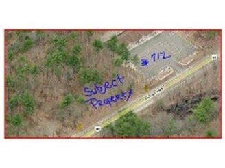
Putnam Pike
GLOC-000014-000000-000224
PROVIDENCE
Commercialacreage
Rhode Island
40
0.55 AC
B and X Area of moderate flood hazard, usually the area between the limits of the 100-year and 500-year floods.
Burrillville/Glocester
2025
Providence
2025
Providence-Warwick, RI-MA
013001
NEARBY LISTINGS FOR SALE OR LEASE
-
-
View all Glocester listings for sale on LoopNet.com
DEMOGRAPHICS near Putnam Pike
1 mile
3 mile
5 mile
2025 Total Population
418
6,793
31,901
2030 Population
434
7,100
33,487
Pop Growth 2025-2030
+ 3.83%
+ 4.52%
+ 4.97%
Average Age
44
44
44
2025 Total Households
157
2,620
11,616
HH Growth 2025-2030
+ 3.82%
+ 4.54%
+ 5.20%
Median Household Inc
$108,333
$109,845
$106,936
Avg Household Size
2.60
2.60
2.50
2025 Avg HH Vehicles
3.00
2.00
2.00
Median Home Value
$429,411
$420,081
$433,756
Median Year Built
1975
1973
1974
Nearby Places
Map Layers
Map Styles
 Street
 Aerial
Transit
 Traffic
 Biking
Places
Listings with unknown addresses are not visible on the map
- Restaurants
- Banks
- Shops
- Fitness
- Groceries
PUBLIC TRANSPORTATION
AIRPORT
Rhode Island Tf Green International
Drive
Walk
Distance
Rhode Island Tf Green International
33 min
20.8 mi
Worcester Regional
Drive
Walk
Distance
Worcester Regional
55 min
38.2 mi
Freight Ports
Port of Davisville, RI
Drive
Walk
Distance
Port of Davisville, RI
44 min
30.1 mi
SALE & LEASE HISTORY
LISTING DATE
SALE/LEASE

Sep 24, 2016
For Sale
Nearby Properties
Address
Land Use
TOTAL SIZE
Lot Size
Zoning
Address
Land Use
TOTAL SIZE
Lot Size
Zoning
45,899 SF
41.06 AC
20
Address
Land Use
TOTAL SIZE
Lot Size
Zoning
173.57 AC
20
Address
Land Use
TOTAL SIZE
Lot Size
Zoning
16,711 SF
2.06 AC
40
Address
Land Use
TOTAL SIZE
Lot Size
Zoning
14,239 SF
186.15 AC
R40
Address
Land Use
TOTAL SIZE
Lot Size
Zoning
16.05 AC
80
Address
Land Use
TOTAL SIZE
Lot Size
Zoning
25,950 SF
4.99 AC
40
Address
Land Use
TOTAL SIZE
Lot Size
Zoning
8.76 AC
80
Address
Land Use
TOTAL SIZE
Lot Size
Zoning
1,390 SF
96 AC
20
Address
Land Use
TOTAL SIZE
Lot Size
Zoning
51.19 AC
10
Address
Land Use
TOTAL SIZE
Lot Size
Zoning
10.22 AC
1
Address
Land Use
TOTAL SIZE
Lot Size
Zoning
131.39 AC
20
Address
Land Use
TOTAL SIZE
Lot Size
Zoning
238.68 AC
20
Address
Land Use
TOTAL SIZE
Lot Size
Zoning
32.18 AC
30
Address
Land Use
TOTAL SIZE
Lot Size
Zoning
1,936 SF
36.04 AC
20
Address
Land Use
TOTAL SIZE
Lot Size
Zoning
2.03 AC
3
Address
Land Use
TOTAL SIZE
Lot Size
Zoning
2.75 AC
2
Address
Land Use
TOTAL SIZE
Lot Size
Zoning
8,054 SF
7.16 AC
20
Address
Land Use
TOTAL SIZE
Lot Size
Zoning
2.88 AC
80
Address
Land Use
TOTAL SIZE
Lot Size
Zoning
4,414 SF
150.82 AC
20
Address
Land Use
TOTAL SIZE
Lot Size
Zoning
4,097 SF
0.87 AC
80
Address
Land Use
TOTAL SIZE
Lot Size
Zoning
9.84 AC
20
Address
Land Use
TOTAL SIZE
Lot Size
Zoning
2.94 AC
60
Address
Land Use
TOTAL SIZE
Lot Size
Zoning
4,884 SF
1.84 AC
20
Address
Land Use
TOTAL SIZE
Lot Size
Zoning
4,255 SF
15 AC
20
Address
Land Use
TOTAL SIZE
Lot Size
Zoning
9,207 SF
1.02 AC
10
Address
Land Use
TOTAL SIZE
Lot Size
Zoning
5,120 SF
18.71 AC
20
Address
Land Use
TOTAL SIZE
Lot Size
Zoning
5,672 SF
1 AC
20
Address
Land Use
TOTAL SIZE
Lot Size
Zoning
41.06 AC
20
Address
Land Use
TOTAL SIZE
Lot Size
Zoning
7,560 SF
1.30 AC
1
Address
Land Use
TOTAL SIZE
Lot Size
Zoning
2,829 SF
3.85 AC
80
The World's #1 Commercial Real Estate Marketplace
Connect with us
© 2026 CoStar Group
The information above has been obtained from sources believed reliable. While we do not doubt its accuracy we have not verified it and make no guarantee, warranty or representation about it. It is your responsibility to independently confirm its accuracy and completeness. Any projections, opinions, assumptions, or estimates used are for example only and do not represent the current or future performance of the property. The value of this transaction to you depends on tax and other factors which should be evaluated by your tax, financial, and legal advisors. You and your advisors should conduct a careful, independent investigation of the property to determine to your satisfaction the suitability of the property for your needs.