Property Record
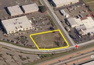
Pyrites Way, Gold River, CA 95670

NEARBY LISTINGS FOR SALE OR LEASE
-
-
-
-
Rancho Cordova Pky @ International Dr.
Rancho Cordova, CA 95742
$645,559 - $14,951,316
1.56 - 14.36 AC Lot
Land
-
-
-
-
View all Gold River listings for sale on LoopNet.com
Property Detail
Pyrites Way
Sacramento-Roseville-Folsom, CA
Sunrise River Industrial Park
069-0031-052
POR PCLS 12 & 13 SUNRISE RIVER INDUSTRIAL PARK, PM 87-20 DES ASBEG AT A PT LOC S19%1330E 271.50 FT FR THE MOST NLY COR OFSD
Industrialacreage
Sacramento
X
California
06067C0207H
12
2024
1.40 AC
2025
Highway 50 Corridor
008908
Sacramento
DEMOGRAPHICS near Pyrites Way
1 Mile
3 Mile
5 Mile
2024 Total Population
8,150
64,133
221,317
2029 Population
8,199
64,437
222,780
Pop Growth 2024-2029
+ 0.60%
+ 0.47%
+ 0.66%
Average Age
47
43
41
2024 Total Households
3,596
25,504
85,694
HH Growth 2024-2029
+ 0.67%
+ 0.44%
+ 0.62%
Median Household Inc
$90,274
$93,850
$88,141
Avg Household Size
2.30
2.50
2.50
2024 Avg HH Vehicles
2.00
2.00
2.00
Median Home Value
$474,555
$514,466
$495,533
Median Year Built
1983
1977
1976
Nearby Places
Map Layers
Map Styles
 Street
 Aerial
- Restaurants
- Banks
- Shops
- Fitness
- Groceries
PUBLIC TRANSPORTATION
AIRPORT
Sacramento International
DRIVE
WALK
Distance
Sacramento International
37 min
27.7 mi
Freight Ports
Port of Stockton
DRIVE
WALK
Distance
Port of Stockton
73 min
61.3 mi
SALE & LEASE HISTORY
LISTING DATE
SALE/LEASE

Sep 24, 2016
For Sale
Nearby Properties
Address
Land Use
TOTAL SIZE
Lot Size
Zoning
Address
Land Use
TOTAL SIZE
Lot Size
Zoning
SPA (ASPA)
Address
Land Use
TOTAL SIZE
Lot Size
Zoning
304,607 SF
14.70 AC
LC
Address
Land Use
TOTAL SIZE
Lot Size
Zoning
251,024 SF
5.19 AC
SPA (CVSPA
Address
Land Use
TOTAL SIZE
Lot Size
Zoning
83.57 AC
MP (RDOSP)
Address
Land Use
TOTAL SIZE
Lot Size
Zoning
7.94 AC
RD-25
Address
Land Use
TOTAL SIZE
Lot Size
Zoning
202,776 SF
12.17 AC
RD-25 (PC)
Address
Land Use
TOTAL SIZE
Lot Size
Zoning
192,500 SF
11.78 AC
OPMU
Address
Land Use
TOTAL SIZE
Lot Size
Zoning
269,928 SF
246.95 AC
SPA
Address
Land Use
TOTAL SIZE
Lot Size
Zoning
323,088 SF
19.69 AC
OPMU
Address
Land Use
TOTAL SIZE
Lot Size
Zoning
14.54 AC
SPA (ASPA)
Address
Land Use
TOTAL SIZE
Lot Size
Zoning
162,023 SF
8.96 AC
OIMU
Address
Land Use
TOTAL SIZE
Lot Size
Zoning
166,216 SF
10.77 AC
M-2
Address
Land Use
TOTAL SIZE
Lot Size
Zoning
6.31 AC
RC (ZSPA)
Address
Land Use
TOTAL SIZE
Lot Size
Zoning
132,149 SF
8.29 AC
OPMU
Address
Land Use
TOTAL SIZE
Lot Size
Zoning
156,032 SF
9.31 AC
OPMU
Address
Land Use
TOTAL SIZE
Lot Size
Zoning
12,548 SF
14.36 AC
RD-30
Address
Land Use
TOTAL SIZE
Lot Size
Zoning
218,216 SF
14.22 AC
OPMU
Address
Land Use
TOTAL SIZE
Lot Size
Zoning
198,413 SF
9.24 AC
RD 30
Address
Land Use
TOTAL SIZE
Lot Size
Zoning
104,042 SF
7.40 AC
OIMU
Address
Land Use
TOTAL SIZE
Lot Size
Zoning
135,197 SF
11.38 AC
SPA (CVSPA
Address
Land Use
TOTAL SIZE
Lot Size
Zoning
137,306 SF
15.91 AC
GC
Address
Land Use
TOTAL SIZE
Lot Size
Zoning
140,102 SF
3.30 AC
RD-20
Address
Land Use
TOTAL SIZE
Lot Size
Zoning
258,819 SF
13.47 AC
RD 30
Address
Land Use
TOTAL SIZE
Lot Size
Zoning
164,149 SF
9.31 AC
LI (ZSPA)
Address
Land Use
TOTAL SIZE
Lot Size
Zoning
12,988 SF
3.98 AC
M-2
Address
Land Use
TOTAL SIZE
Lot Size
Zoning
112,244 SF
3.55 AC
GC
Address
Land Use
TOTAL SIZE
Lot Size
Zoning
218,823 SF
10.77 AC
HDR
Address
Land Use
TOTAL SIZE
Lot Size
Zoning
115,593 SF
6.31 AC
OPMU
Address
Land Use
TOTAL SIZE
Lot Size
Zoning
85,320 SF
4 AC
SPA
Address
Land Use
TOTAL SIZE
Lot Size
Zoning
2,646.76 AC
SPA
The World's #1 Commercial Real Estate Marketplace
Connect with us
© 2026 CoStar Group
The information above has been obtained from sources believed reliable. While we do not doubt its accuracy we have not verified it and make no guarantee, warranty or representation about it. It is your responsibility to independently confirm its accuracy and completeness. Any projections, opinions, assumptions, or estimates used are for example only and do not represent the current or future performance of the property. The value of this transaction to you depends on tax and other factors which should be evaluated by your tax, financial, and legal advisors. You and your advisors should conduct a careful, independent investigation of the property to determine to your satisfaction the suitability of the property for your needs.