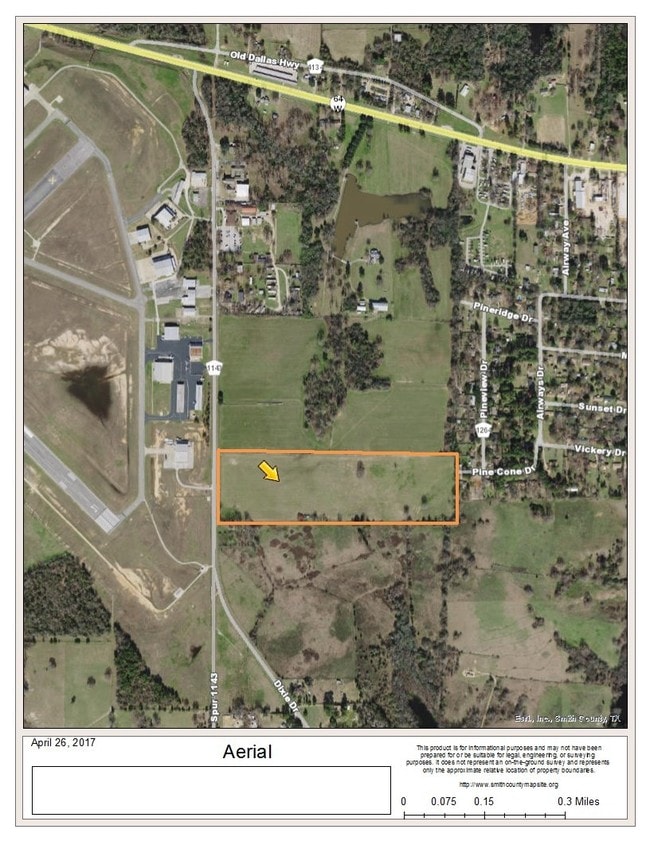
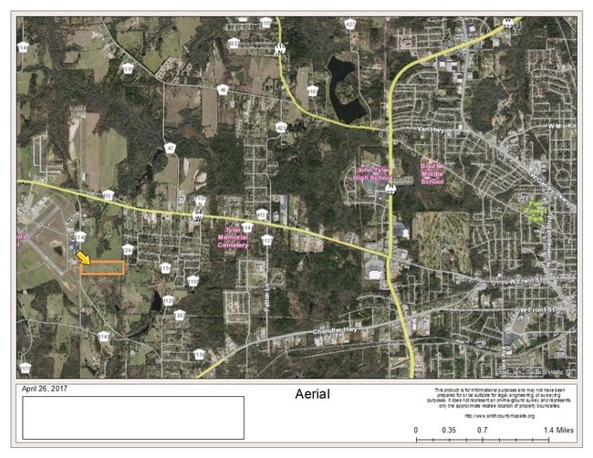
Property Record
R114 County Road 1143, , TX

Property Detail
R114 County Road 1143
Tyler, TX
ABST A0643 G MYERS TRACT 60
1-00000-0643-02-060000
SMITH
Agriculturalland
Texas
B and X Area of moderate flood hazard, usually the area between the limits of the 100-year and 500-year floods.
25.80 AC
2025
Tyler
2025
Other Market Areas
001607
NEARBY LISTINGS FOR SALE OR LEASE
DEMOGRAPHICS near R114 County Road 1143
1 mile
3 mile
5 mile
2025 Total Population
1,849
11,790
44,231
2030 Population
1,949
12,541
46,855
Pop Growth 2025-2030
+ 5.41%
+ 6.37%
+ 5.93%
Average Age
39
38
37
2025 Total Households
690
4,215
15,956
HH Growth 2025-2030
+ 4.93%
+ 5.86%
+ 5.45%
Median Household Inc
$66,088
$58,485
$56,434
Avg Household Size
2.50
2.70
2.60
2025 Avg HH Vehicles
2.00
2.00
2.00
Median Home Value
$170,535
$190,299
$147,758
Median Year Built
1977
1976
1971
Nearby Places
Map Layers
Map Styles
 Street
 Aerial
Layers
 Traffic
 Biking
Places
Listings with unknown addresses are not visible on the map
- Restaurants
- Banks
- Shops
- Fitness
- Groceries
PUBLIC TRANSPORTATION
AIRPORT
Tyler Pounds Regional
Drive
Walk
Distance
Tyler Pounds Regional
9 min
3.0 mi
Freight Ports
Port of Shreveport
Drive
Walk
Distance
Port of Shreveport
131 min
112.4 mi
SALE & LEASE HISTORY
LISTING DATE
SALE/LEASE

Sep 24, 2019
For Sale
Jul 26, 2017
For Lease
Apr 28, 2017
For Sale
Nearby Properties
Address
Land Use
TOTAL SIZE
Lot Size
Zoning
Address
Land Use
TOTAL SIZE
Lot Size
Zoning
187.64 AC
R1A
Address
Land Use
TOTAL SIZE
Lot Size
Zoning
311.96 AC
Address
Land Use
TOTAL SIZE
Lot Size
Zoning
63 AC
R1A
Address
Land Use
TOTAL SIZE
Lot Size
Zoning
22.85 AC
Address
Land Use
TOTAL SIZE
Lot Size
Zoning
Address
Land Use
TOTAL SIZE
Lot Size
Zoning
722 SF
14 AC
RMF
Address
Land Use
TOTAL SIZE
Lot Size
Zoning
14.16 AC
Address
Land Use
TOTAL SIZE
Lot Size
Zoning
205,196 SF
25.19 AC
C2
Address
Land Use
TOTAL SIZE
Lot Size
Zoning
25.57 AC
Address
Land Use
TOTAL SIZE
Lot Size
Zoning
51,000 SF
52.09 AC
Address
Land Use
TOTAL SIZE
Lot Size
Zoning
135,792 SF
12.05 AC
C1
Address
Land Use
TOTAL SIZE
Lot Size
Zoning
1,868 SF
2.24 AC
Address
Land Use
TOTAL SIZE
Lot Size
Zoning
92,268 SF
8.48 AC
C2
Address
Land Use
TOTAL SIZE
Lot Size
Zoning
352.91 AC
OSP
Address
Land Use
TOTAL SIZE
Lot Size
Zoning
64,882 SF
6.07 AC
C1
Address
Land Use
TOTAL SIZE
Lot Size
Zoning
32,175 SF
3.48 AC
C2
Address
Land Use
TOTAL SIZE
Lot Size
Zoning
1,200 SF
42.83 AC
Address
Land Use
TOTAL SIZE
Lot Size
Zoning
12,355 SF
7 AC
Address
Land Use
TOTAL SIZE
Lot Size
Zoning
69,000 SF
6 AC
Address
Land Use
TOTAL SIZE
Lot Size
Zoning
3,950 SF
3.13 AC
Address
Land Use
TOTAL SIZE
Lot Size
Zoning
55,840 SF
6.39 AC
Address
Land Use
TOTAL SIZE
Lot Size
Zoning
17,617 SF
8.88 AC
Address
Land Use
TOTAL SIZE
Lot Size
Zoning
10,000 SF
89.17 AC
Address
Land Use
TOTAL SIZE
Lot Size
Zoning
24,912 SF
3.60 AC
RMF
Address
Land Use
TOTAL SIZE
Lot Size
Zoning
1,479 SF
1.38 AC
Address
Land Use
TOTAL SIZE
Lot Size
Zoning
8,392 SF
6.48 AC
Address
Land Use
TOTAL SIZE
Lot Size
Zoning
20.10 AC
R1A
Address
Land Use
TOTAL SIZE
Lot Size
Zoning
4.97 AC
R1A
Address
Land Use
TOTAL SIZE
Lot Size
Zoning
12,440 SF
12.09 AC
Address
Land Use
TOTAL SIZE
Lot Size
Zoning
9.83 AC
The World's #1 Commercial Real Estate Marketplace
Connect with us
© 2026 CoStar Group
The information above has been obtained from sources believed reliable. While we do not doubt its accuracy we have not verified it and make no guarantee, warranty or representation about it. It is your responsibility to independently confirm its accuracy and completeness. Any projections, opinions, assumptions, or estimates used are for example only and do not represent the current or future performance of the property. The value of this transaction to you depends on tax and other factors which should be evaluated by your tax, financial, and legal advisors. You and your advisors should conduct a careful, independent investigation of the property to determine to your satisfaction the suitability of the property for your needs.