Property Record
R3e R3e, Davis, CA 95694

This Property Is For Sale
Property Detail
R3e R3e
033-110-008-000
T8N R3E 320.00 AC
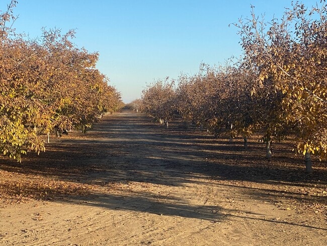
Farms
YOLO
AP
California
A Areas with a 1% annual chance of flooding and a 26% chance of flooding over the life of a 30-year mortgage.
160 AC
2024
Davis/Woodland
2025
Sacramento
010401
Sacramento-Roseville-Folsom, CA
NEARBY LISTINGS FOR SALE OR LEASE
-
-
View all Davis listings for sale on LoopNet.com
DEMOGRAPHICS near R3e R3e
1 mile
3 mile
5 mile
2025 Total Population
3
2,498
42,016
2030 Population
3
2,534
43,049
Pop Growth 2025-2030
0.00%
+ 1.44%
+ 2.46%
Average Age
0
48
35
2025 Total Households
1
959
14,803
HH Growth 2025-2030
0.00%
+ 1.77%
+ 2.50%
Median Household Inc
$0
$220,225
$92,671
Avg Household Size
.00
2.60
2.50
2025 Avg HH Vehicles
.00
2.00
2.00
Median Home Value
$1,150,000
$1,110,090
$828,261
Median Year Built
0
1980
1984
Nearby Places
Map Layers
Map Styles
 Street
 Aerial
Transit
 Traffic
 Biking
Places
Listings with unknown addresses are not visible on the map
- Restaurants
- Banks
- Shops
- Fitness
- Groceries
PUBLIC TRANSPORTATION
COMMUTER RAIL
Davis (Capitol Corridor - Capitol Corridor Joint Powers Authority)
Drive
Walk
Distance
Davis (Capitol Corridor - Capitol Corridor Joint Powers Authority)
13 min
5.9 mi
AIRPORT
Sacramento International
Drive
Walk
Distance
Sacramento International
34 min
22.4 mi
Freight Ports
Port of Stockton
Drive
Walk
Distance
Port of Stockton
72 min
58.4 mi
Nearby Properties
Address
Land Use
TOTAL SIZE
Lot Size
Zoning
Address
Land Use
TOTAL SIZE
Lot Size
Zoning
29,376 SF
0.14 AC
PD
Address
Land Use
TOTAL SIZE
Lot Size
Zoning
225,000 SF
7.43 AC
PD
Address
Land Use
TOTAL SIZE
Lot Size
Zoning
209,988 SF
0.11 AC
PD
Address
Land Use
TOTAL SIZE
Lot Size
Zoning
168,279 SF
0.09 AC
R-M
Address
Land Use
TOTAL SIZE
Lot Size
Zoning
134,214 SF
5.99 AC
PD
Address
Land Use
TOTAL SIZE
Lot Size
Zoning
174,228 SF
0.16 AC
PD
Address
Land Use
TOTAL SIZE
Lot Size
Zoning
126,842 SF
13.56 AC
PD
Address
Land Use
TOTAL SIZE
Lot Size
Zoning
148,848 SF
0.13 AC
I
Address
Land Use
TOTAL SIZE
Lot Size
Zoning
107,817 SF
6.44 AC
PD
Address
Land Use
TOTAL SIZE
Lot Size
Zoning
1.37 AC
PD
Address
Land Use
TOTAL SIZE
Lot Size
Zoning
2.52 AC
I
Address
Land Use
TOTAL SIZE
Lot Size
Zoning
99,399 SF
5.83 AC
I
Address
Land Use
TOTAL SIZE
Lot Size
Zoning
68,428 SF
0.29 AC
PD
Address
Land Use
TOTAL SIZE
Lot Size
Zoning
213,692 SF
8.07 AC
03
Address
Land Use
TOTAL SIZE
Lot Size
Zoning
102,400 SF
5.78 AC
PD
Address
Land Use
TOTAL SIZE
Lot Size
Zoning
90,752 SF
0.21 AC
R3
Address
Land Use
TOTAL SIZE
Lot Size
Zoning
78,953 SF
2.69 AC
I
Address
Land Use
TOTAL SIZE
Lot Size
Zoning
79,719 SF
3.50 AC
PD
Address
Land Use
TOTAL SIZE
Lot Size
Zoning
99,968 SF
0.19 AC
R3M
Address
Land Use
TOTAL SIZE
Lot Size
Zoning
2.03 AC
I-R
Address
Land Use
TOTAL SIZE
Lot Size
Zoning
0.23 AC
PD
Address
Land Use
TOTAL SIZE
Lot Size
Zoning
5.24 AC
I-R
Address
Land Use
TOTAL SIZE
Lot Size
Zoning
62,216 SF
2.49 AC
I
Address
Land Use
TOTAL SIZE
Lot Size
Zoning
60,000 SF
6.39 AC
PD4
Address
Land Use
TOTAL SIZE
Lot Size
Zoning
71,139 SF
5.11 AC
I
Address
Land Use
TOTAL SIZE
Lot Size
Zoning
107,612 SF
7.81 AC
I
Address
Land Use
TOTAL SIZE
Lot Size
Zoning
58,968 SF
0.27 AC
R-M
Address
Land Use
TOTAL SIZE
Lot Size
Zoning
130,500 SF
0.12 AC
R3L
Address
Land Use
TOTAL SIZE
Lot Size
Zoning
50,396 SF
0.42 AC
PD
Address
Land Use
TOTAL SIZE
Lot Size
Zoning
1.27 AC
PD
The World's #1 Commercial Real Estate Marketplace
Connect with us
© 2026 CoStar Group
The information above has been obtained from sources believed reliable. While we do not doubt its accuracy we have not verified it and make no guarantee, warranty or representation about it. It is your responsibility to independently confirm its accuracy and completeness. Any projections, opinions, assumptions, or estimates used are for example only and do not represent the current or future performance of the property. The value of this transaction to you depends on tax and other factors which should be evaluated by your tax, financial, and legal advisors. You and your advisors should conduct a careful, independent investigation of the property to determine to your satisfaction the suitability of the property for your needs.