Property Record
Radar Hill Rd, Rapid City, SD 57703

Property Detail
Radar Hill Rd
Rapid City, SD
S18, T1N, R09E, BLACK HILLS MERIDIAN, E1/2 LESS ROW; E1/2W1/2 LESS ROW; GL 1 LESS LOT A & LESS ROW; GL 3 LESS PT OF LOT 4 OF
0065214
PENNINGTON
Agriculturalland
South Dakota
A Areas with a 1% annual chance of flooding and a 26% chance of flooding over the life of a 30-year mortgage.
1a
2025
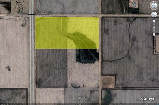
560.36 AC
2025
Rapid City
011601
Other Market Areas
NEARBY LISTINGS FOR SALE OR LEASE
-
-
View all Rapid City listings for sale on LoopNet.com
DEMOGRAPHICS near Radar Hill Rd
1 mile
3 mile
5 mile
2025 Total Population
451
9,675
23,121
2030 Population
481
10,101
24,332
Pop Growth 2025-2030
+ 6.65%
+ 4.40%
+ 5.24%
Average Age
36
39
39
2025 Total Households
168
3,647
8,759
HH Growth 2025-2030
+ 7.14%
+ 4.61%
+ 5.43%
Median Household Inc
$86,538
$85,909
$86,183
Avg Household Size
2.70
2.60
2.60
2025 Avg HH Vehicles
3.00
2.00
2.00
Median Home Value
$340,000
$266,752
$289,159
Median Year Built
2010
1995
2000
Nearby Places
Map Layers
Map Styles
 Street
 Aerial
Layers
 Traffic
 Biking
Places
Listings with unknown addresses are not visible on the map
- Restaurants
- Banks
- Shops
- Fitness
- Groceries
PUBLIC TRANSPORTATION
AIRPORT
Rapid City Regional
Drive
Walk
Distance
Rapid City Regional
9 min
4.6 mi
Freight Ports
Tulsa Port Of Catoosa
Drive
Walk
Distance
Tulsa Port Of Catoosa
967 min
886.5 mi
Nearby Properties
Address
Land Use
TOTAL SIZE
Lot Size
Zoning
Address
Land Use
TOTAL SIZE
Lot Size
Zoning
22,027 SF
643.59 AC
Address
Land Use
TOTAL SIZE
Lot Size
Zoning
27,200 SF
643.59 AC
Address
Land Use
TOTAL SIZE
Lot Size
Zoning
4,464 SF
50.45 AC
Address
Land Use
TOTAL SIZE
Lot Size
Zoning
19,500 SF
643.59 AC
Address
Land Use
TOTAL SIZE
Lot Size
Zoning
9,354 SF
1.50 AC
Address
Land Use
TOTAL SIZE
Lot Size
Zoning
11,500 SF
643.59 AC
Address
Land Use
TOTAL SIZE
Lot Size
Zoning
768 SF
0.31 AC
Address
Land Use
TOTAL SIZE
Lot Size
Zoning
2,880 SF
0.70 AC
Address
Land Use
TOTAL SIZE
Lot Size
Zoning
2,880 SF
0.69 AC
Address
Land Use
TOTAL SIZE
Lot Size
Zoning
4,800 SF
2.71 AC
Address
Land Use
TOTAL SIZE
Lot Size
Zoning
3,840 SF
22.08 AC
Address
Land Use
TOTAL SIZE
Lot Size
Zoning
1,692 SF
4.17 AC
Address
Land Use
TOTAL SIZE
Lot Size
Zoning
2,316 SF
0.40 AC
Address
Land Use
TOTAL SIZE
Lot Size
Zoning
2,296 SF
0.29 AC
Address
Land Use
TOTAL SIZE
Lot Size
Zoning
2,296 SF
0.43 AC
Address
Land Use
TOTAL SIZE
Lot Size
Zoning
2,316 SF
0.50 AC
Address
Land Use
TOTAL SIZE
Lot Size
Zoning
12,204 SF
643.59 AC
Address
Land Use
TOTAL SIZE
Lot Size
Zoning
9,038 SF
5 AC
Address
Land Use
TOTAL SIZE
Lot Size
Zoning
15,140 SF
643.59 AC
Address
Land Use
TOTAL SIZE
Lot Size
Zoning
10,000 SF
643.59 AC
Address
Land Use
TOTAL SIZE
Lot Size
Zoning
6,400 SF
643.59 AC
Address
Land Use
TOTAL SIZE
Lot Size
Zoning
4,000 SF
1.84 AC
Address
Land Use
TOTAL SIZE
Lot Size
Zoning
5,600 SF
643.59 AC
Address
Land Use
TOTAL SIZE
Lot Size
Zoning
5,400 SF
643.59 AC
Address
Land Use
TOTAL SIZE
Lot Size
Zoning
3,600 SF
643.68 AC
Address
Land Use
TOTAL SIZE
Lot Size
Zoning
567 SF
3.36 AC
Address
Land Use
TOTAL SIZE
Lot Size
Zoning
179.03 AC
Address
Land Use
TOTAL SIZE
Lot Size
Zoning
5,893 SF
643.59 AC
Address
Land Use
TOTAL SIZE
Lot Size
Zoning
33.80 AC
The World's #1 Commercial Real Estate Marketplace
Connect with us
© 2026 CoStar Group
The information above has been obtained from sources believed reliable. While we do not doubt its accuracy we have not verified it and make no guarantee, warranty or representation about it. It is your responsibility to independently confirm its accuracy and completeness. Any projections, opinions, assumptions, or estimates used are for example only and do not represent the current or future performance of the property. The value of this transaction to you depends on tax and other factors which should be evaluated by your tax, financial, and legal advisors. You and your advisors should conduct a careful, independent investigation of the property to determine to your satisfaction the suitability of the property for your needs.