Property Record
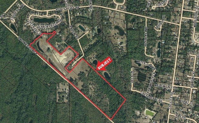
Raddin Rd, Yulee, FL 32097
NEARBY LISTINGS FOR SALE OR LEASE
Property Detail
Raddin Rd
Jacksonville, FL
F Griffin Lands
51-3N-27-4760-0008-0000
LOT 8 IN OR 2725/1341 SUB OF F GRIFFIN DB 39/357
Vacantlandnec
Nassau
X
Florida
12089C0216G
8
2025
7.50 AC
2025
Nassau County
050304
Jacksonville (Florida)
DEMOGRAPHICS near Raddin Rd
1 Mile
3 Mile
5 Mile
2024 Total Population
1,568
8,228
25,453
2029 Population
1,883
9,881
30,558
Pop Growth 2024-2029
+ 20.09%
+ 20.09%
+ 20.06%
Average Age
40
41
43
2024 Total Households
611
3,122
10,100
HH Growth 2024-2029
+ 21.28%
+ 21.33%
+ 21.00%
Median Household Inc
$67,500
$74,761
$80,763
Avg Household Size
2.50
2.60
2.50
2024 Avg HH Vehicles
2.00
2.00
2.00
Median Home Value
$269,791
$296,095
$300,961
Median Year Built
2005
2007
2005
Nearby Places
Map Layers
Map Styles
 Street
 Aerial
- Restaurants
- Banks
- Shops
- Fitness
- Groceries
PUBLIC TRANSPORTATION
AIRPORT
Jacksonville International
DRIVE
WALK
Distance
Jacksonville International
42 min
21.4 mi
Freight Ports
Jacksonville Port
DRIVE
WALK
Distance
Jacksonville Port
52 min
32.8 mi
SALE & LEASE HISTORY
LISTING DATE
SALE/LEASE

Sep 24, 2016
For Sale
Mar 28, 2017
For Sale
Nearby Properties
Address
Land Use
TOTAL SIZE
Lot Size
Zoning
Address
Land Use
TOTAL SIZE
Lot Size
Zoning
282,898 SF
22.88 AC
RG-2
Address
Land Use
TOTAL SIZE
Lot Size
Zoning
493,661 SF
49.08 AC
PUD
Address
Land Use
TOTAL SIZE
Lot Size
Zoning
125,733 SF
10.89 AC
IW
Address
Land Use
TOTAL SIZE
Lot Size
Zoning
109,094 SF
11.03 AC
IW
Address
Land Use
TOTAL SIZE
Lot Size
Zoning
24.41 AC
IW
Address
Land Use
TOTAL SIZE
Lot Size
Zoning
95,332 SF
23.03 AC
PUD
Address
Land Use
TOTAL SIZE
Lot Size
Zoning
48,321 SF
8.18 AC
IW
Address
Land Use
TOTAL SIZE
Lot Size
Zoning
1,491 SF
129.83 AC
RSF-2
Address
Land Use
TOTAL SIZE
Lot Size
Zoning
15,423 SF
3.85 AC
IW
Address
Land Use
TOTAL SIZE
Lot Size
Zoning
5,382 SF
3.82 AC
IW
Address
Land Use
TOTAL SIZE
Lot Size
Zoning
14,870 SF
9.12 AC
IW
Address
Land Use
TOTAL SIZE
Lot Size
Zoning
4,180 SF
44.06 AC
OR
Address
Land Use
TOTAL SIZE
Lot Size
Zoning
7,961 SF
12.88 AC
RG-2
Address
Land Use
TOTAL SIZE
Lot Size
Zoning
31,588 SF
12.26 AC
IW
Address
Land Use
TOTAL SIZE
Lot Size
Zoning
17,699 SF
4.99 AC
RMH
Address
Land Use
TOTAL SIZE
Lot Size
Zoning
14,192 SF
1.61 AC
IW
Address
Land Use
TOTAL SIZE
Lot Size
Zoning
13,195 SF
13.84 AC
IW
Address
Land Use
TOTAL SIZE
Lot Size
Zoning
29,560 SF
3 AC
IW
Address
Land Use
TOTAL SIZE
Lot Size
Zoning
4,595 SF
1.20 AC
IW
Address
Land Use
TOTAL SIZE
Lot Size
Zoning
11,083 SF
15.44 AC
IW
Address
Land Use
TOTAL SIZE
Lot Size
Zoning
4,650.71 AC
PD - ENCPA
Address
Land Use
TOTAL SIZE
Lot Size
Zoning
10.18 AC
PUD
Address
Land Use
TOTAL SIZE
Lot Size
Zoning
31,636 SF
5.80 AC
PUD
Address
Land Use
TOTAL SIZE
Lot Size
Zoning
8,961 SF
5 AC
OR
Address
Land Use
TOTAL SIZE
Lot Size
Zoning
10,500 SF
12.47 AC
IW
Address
Land Use
TOTAL SIZE
Lot Size
Zoning
4.57 AC
PUD
Address
Land Use
TOTAL SIZE
Lot Size
Zoning
105 AC
OR
Address
Land Use
TOTAL SIZE
Lot Size
Zoning
7,518 SF
1.33 AC
PUD
Address
Land Use
TOTAL SIZE
Lot Size
Zoning
4.85 AC
IW
Address
Land Use
TOTAL SIZE
Lot Size
Zoning
4,379 SF
1.02 AC
IW
The World's #1 Commercial Real Estate Marketplace
Connect with us
© 2026 CoStar Group
The information above has been obtained from sources believed reliable. While we do not doubt its accuracy we have not verified it and make no guarantee, warranty or representation about it. It is your responsibility to independently confirm its accuracy and completeness. Any projections, opinions, assumptions, or estimates used are for example only and do not represent the current or future performance of the property. The value of this transaction to you depends on tax and other factors which should be evaluated by your tax, financial, and legal advisors. You and your advisors should conduct a careful, independent investigation of the property to determine to your satisfaction the suitability of the property for your needs.