Property Record
Rainbow Way, , GA

Property Detail
Rainbow Way
05-52-00-039
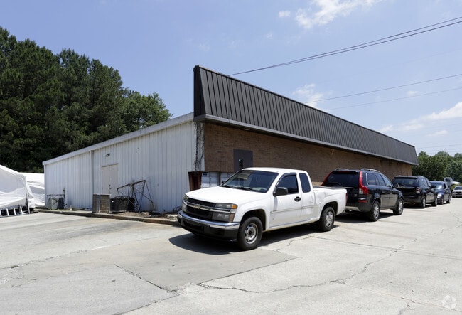
HWY 85 3 AC TIRE STORE
Regionalshoppingcenterormallwithanchorstore
FAYETTE
C CH
Georgia
B and X Area of moderate flood hazard, usually the area between the limits of the 100-year and 500-year floods.
6.90 AC
2024
Fayette/Peachtree
2025
Atlanta
140403
Atlanta-Sandy Springs-Roswell, GA
47,100 SF
NEARBY LISTINGS FOR SALE OR LEASE
DEMOGRAPHICS near Rainbow Way
1 mile
3 mile
5 mile
2024 Total Population
2,859
46,766
127,216
2029 Population
2,867
47,235
128,814
Pop Growth 2024-2029
+ 0.28%
+ 1.00%
+ 1.26%
Average Age
38
38
38
2024 Total Households
1,049
16,515
45,287
HH Growth 2024-2029
+ 0.19%
+ 1.00%
+ 1.33%
Median Household Inc
$66,562
$63,625
$57,946
Avg Household Size
2.70
2.80
2.70
2024 Avg HH Vehicles
2.00
2.00
2.00
Median Home Value
$207,017
$207,630
$204,253
Median Year Built
1987
1987
1987
Nearby Places
Map Layers
Map Styles
 Street
 Aerial
Transit
 Traffic
 Biking
Places
Listings with unknown addresses are not visible on the map
- Restaurants
- Banks
- Shops
- Fitness
- Groceries
PUBLIC TRANSPORTATION
AIRPORT
Hartsfield - Jackson Atlanta International
Drive
Walk
Distance
Hartsfield - Jackson Atlanta International
20 min
11.2 mi
Freight Ports
Georgia Ports - Savannah
Drive
Walk
Distance
Georgia Ports - Savannah
273 min
241.9 mi
SALE & LEASE HISTORY
LISTING DATE
SALE/LEASE

May 03, 2018
For Lease
Nearby Properties
Address
Land Use
TOTAL SIZE
Lot Size
Zoning
Address
Land Use
TOTAL SIZE
Lot Size
Zoning
194.98 AC
PCD
Address
Land Use
TOTAL SIZE
Lot Size
Zoning
565,679 SF
288.50 AC
PCD
Address
Land Use
TOTAL SIZE
Lot Size
Zoning
7,851 SF
94.84 AC
RS180
Address
Land Use
TOTAL SIZE
Lot Size
Zoning
424 SF
54.79 AC
RM
Address
Land Use
TOTAL SIZE
Lot Size
Zoning
270 SF
28.02 AC
RM
Address
Land Use
TOTAL SIZE
Lot Size
Zoning
230,474 SF
288.50 AC
PCD
Address
Land Use
TOTAL SIZE
Lot Size
Zoning
88,509 SF
31.54 AC
C C3
Address
Land Use
TOTAL SIZE
Lot Size
Zoning
278 SF
18.53 AC
PUD
Address
Land Use
TOTAL SIZE
Lot Size
Zoning
224 SF
25 AC
C
Address
Land Use
TOTAL SIZE
Lot Size
Zoning
256 SF
25 AC
PUD
Address
Land Use
TOTAL SIZE
Lot Size
Zoning
179,852 SF
35.39 AC
C C3
Address
Land Use
TOTAL SIZE
Lot Size
Zoning
321,508 SF
44.16 AC
C CH
Address
Land Use
TOTAL SIZE
Lot Size
Zoning
260,883 SF
21.30 AC
C C3
Address
Land Use
TOTAL SIZE
Lot Size
Zoning
57.05 AC
GB
Address
Land Use
TOTAL SIZE
Lot Size
Zoning
160 SF
19.95 AC
RM
Address
Land Use
TOTAL SIZE
Lot Size
Zoning
176 SF
17.67 AC
RM
Address
Land Use
TOTAL SIZE
Lot Size
Zoning
200 SF
13.12 AC
RM
Address
Land Use
TOTAL SIZE
Lot Size
Zoning
141,792 SF
18.50 AC
RS110
Address
Land Use
TOTAL SIZE
Lot Size
Zoning
86,781 SF
16 AC
RS110
Address
Land Use
TOTAL SIZE
Lot Size
Zoning
210,122 SF
16.77 AC
C C3
Address
Land Use
TOTAL SIZE
Lot Size
Zoning
184,862 SF
21.90 AC
C C3
Address
Land Use
TOTAL SIZE
Lot Size
Zoning
39,498 SF
28.80 AC
GB
Address
Land Use
TOTAL SIZE
Lot Size
Zoning
127,836 SF
14.33 AC
C CH
Address
Land Use
TOTAL SIZE
Lot Size
Zoning
199,132 SF
19.59 AC
C PUD
Address
Land Use
TOTAL SIZE
Lot Size
Zoning
136,320 SF
19.51 AC
C C3
Address
Land Use
TOTAL SIZE
Lot Size
Zoning
Address
Land Use
TOTAL SIZE
Lot Size
Zoning
57,441 SF
15.20 AC
RS110
Address
Land Use
TOTAL SIZE
Lot Size
Zoning
65,951 SF
6.70 AC
C C3
Address
Land Use
TOTAL SIZE
Lot Size
Zoning
49.20 AC
MX
Address
Land Use
TOTAL SIZE
Lot Size
Zoning
103,582 SF
10.43 AC
C C3
The World's #1 Commercial Real Estate Marketplace
Connect with us
© 2026 CoStar Group
The information above has been obtained from sources believed reliable. While we do not doubt its accuracy we have not verified it and make no guarantee, warranty or representation about it. It is your responsibility to independently confirm its accuracy and completeness. Any projections, opinions, assumptions, or estimates used are for example only and do not represent the current or future performance of the property. The value of this transaction to you depends on tax and other factors which should be evaluated by your tax, financial, and legal advisors. You and your advisors should conduct a careful, independent investigation of the property to determine to your satisfaction the suitability of the property for your needs.