Property Record
5 Weldwood Dr, Elgin, IL 60123


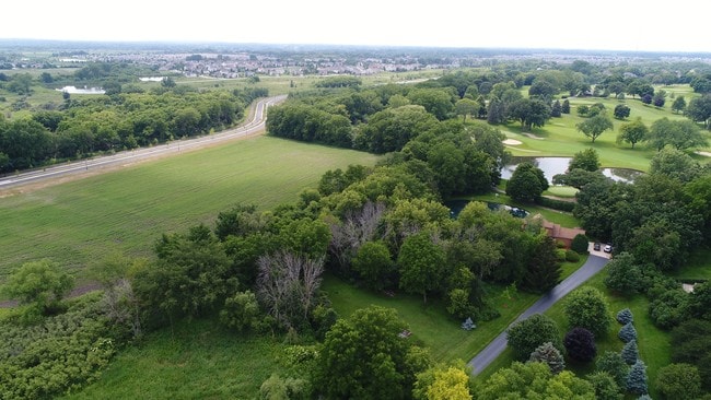
This Property Is For Sale
Property Detail
5 Weldwood Dr
Chicago-Naperville-Elgin, IL-IN
NONE PART OF THE EAST 1/2 NORTHEAST 1/4 SEC 20-41-8 DESC IN DOC 91K16844 (EXCEPT DESC IN DOCS 91K45160, 91K45163, 91K45164, & 91K45165 & 2010K014486)
06-20-276-006
KANE
Farms
Illinois
AE The base floodplain where base flood elevations are provided. AE Zones are now used on new format FIRMs instead of A1-A30 Zones.
41.25 AC
2024
Western East/West Corr
2024
Chicago
851102
NEARBY LISTINGS FOR SALE OR LEASE
-
-
-
-
No Photo
-
-
-
-
View all Elgin listings for sale on LoopNet.com
DEMOGRAPHICS near 5 Weldwood Dr
1 mile
3 mile
5 mile
2024 Total Population
6,302
75,289
152,876
2029 Population
6,376
76,184
154,631
Pop Growth 2024-2029
+ 1.17%
+ 1.19%
+ 1.15%
Average Age
45
40
39
2024 Total Households
2,415
26,194
51,947
HH Growth 2024-2029
+ 1.16%
+ 1.13%
+ 1.12%
Median Household Inc
$90,915
$105,611
$100,073
Avg Household Size
2.60
2.80
2.90
2024 Avg HH Vehicles
2.00
2.00
2.00
Median Home Value
$332,432
$312,230
$307,708
Median Year Built
1997
1989
1983
Nearby Places
Map Layers
Map Styles
 Street
 Aerial
Transit
 Traffic
 Biking
Places
Listings with unknown addresses are not visible on the map
- Restaurants
- Banks
- Shops
- Fitness
- Groceries
PUBLIC TRANSPORTATION
COMMUTER RAIL
Big Timber Road Station (Milwaukee District West Line - Northeast Illinois Regional Commuter Railroad (Metra))
Drive
Walk
Distance
Big Timber Road Station (Milwaukee District West Line - Northeast Illinois Regional Commuter Railroad (Metra))
10 min
4.3 mi
Elgin Station (Milwaukee District West Line - Northeast Illinois Regional Commuter Railroad (Metra))
Drive
Walk
Distance
Elgin Station (Milwaukee District West Line - Northeast Illinois Regional Commuter Railroad (Metra))
10 min
5.3 mi
AIRPORT
Chicago O'Hare International
Drive
Walk
Distance
Chicago O'Hare International
43 min
32.7 mi
Freight Ports
Port Milwaukee
Drive
Walk
Distance
Port Milwaukee
122 min
89.0 mi
Nearby Properties
Address
Land Use
TOTAL SIZE
Lot Size
Zoning
Address
Land Use
TOTAL SIZE
Lot Size
Zoning
15.31 AC
Address
Land Use
TOTAL SIZE
Lot Size
Zoning
27.33 AC
Address
Land Use
TOTAL SIZE
Lot Size
Zoning
Address
Land Use
TOTAL SIZE
Lot Size
Zoning
238,115 SF
21.61 AC
Address
Land Use
TOTAL SIZE
Lot Size
Zoning
35,808 SF
11.40 AC
Address
Land Use
TOTAL SIZE
Lot Size
Zoning
8,012 SF
6.56 AC
Address
Land Use
TOTAL SIZE
Lot Size
Zoning
217,848 SF
9.81 AC
Address
Land Use
TOTAL SIZE
Lot Size
Zoning
76,884 SF
2.87 AC
Address
Land Use
TOTAL SIZE
Lot Size
Zoning
11.07 AC
Address
Land Use
TOTAL SIZE
Lot Size
Zoning
186,692 SF
19.48 AC
Address
Land Use
TOTAL SIZE
Lot Size
Zoning
30,000 SF
9.96 AC
Address
Land Use
TOTAL SIZE
Lot Size
Zoning
9.11 AC
Address
Land Use
TOTAL SIZE
Lot Size
Zoning
8.98 AC
Address
Land Use
TOTAL SIZE
Lot Size
Zoning
10.03 AC
Address
Land Use
TOTAL SIZE
Lot Size
Zoning
142,044 SF
14.98 AC
Address
Land Use
TOTAL SIZE
Lot Size
Zoning
Address
Land Use
TOTAL SIZE
Lot Size
Zoning
146,694 SF
10.25 AC
Address
Land Use
TOTAL SIZE
Lot Size
Zoning
5.44 AC
Address
Land Use
TOTAL SIZE
Lot Size
Zoning
103,536 SF
17.71 AC
Address
Land Use
TOTAL SIZE
Lot Size
Zoning
Address
Land Use
TOTAL SIZE
Lot Size
Zoning
134,434 SF
8.83 AC
Address
Land Use
TOTAL SIZE
Lot Size
Zoning
7.51 AC
Address
Land Use
TOTAL SIZE
Lot Size
Zoning
61,720 SF
10.02 AC
Address
Land Use
TOTAL SIZE
Lot Size
Zoning
14.40 AC
Address
Land Use
TOTAL SIZE
Lot Size
Zoning
78,985 SF
3 AC
Address
Land Use
TOTAL SIZE
Lot Size
Zoning
100,035 SF
5.20 AC
Address
Land Use
TOTAL SIZE
Lot Size
Zoning
106,421 SF
10.76 AC
Address
Land Use
TOTAL SIZE
Lot Size
Zoning
160,680 SF
13.71 AC
Address
Land Use
TOTAL SIZE
Lot Size
Zoning
100,800 SF
5.71 AC
The World's #1 Commercial Real Estate Marketplace
Connect with us
© 2026 CoStar Group
The information above has been obtained from sources believed reliable. While we do not doubt its accuracy we have not verified it and make no guarantee, warranty or representation about it. It is your responsibility to independently confirm its accuracy and completeness. Any projections, opinions, assumptions, or estimates used are for example only and do not represent the current or future performance of the property. The value of this transaction to you depends on tax and other factors which should be evaluated by your tax, financial, and legal advisors. You and your advisors should conduct a careful, independent investigation of the property to determine to your satisfaction the suitability of the property for your needs.