Property Record
Raner Creek Dr, Arlington, TN 38002

NEARBY LISTINGS FOR SALE OR LEASE
Property Detail
Raner Creek Dr
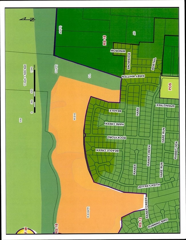
D0-138-0-0147
NS RANER CREEK DR SEE MAP D1-38
Vacantlandnec
Shelby
AE
Tennessee
47157C0190G
155.46 AC
2024
North
2025
Memphis
020836
Memphis, TN-MS-AR
DEMOGRAPHICS near Raner Creek Dr
1 Mile
3 Mile
5 Mile
2024 Total Population
2,793
21,416
68,857
2029 Population
2,680
20,645
66,639
Pop Growth 2024-2029
(4.05%)
(3.60%)
(3.22%)
Average Age
38
40
40
2024 Total Households
943
7,582
24,836
HH Growth 2024-2029
(4.14%)
(3.72%)
(3.35%)
Median Household Inc
$120,631
$98,871
$77,966
Avg Household Size
3.00
2.80
2.70
2024 Avg HH Vehicles
2.00
2.00
2.00
Median Home Value
$275,220
$267,797
$228,165
Median Year Built
2003
1995
1989
Nearby Places
Map Layers
Map Styles
 Street
 Aerial
- Restaurants
- Banks
- Shops
- Fitness
- Groceries
PUBLIC TRANSPORTATION
AIRPORT
Memphis International
DRIVE
WALK
Distance
Memphis International
35 min
21.4 mi
Freight Ports
Port of Shreveport
DRIVE
WALK
Distance
Port of Shreveport
423 min
386.1 mi
SALE & LEASE HISTORY
LISTING DATE
SALE/LEASE

Sep 24, 2016
For Sale
Nearby Properties
Address
Land Use
TOTAL SIZE
Lot Size
Zoning
Address
Land Use
TOTAL SIZE
Lot Size
Zoning
67,640 SF
20.28 AC
R-M
Address
Land Use
TOTAL SIZE
Lot Size
Zoning
85,332 SF
10.51 AC
R-M
Address
Land Use
TOTAL SIZE
Lot Size
Zoning
157.98 AC
AP
Address
Land Use
TOTAL SIZE
Lot Size
Zoning
10,485 SF
5 AC
CA
Address
Land Use
TOTAL SIZE
Lot Size
Zoning
5,589 SF
8.52 AC
R-E
Address
Land Use
TOTAL SIZE
Lot Size
Zoning
144.75 AC
CA
Address
Land Use
TOTAL SIZE
Lot Size
Zoning
50,688 SF
7.04 AC
SC-1
Address
Land Use
TOTAL SIZE
Lot Size
Zoning
16,346 SF
11.45 AC
O-R-1
Address
Land Use
TOTAL SIZE
Lot Size
Zoning
14,897 SF
2.04 AC
SC-1
Address
Land Use
TOTAL SIZE
Lot Size
Zoning
5,304 SF
5.45 AC
RS-10
Address
Land Use
TOTAL SIZE
Lot Size
Zoning
14,042 SF
103.12 AC
RS-10
Address
Land Use
TOTAL SIZE
Lot Size
Zoning
17.47 AC
RS-15
Address
Land Use
TOTAL SIZE
Lot Size
Zoning
5,771 SF
10 AC
A-O
Address
Land Use
TOTAL SIZE
Lot Size
Zoning
4,080 SF
4.07 AC
CMU-3
Address
Land Use
TOTAL SIZE
Lot Size
Zoning
6.86 AC
R-E
Address
Land Use
TOTAL SIZE
Lot Size
Zoning
362.24 AC
CA
Address
Land Use
TOTAL SIZE
Lot Size
Zoning
693.62 AC
CA
Address
Land Use
TOTAL SIZE
Lot Size
Zoning
7,470 SF
7.99 AC
RU-2
Address
Land Use
TOTAL SIZE
Lot Size
Zoning
318.49 AC
CA
Address
Land Use
TOTAL SIZE
Lot Size
Zoning
6,642 SF
5.53 AC
CA
Address
Land Use
TOTAL SIZE
Lot Size
Zoning
11,508 SF
2.76 AC
R-10
Address
Land Use
TOTAL SIZE
Lot Size
Zoning
10.24 AC
SC-1
Address
Land Use
TOTAL SIZE
Lot Size
Zoning
3,102 SF
0.22 AC
RS-15 PD
Address
Land Use
TOTAL SIZE
Lot Size
Zoning
5.50 AC
O-R-1
Address
Land Use
TOTAL SIZE
Lot Size
Zoning
23.05 AC
R-S15
Address
Land Use
TOTAL SIZE
Lot Size
Zoning
3,680 SF
1.03 AC
SC-1
Address
Land Use
TOTAL SIZE
Lot Size
Zoning
19.88 AC
RS-18 PD
Address
Land Use
TOTAL SIZE
Lot Size
Zoning
67.56 AC
RS-18
Address
Land Use
TOTAL SIZE
Lot Size
Zoning
18.58 AC
R-S15
Address
Land Use
TOTAL SIZE
Lot Size
Zoning
17.64 AC
RS-18 PD
The World's #1 Commercial Real Estate Marketplace
Connect with us
© 2026 CoStar Group
The information above has been obtained from sources believed reliable. While we do not doubt its accuracy we have not verified it and make no guarantee, warranty or representation about it. It is your responsibility to independently confirm its accuracy and completeness. Any projections, opinions, assumptions, or estimates used are for example only and do not represent the current or future performance of the property. The value of this transaction to you depends on tax and other factors which should be evaluated by your tax, financial, and legal advisors. You and your advisors should conduct a careful, independent investigation of the property to determine to your satisfaction the suitability of the property for your needs.