Property Record
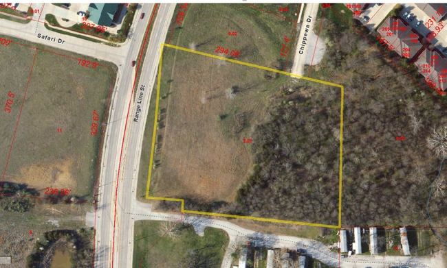
Range Line St, Columbia, MO 65202


Property Detail
Range Line St
11-904-00-00-002-01-01
PT NE (E OF HWY 763) TR 1 SUR 689-480 EXC PT FOR RD
Commercialacreage
Boone
X
Missouri
29019C0280E
3.96 AC
2025
Columbia/Jefferson City
2025
Other Market Areas
001508
Columbia, MO
NEARBY LISTINGS FOR SALE OR LEASE
DEMOGRAPHICS near Range Line St
1 mile
3 mile
5 mile
2024 Total Population
6,872
52,524
112,417
2029 Population
7,174
55,875
119,174
Pop Growth 2024-2029
+ 4.39%
+ 6.38%
+ 6.01%
Average Age
36
35
35
2024 Total Households
2,663
22,167
45,906
HH Growth 2024-2029
+ 4.58%
+ 6.67%
+ 6.45%
Median Household Inc
$69,514
$44,706
$53,162
Avg Household Size
2.50
2.20
2.20
2024 Avg HH Vehicles
2.00
2.00
2.00
Median Home Value
$192,943
$173,086
$199,892
Median Year Built
2000
1987
1988
Nearby Places
Map Layers
Map Styles
 Street
 Aerial
Transit
 Traffic
 Biking
Places
Listings with unknown addresses are not visible on the map
- Restaurants
- Banks
- Shops
- Fitness
- Groceries
PUBLIC TRANSPORTATION
AIRPORT
Columbia Regional
Drive
Walk
Distance
Columbia Regional
21 min
15.8 mi
SALE & LEASE HISTORY
LISTING DATE
SALE/LEASE

Nov 09, 2024
For Sale
Nearby Properties
Address
Land Use
TOTAL SIZE
Lot Size
Zoning
Address
Land Use
TOTAL SIZE
Lot Size
Zoning
321,295 SF
79.83 AC
Address
Land Use
TOTAL SIZE
Lot Size
Zoning
171,157 SF
5.60 AC
O1
Address
Land Use
TOTAL SIZE
Lot Size
Zoning
40,016 SF
2.13 AC
O1
Address
Land Use
TOTAL SIZE
Lot Size
Zoning
3,808 SF
0.39 AC
C2
Address
Land Use
TOTAL SIZE
Lot Size
Zoning
234,111 SF
2.27 AC
Address
Land Use
TOTAL SIZE
Lot Size
Zoning
159,169 SF
1.26 AC
R3
Address
Land Use
TOTAL SIZE
Lot Size
Zoning
134,625 SF
0.79 AC
C2
Address
Land Use
TOTAL SIZE
Lot Size
Zoning
45,750 SF
0.66 AC
R3
Address
Land Use
TOTAL SIZE
Lot Size
Zoning
38,500 SF
3.10 AC
O1
Address
Land Use
TOTAL SIZE
Lot Size
Zoning
87,060 SF
0.37 AC
R3
Address
Land Use
TOTAL SIZE
Lot Size
Zoning
125,487 SF
3.36 AC
Address
Land Use
TOTAL SIZE
Lot Size
Zoning
97,092 SF
1.56 AC
Address
Land Use
TOTAL SIZE
Lot Size
Zoning
33,732 SF
3.34 AC
O1
Address
Land Use
TOTAL SIZE
Lot Size
Zoning
82,970 SF
9.07 AC
C3
Address
Land Use
TOTAL SIZE
Lot Size
Zoning
136,448 SF
0.78 AC
C2
Address
Land Use
TOTAL SIZE
Lot Size
Zoning
68,408 SF
4.38 AC
O1
Address
Land Use
TOTAL SIZE
Lot Size
Zoning
184,413 SF
17.63 AC
CP
Address
Land Use
TOTAL SIZE
Lot Size
Zoning
17,589 SF
0.52 AC
C2
Address
Land Use
TOTAL SIZE
Lot Size
Zoning
70,783 SF
5.07 AC
O1
Address
Land Use
TOTAL SIZE
Lot Size
Zoning
125,907 SF
22.59 AC
C3
Address
Land Use
TOTAL SIZE
Lot Size
Zoning
26,544 SF
1.24 AC
R1
Address
Land Use
TOTAL SIZE
Lot Size
Zoning
56,305 SF
12 AC
CP
Address
Land Use
TOTAL SIZE
Lot Size
Zoning
34,707 SF
0.41 AC
R3
Address
Land Use
TOTAL SIZE
Lot Size
Zoning
35,436 SF
19.09 AC
Address
Land Use
TOTAL SIZE
Lot Size
Zoning
93,320 SF
0.50 AC
C2
Address
Land Use
TOTAL SIZE
Lot Size
Zoning
63,608 SF
6.89 AC
CP
Address
Land Use
TOTAL SIZE
Lot Size
Zoning
32,686 SF
3.20 AC
O1
Address
Land Use
TOTAL SIZE
Lot Size
Zoning
83,978 SF
8.60 AC
C3
Address
Land Use
TOTAL SIZE
Lot Size
Zoning
115,194 SF
8.10 AC
C3
Address
Land Use
TOTAL SIZE
Lot Size
Zoning
25,578 SF
0.43 AC
C2
The World's #1 Commercial Real Estate Marketplace
Connect with us
© 2026 CoStar Group
The information above has been obtained from sources believed reliable. While we do not doubt its accuracy we have not verified it and make no guarantee, warranty or representation about it. It is your responsibility to independently confirm its accuracy and completeness. Any projections, opinions, assumptions, or estimates used are for example only and do not represent the current or future performance of the property. The value of this transaction to you depends on tax and other factors which should be evaluated by your tax, financial, and legal advisors. You and your advisors should conduct a careful, independent investigation of the property to determine to your satisfaction the suitability of the property for your needs.