Property Record
Rangerville Rd, , TX


NEARBY LISTINGS FOR SALE OR LEASE
Property Detail
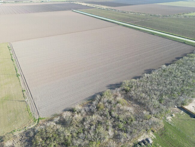
Rangerville Rd
Brownsville-Harlingen, TX
Lon C Hill Subdivision
881920-0130-000010
BLK 13 LON C HILL SUBDIVISION 31.1310 ACRES OUT OF 39.50 ACRES
Agriculturalland
Cameron
X
Texas
48061C0265F
31.31 AC
2024
Greater Harlingen
2025
Brownsville/Harlingen
012104
DEMOGRAPHICS near Rangerville Rd
1 Mile
3 Mile
5 Mile
2024 Total Population
3,102
38,827
99,861
2029 Population
3,105
39,601
102,206
Pop Growth 2024-2029
+ 0.10%
+ 1.99%
+ 2.35%
Average Age
37
38
37
2024 Total Households
969
13,331
34,286
HH Growth 2024-2029
0.00%
+ 2.01%
+ 2.27%
Median Household Inc
$38,685
$45,201
$50,114
Avg Household Size
3.00
2.80
2.80
2024 Avg HH Vehicles
2.00
2.00
2.00
Median Home Value
$80,547
$85,260
$99,633
Median Year Built
1985
1982
1986
Nearby Places
Map Layers
Map Styles
 Street
 Aerial
- Restaurants
- Banks
- Shops
- Fitness
- Groceries
PUBLIC TRANSPORTATION
AIRPORT
Valley International
DRIVE
WALK
Distance
Valley International
17 min
8.3 mi
Brownsville/South Padre Island International
DRIVE
WALK
Distance
Brownsville/South Padre Island International
40 min
29.5 mi
Freight Ports
Port of Brownsville
DRIVE
WALK
Distance
Port of Brownsville
33 min
27.2 mi
SALE & LEASE HISTORY
LISTING DATE
SALE/LEASE

Aug 22, 2024
For Sale
Nearby Properties
Address
Land Use
TOTAL SIZE
Lot Size
Zoning
Address
Land Use
TOTAL SIZE
Lot Size
Zoning
89,797 SF
7.90 AC
Address
Land Use
TOTAL SIZE
Lot Size
Zoning
135,258 SF
4.26 AC
C
Address
Land Use
TOTAL SIZE
Lot Size
Zoning
206,973 SF
12.77 AC
Address
Land Use
TOTAL SIZE
Lot Size
Zoning
108,000 SF
10.44 AC
C
Address
Land Use
TOTAL SIZE
Lot Size
Zoning
55,573 SF
20 AC
C
Address
Land Use
TOTAL SIZE
Lot Size
Zoning
67,876 SF
14.15 AC
Address
Land Use
TOTAL SIZE
Lot Size
Zoning
40,392 SF
3.39 AC
Address
Land Use
TOTAL SIZE
Lot Size
Zoning
39,996 SF
2.25 AC
C
Address
Land Use
TOTAL SIZE
Lot Size
Zoning
887 SF
4.07 AC
Address
Land Use
TOTAL SIZE
Lot Size
Zoning
68,916 SF
2.40 AC
Address
Land Use
TOTAL SIZE
Lot Size
Zoning
48,324 SF
2.79 AC
Address
Land Use
TOTAL SIZE
Lot Size
Zoning
83,211 SF
71.41 AC
C
Address
Land Use
TOTAL SIZE
Lot Size
Zoning
31,298 SF
9.12 AC
C
Address
Land Use
TOTAL SIZE
Lot Size
Zoning
11,284 SF
5.35 AC
Address
Land Use
TOTAL SIZE
Lot Size
Zoning
20,940 SF
1.27 AC
B
Address
Land Use
TOTAL SIZE
Lot Size
Zoning
62,400 SF
3.60 AC
C
Address
Land Use
TOTAL SIZE
Lot Size
Zoning
52,500 SF
4.25 AC
Address
Land Use
TOTAL SIZE
Lot Size
Zoning
20,188 SF
1.71 AC
C
Address
Land Use
TOTAL SIZE
Lot Size
Zoning
18,388 SF
0.92 AC
C
Address
Land Use
TOTAL SIZE
Lot Size
Zoning
17,250 SF
1.73 AC
Address
Land Use
TOTAL SIZE
Lot Size
Zoning
24,834 SF
8 AC
A-R
Address
Land Use
TOTAL SIZE
Lot Size
Zoning
30,009 SF
2.78 AC
Address
Land Use
TOTAL SIZE
Lot Size
Zoning
10,072 SF
2.22 AC
C
Address
Land Use
TOTAL SIZE
Lot Size
Zoning
24,650 SF
2.58 AC
C
Address
Land Use
TOTAL SIZE
Lot Size
Zoning
2,854 SF
0.89 AC
C
Address
Land Use
TOTAL SIZE
Lot Size
Zoning
11,058 SF
0.58 AC
Address
Land Use
TOTAL SIZE
Lot Size
Zoning
41,000 SF
1.96 AC
C
Address
Land Use
TOTAL SIZE
Lot Size
Zoning
27,000 SF
1.61 AC
C
Address
Land Use
TOTAL SIZE
Lot Size
Zoning
3,745 SF
0.90 AC
Address
Land Use
TOTAL SIZE
Lot Size
Zoning
7,500 SF
3.11 AC
The World's #1 Commercial Real Estate Marketplace
Connect with us
© 2026 CoStar Group
The information above has been obtained from sources believed reliable. While we do not doubt its accuracy we have not verified it and make no guarantee, warranty or representation about it. It is your responsibility to independently confirm its accuracy and completeness. Any projections, opinions, assumptions, or estimates used are for example only and do not represent the current or future performance of the property. The value of this transaction to you depends on tax and other factors which should be evaluated by your tax, financial, and legal advisors. You and your advisors should conduct a careful, independent investigation of the property to determine to your satisfaction the suitability of the property for your needs.