Property Record
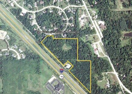
Ravenna Rd, Hudson, OH 44236

NEARBY LISTINGS FOR SALE OR LEASE
Property Detail
Ravenna Rd
Akron, OH
Hudson
30-06677
LOT 99 100 NE OF RE LOC SR #14
Timberlandforesttreesagricultural
Summit
X
Ohio
39153C0069F
99
2023
18.41 AC
2025
Akron
533102
Cleveland
DEMOGRAPHICS near Ravenna Rd
1 Mile
3 Mile
5 Mile
2024 Total Population
2,315
21,356
73,183
2029 Population
2,278
21,237
73,235
Pop Growth 2024-2029
(1.60%)
(0.56%)
+ 0.07%
Average Age
42
42
42
2024 Total Households
789
8,066
28,288
HH Growth 2024-2029
(1.65%)
(0.46%)
+ 0.16%
Median Household Inc
$139,436
$115,918
$108,281
Avg Household Size
2.80
2.60
2.50
2024 Avg HH Vehicles
2.00
2.00
2.00
Median Home Value
$361,249
$341,268
$320,374
Median Year Built
1981
1986
1989
Nearby Places
Map Layers
Map Styles
 Street
 Aerial
- Restaurants
- Banks
- Shops
- Fitness
- Groceries
PUBLIC TRANSPORTATION
COMMUTER RAIL
Peninsula Depot (Lock 29) (National Park Scenic Railway - Cuyahoga Valley Scenic Railroad)
DRIVE
WALK
Distance
Peninsula Depot (Lock 29) (National Park Scenic Railway - Cuyahoga Valley Scenic Railroad)
20 min
9.7 mi
Boston Mill (National Park Scenic Railway - Cuyahoga Valley Scenic Railroad)
DRIVE
WALK
Distance
Boston Mill (National Park Scenic Railway - Cuyahoga Valley Scenic Railroad)
22 min
9.8 mi
AIRPORT
Akron-Canton Regional
DRIVE
WALK
Distance
Akron-Canton Regional
46 min
30.9 mi
Cleveland-Hopkins International
DRIVE
WALK
Distance
Cleveland-Hopkins International
48 min
32.2 mi
Freight Ports
Port of Toledo
DRIVE
WALK
Distance
Port of Toledo
156 min
132.7 mi
Nearby Properties
Address
Land Use
TOTAL SIZE
Lot Size
Zoning
Address
Land Use
TOTAL SIZE
Lot Size
Zoning
670,026 SF
53.79 AC
Address
Land Use
TOTAL SIZE
Lot Size
Zoning
73,902 SF
12.85 AC
Address
Land Use
TOTAL SIZE
Lot Size
Zoning
201,734 SF
92.42 AC
Address
Land Use
TOTAL SIZE
Lot Size
Zoning
Address
Land Use
TOTAL SIZE
Lot Size
Zoning
650,506 SF
57.86 AC
Address
Land Use
TOTAL SIZE
Lot Size
Zoning
409,569 SF
82.25 AC
Address
Land Use
TOTAL SIZE
Lot Size
Zoning
Address
Land Use
TOTAL SIZE
Lot Size
Zoning
60,305 SF
57.84 AC
Address
Land Use
TOTAL SIZE
Lot Size
Zoning
441,158 SF
74.07 AC
Address
Land Use
TOTAL SIZE
Lot Size
Zoning
368,060 SF
27.87 AC
Address
Land Use
TOTAL SIZE
Lot Size
Zoning
418,878 SF
51.63 AC
Address
Land Use
TOTAL SIZE
Lot Size
Zoning
290,113 SF
15.05 AC
Address
Land Use
TOTAL SIZE
Lot Size
Zoning
348,301 SF
27.65 AC
Address
Land Use
TOTAL SIZE
Lot Size
Zoning
353,200 SF
25.60 AC
Address
Land Use
TOTAL SIZE
Lot Size
Zoning
340,850 SF
29.70 AC
Address
Land Use
TOTAL SIZE
Lot Size
Zoning
155,932 SF
12.94 AC
Address
Land Use
TOTAL SIZE
Lot Size
Zoning
73,753 SF
17 AC
Address
Land Use
TOTAL SIZE
Lot Size
Zoning
30.10 AC
Address
Land Use
TOTAL SIZE
Lot Size
Zoning
144,295 SF
17.27 AC
Address
Land Use
TOTAL SIZE
Lot Size
Zoning
235,200 SF
19.57 AC
Address
Land Use
TOTAL SIZE
Lot Size
Zoning
300,900 SF
10.39 AC
Address
Land Use
TOTAL SIZE
Lot Size
Zoning
Address
Land Use
TOTAL SIZE
Lot Size
Zoning
170,929 SF
16.29 AC
Address
Land Use
TOTAL SIZE
Lot Size
Zoning
47,460 SF
11.69 AC
Address
Land Use
TOTAL SIZE
Lot Size
Zoning
206,907 SF
1.11 AC
Address
Land Use
TOTAL SIZE
Lot Size
Zoning
358,135 SF
35.67 AC
Address
Land Use
TOTAL SIZE
Lot Size
Zoning
146,205 SF
99.38 AC
Address
Land Use
TOTAL SIZE
Lot Size
Zoning
149,850 SF
24.08 AC
Address
Land Use
TOTAL SIZE
Lot Size
Zoning
22,052 SF
12.52 AC
Address
Land Use
TOTAL SIZE
Lot Size
Zoning
251,864 SF
22.07 AC
The World's #1 Commercial Real Estate Marketplace
Connect with us
© 2026 CoStar Group
The information above has been obtained from sources believed reliable. While we do not doubt its accuracy we have not verified it and make no guarantee, warranty or representation about it. It is your responsibility to independently confirm its accuracy and completeness. Any projections, opinions, assumptions, or estimates used are for example only and do not represent the current or future performance of the property. The value of this transaction to you depends on tax and other factors which should be evaluated by your tax, financial, and legal advisors. You and your advisors should conduct a careful, independent investigation of the property to determine to your satisfaction the suitability of the property for your needs.