Property Record
Rebar Ave Ne, Canton, OH 44705
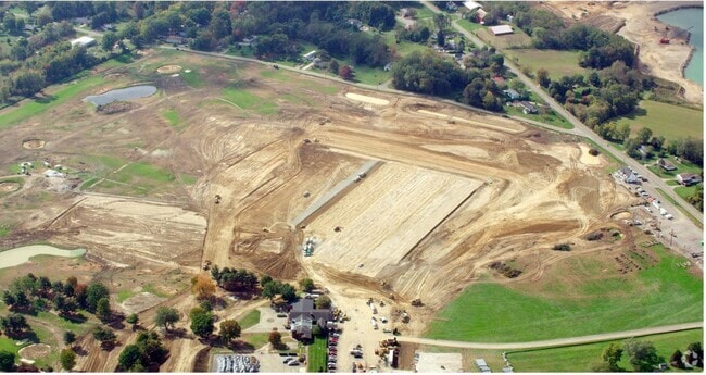
Property Detail
Rebar Ave Ne
10014441
OL 1473 - 91.83A
Warehouse
STARK
B and X Area of moderate flood hazard, usually the area between the limits of the 100-year and 500-year floods.
Ohio
0
40 AC
2025
Stark County
712400
Cleveland
140 SF
Canton-Massillon, OH
NEARBY LISTINGS FOR SALE OR LEASE
DEMOGRAPHICS near Rebar Ave Ne
1 mile
3 mile
5 mile
2025 Total Population
2,930
39,466
106,100
2030 Population
2,936
39,441
106,016
Pop Growth 2025-2030
+ 0.20%
(0.06%)
(0.08%)
Average Age
43
42
41
2025 Total Households
1,037
16,254
44,438
HH Growth 2025-2030
+ 0.48%
(0.11%)
(0.13%)
Median Household Inc
$69,803
$60,651
$57,052
Avg Household Size
2.40
2.40
2.30
2025 Avg HH Vehicles
2.00
2.00
2.00
Median Home Value
$207,784
$173,608
$172,201
Median Year Built
1975
1964
1961
Nearby Places
Map Layers
Map Styles
 Street
 Aerial
Layers
 Traffic
 Biking
Places
Listings with unknown addresses are not visible on the map
- Restaurants
- Banks
- Shops
- Fitness
- Groceries
PUBLIC TRANSPORTATION
AIRPORT
Akron-Canton Regional
Drive
Walk
Distance
Akron-Canton Regional
21 min
13.1 mi
Freight Ports
Port of Toledo
Drive
Walk
Distance
Port of Toledo
192 min
160.3 mi
Nearby Properties
Address
Land Use
TOTAL SIZE
Lot Size
Zoning
Address
Land Use
TOTAL SIZE
Lot Size
Zoning
365,452 SF
113.92 AC
Address
Land Use
TOTAL SIZE
Lot Size
Zoning
91.83 AC
Address
Land Use
TOTAL SIZE
Lot Size
Zoning
125,619 SF
13.15 AC
Address
Land Use
TOTAL SIZE
Lot Size
Zoning
272,327 SF
23.62 AC
Address
Land Use
TOTAL SIZE
Lot Size
Zoning
141,077 SF
21.73 AC
Address
Land Use
TOTAL SIZE
Lot Size
Zoning
116,904 SF
55.51 AC
Address
Land Use
TOTAL SIZE
Lot Size
Zoning
476,634 SF
15.08 AC
Address
Land Use
TOTAL SIZE
Lot Size
Zoning
681,718 SF
35.20 AC
Address
Land Use
TOTAL SIZE
Lot Size
Zoning
202,684 SF
40.97 AC
Address
Land Use
TOTAL SIZE
Lot Size
Zoning
133,991 SF
24.51 AC
Address
Land Use
TOTAL SIZE
Lot Size
Zoning
180,088 SF
71.80 AC
Address
Land Use
TOTAL SIZE
Lot Size
Zoning
153,834 SF
20.21 AC
Address
Land Use
TOTAL SIZE
Lot Size
Zoning
145,719 SF
43.60 AC
Address
Land Use
TOTAL SIZE
Lot Size
Zoning
217,695 SF
19.46 AC
Address
Land Use
TOTAL SIZE
Lot Size
Zoning
135,840 SF
21 AC
Address
Land Use
TOTAL SIZE
Lot Size
Zoning
58,021 SF
13.25 AC
Address
Land Use
TOTAL SIZE
Lot Size
Zoning
52,876 SF
4.96 AC
Address
Land Use
TOTAL SIZE
Lot Size
Zoning
118,052 SF
12.52 AC
Address
Land Use
TOTAL SIZE
Lot Size
Zoning
81,369 SF
3 AC
Address
Land Use
TOTAL SIZE
Lot Size
Zoning
1,083,703 SF
91.83 AC
Address
Land Use
TOTAL SIZE
Lot Size
Zoning
101,463 SF
8.85 AC
Address
Land Use
TOTAL SIZE
Lot Size
Zoning
35,179 SF
5.06 AC
Address
Land Use
TOTAL SIZE
Lot Size
Zoning
68,419 SF
8.93 AC
Address
Land Use
TOTAL SIZE
Lot Size
Zoning
187,797 SF
20.29 AC
Address
Land Use
TOTAL SIZE
Lot Size
Zoning
14,070 SF
10.04 AC
Address
Land Use
TOTAL SIZE
Lot Size
Zoning
19,129 SF
41.96 AC
Address
Land Use
TOTAL SIZE
Lot Size
Zoning
49,900 SF
1.31 AC
Address
Land Use
TOTAL SIZE
Lot Size
Zoning
117,239 SF
14.13 AC
Address
Land Use
TOTAL SIZE
Lot Size
Zoning
54,593 SF
10.66 AC
Address
Land Use
TOTAL SIZE
Lot Size
Zoning
44,642 SF
7 AC
The World's #1 Commercial Real Estate Marketplace
Connect with us
© 2026 CoStar Group
The information above has been obtained from sources believed reliable. While we do not doubt its accuracy we have not verified it and make no guarantee, warranty or representation about it. It is your responsibility to independently confirm its accuracy and completeness. Any projections, opinions, assumptions, or estimates used are for example only and do not represent the current or future performance of the property. The value of this transaction to you depends on tax and other factors which should be evaluated by your tax, financial, and legal advisors. You and your advisors should conduct a careful, independent investigation of the property to determine to your satisfaction the suitability of the property for your needs.