Property Record
Rebel Rd, Eight Mile, AL 36613
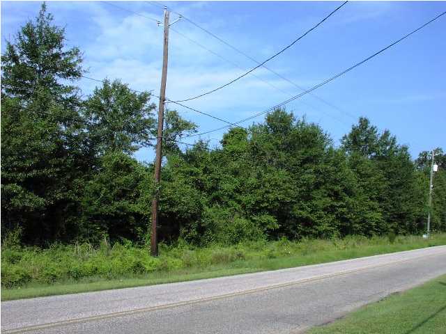

Property Detail
Rebel Rd
Mobile, AL
SE 1/2 OF LOT 11 BDED S & E BY LOT 12 ON N & W BY N & W 1/2 OF SD LOT 11 & M & O RR CONTG 10 ACS M/L BEING SAME PPTY CONVEYED
22-04-36-0-008-018
MOBILE
Realpropertynec
Alabama
AE The base floodplain where base flood elevations are provided. AE Zones are now used on new format FIRMs instead of A1-A30 Zones.
11-12
2025
20 AC
2025
Prichard/Saraland
006102
Mobile
NEARBY LISTINGS FOR SALE OR LEASE
DEMOGRAPHICS near Rebel Rd
1 mile
3 mile
5 mile
2024 Total Population
2,114
25,803
72,806
2029 Population
2,156
26,157
73,480
Pop Growth 2024-2029
+ 1.99%
+ 1.37%
+ 0.93%
Average Age
41
40
41
2024 Total Households
793
10,091
28,349
HH Growth 2024-2029
+ 1.89%
+ 1.38%
+ 1.01%
Median Household Inc
$45,331
$38,770
$42,738
Avg Household Size
2.50
2.40
2.40
2024 Avg HH Vehicles
2.00
2.00
2.00
Median Home Value
$84,693
$89,592
$123,493
Median Year Built
1972
1969
1970
Nearby Places
Map Layers
Map Styles
 Street
 Aerial
Transit
 Traffic
 Biking
Places
Listings with unknown addresses are not visible on the map
- Restaurants
- Banks
- Shops
- Fitness
- Groceries
PUBLIC TRANSPORTATION
AIRPORT
Mobile International
Drive
Walk
Distance
Mobile International
21 min
12.1 mi
Mobile Regional
Drive
Walk
Distance
Mobile Regional
29 min
12.7 mi
Freight Ports
Port of Mobile
Drive
Walk
Distance
Port of Mobile
12 min
7.0 mi
Nearby Properties
Address
Land Use
TOTAL SIZE
Lot Size
Zoning
Address
Land Use
TOTAL SIZE
Lot Size
Zoning
66,138 SF
35.24 AC
Address
Land Use
TOTAL SIZE
Lot Size
Zoning
63,390 SF
107.45 AC
Address
Land Use
TOTAL SIZE
Lot Size
Zoning
35,775 SF
22.48 AC
Address
Land Use
TOTAL SIZE
Lot Size
Zoning
35,828 SF
26.30 AC
Address
Land Use
TOTAL SIZE
Lot Size
Zoning
187,257 SF
33.10 AC
Address
Land Use
TOTAL SIZE
Lot Size
Zoning
197,471 SF
15.90 AC
Address
Land Use
TOTAL SIZE
Lot Size
Zoning
66,678 SF
2.29 AC
Address
Land Use
TOTAL SIZE
Lot Size
Zoning
5,553 SF
40.77 AC
Address
Land Use
TOTAL SIZE
Lot Size
Zoning
57,084 SF
1.97 AC
Address
Land Use
TOTAL SIZE
Lot Size
Zoning
131,516 SF
15 AC
Address
Land Use
TOTAL SIZE
Lot Size
Zoning
53,850 SF
12 AC
Address
Land Use
TOTAL SIZE
Lot Size
Zoning
45,980 SF
10.72 AC
Address
Land Use
TOTAL SIZE
Lot Size
Zoning
54,965 SF
1.97 AC
Address
Land Use
TOTAL SIZE
Lot Size
Zoning
87,532 SF
17 AC
Address
Land Use
TOTAL SIZE
Lot Size
Zoning
86,174 SF
9.30 AC
Address
Land Use
TOTAL SIZE
Lot Size
Zoning
18,818 SF
6.21 AC
Address
Land Use
TOTAL SIZE
Lot Size
Zoning
94,787 SF
18 AC
Address
Land Use
TOTAL SIZE
Lot Size
Zoning
40,245 SF
1.99 AC
Address
Land Use
TOTAL SIZE
Lot Size
Zoning
48,304 SF
3.28 AC
Address
Land Use
TOTAL SIZE
Lot Size
Zoning
101,578 SF
32 AC
Address
Land Use
TOTAL SIZE
Lot Size
Zoning
58,789 SF
17 AC
Address
Land Use
TOTAL SIZE
Lot Size
Zoning
107,965 SF
8.14 AC
Address
Land Use
TOTAL SIZE
Lot Size
Zoning
58,624 SF
8.30 AC
Address
Land Use
TOTAL SIZE
Lot Size
Zoning
74,538 SF
4.48 AC
Address
Land Use
TOTAL SIZE
Lot Size
Zoning
122,776 SF
14.32 AC
Address
Land Use
TOTAL SIZE
Lot Size
Zoning
17,300 SF
7.17 AC
Address
Land Use
TOTAL SIZE
Lot Size
Zoning
50,740 SF
1.57 AC
Address
Land Use
TOTAL SIZE
Lot Size
Zoning
31,420 SF
3.54 AC
Address
Land Use
TOTAL SIZE
Lot Size
Zoning
17,422 SF
2.68 AC
Address
Land Use
TOTAL SIZE
Lot Size
Zoning
60,446 SF
2.67 AC
The World's #1 Commercial Real Estate Marketplace
Connect with us
© 2026 CoStar Group
The information above has been obtained from sources believed reliable. While we do not doubt its accuracy we have not verified it and make no guarantee, warranty or representation about it. It is your responsibility to independently confirm its accuracy and completeness. Any projections, opinions, assumptions, or estimates used are for example only and do not represent the current or future performance of the property. The value of this transaction to you depends on tax and other factors which should be evaluated by your tax, financial, and legal advisors. You and your advisors should conduct a careful, independent investigation of the property to determine to your satisfaction the suitability of the property for your needs.