Property Record
Red Lion Rd, White Marsh, MD 21162

Property Detail
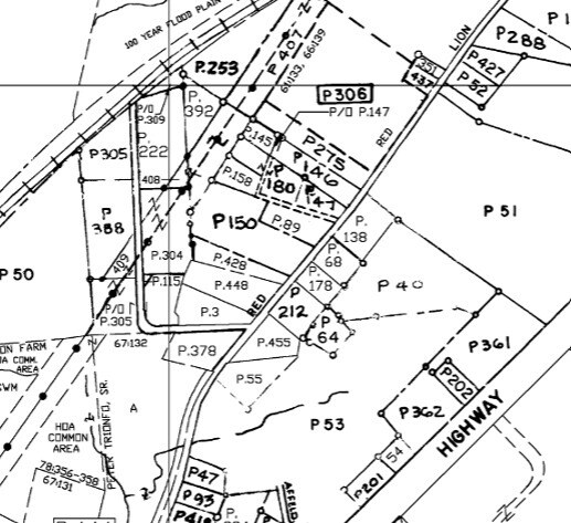
Red Lion Rd
11-1116060451
.1767 AC NWS
Industrialgeneral
BALTIMORE
ML
Maryland
B and X Area of moderate flood hazard, usually the area between the limits of the 100-year and 500-year floods.
0.18 AC
0
Baltimore County East
2025
Baltimore
411302
Baltimore-Columbia-Towson, MD
NEARBY LISTINGS FOR SALE OR LEASE
-
-
-
-
-
-
-
No Photo
-
View all White Marsh listings for sale on LoopNet.com
DEMOGRAPHICS near Red Lion Rd
1 mile
3 mile
5 mile
2025 Total Population
4,126
35,904
126,570
2030 Population
4,259
36,406
127,484
Pop Growth 2025-2030
+ 3.22%
+ 1.40%
+ 0.72%
Average Age
39
42
41
2025 Total Households
1,280
13,530
48,608
HH Growth 2025-2030
+ 3.28%
+ 1.35%
+ 0.67%
Median Household Inc
$157,704
$116,603
$98,693
Avg Household Size
3.20
2.60
2.50
2025 Avg HH Vehicles
2.00
2.00
2.00
Median Home Value
$578,475
$415,277
$355,022
Median Year Built
2005
1993
1985
Nearby Places
Map Layers
Map Styles
 Street
 Aerial
Layers
 Traffic
 Biking
Places
Listings with unknown addresses are not visible on the map
- Restaurants
- Banks
- Shops
- Fitness
- Groceries
PUBLIC TRANSPORTATION
COMMUTER RAIL
Drive
Walk
Distance
12 min
6.0 mi
Drive
Walk
Distance
15 min
8.6 mi
AIRPORT
Baltimore/Washington International Thurgood Marshall
Drive
Walk
Distance
Baltimore/Washington International Thurgood Marshall
39 min
25.3 mi
Freight Ports
Port of Baltimore
Drive
Walk
Distance
Port of Baltimore
28 min
18.8 mi
Nearby Properties
Address
Land Use
TOTAL SIZE
Lot Size
Zoning
Address
Land Use
TOTAL SIZE
Lot Size
Zoning
504,086 SF
7.48 AC
MH
Address
Land Use
TOTAL SIZE
Lot Size
Zoning
553,984 SF
7.42 AC
Address
Land Use
TOTAL SIZE
Lot Size
Zoning
584,740 SF
32.61 AC
Address
Land Use
TOTAL SIZE
Lot Size
Zoning
240,121 SF
9.97 AC
Address
Land Use
TOTAL SIZE
Lot Size
Zoning
225,070 SF
20.65 AC
Address
Land Use
TOTAL SIZE
Lot Size
Zoning
239,798 SF
11.90 AC
Address
Land Use
TOTAL SIZE
Lot Size
Zoning
222,711 SF
39.21 AC
DR55
Address
Land Use
TOTAL SIZE
Lot Size
Zoning
64,480 SF
20.43 AC
Address
Land Use
TOTAL SIZE
Lot Size
Zoning
12.09 AC
DR5.5
Address
Land Use
TOTAL SIZE
Lot Size
Zoning
9.79 AC
DR5.5
Address
Land Use
TOTAL SIZE
Lot Size
Zoning
100,725 SF
6.30 AC
BL
Address
Land Use
TOTAL SIZE
Lot Size
Zoning
10.88 AC
DR16
Address
Land Use
TOTAL SIZE
Lot Size
Zoning
89,522 SF
4.03 AC
Address
Land Use
TOTAL SIZE
Lot Size
Zoning
128,400 SF
12.68 AC
Address
Land Use
TOTAL SIZE
Lot Size
Zoning
136,736 SF
9.82 AC
BM
Address
Land Use
TOTAL SIZE
Lot Size
Zoning
59,061 SF
15.68 AC
Address
Land Use
TOTAL SIZE
Lot Size
Zoning
77,574 SF
3.23 AC
Address
Land Use
TOTAL SIZE
Lot Size
Zoning
141,550 SF
23.81 AC
ML
Address
Land Use
TOTAL SIZE
Lot Size
Zoning
136,489 SF
33.41 AC
MLIM
Address
Land Use
TOTAL SIZE
Lot Size
Zoning
165,000 SF
13.10 AC
Address
Land Use
TOTAL SIZE
Lot Size
Zoning
103,432 SF
5.53 AC
Address
Land Use
TOTAL SIZE
Lot Size
Zoning
69,744 SF
9.19 AC
BL-CS
Address
Land Use
TOTAL SIZE
Lot Size
Zoning
133,775 SF
14.88 AC
BM
Address
Land Use
TOTAL SIZE
Lot Size
Zoning
97,874 SF
3.98 AC
Address
Land Use
TOTAL SIZE
Lot Size
Zoning
50,400 SF
7.13 AC
MH
Address
Land Use
TOTAL SIZE
Lot Size
Zoning
18,228 SF
2.38 AC
Address
Land Use
TOTAL SIZE
Lot Size
Zoning
68,000 SF
29.42 AC
MH-1M
Address
Land Use
TOTAL SIZE
Lot Size
Zoning
35,170 SF
5.50 AC
BM
Address
Land Use
TOTAL SIZE
Lot Size
Zoning
49,704 SF
12.60 AC
Address
Land Use
TOTAL SIZE
Lot Size
Zoning
142,008 SF
2.25 AC
BM
The World's #1 Commercial Real Estate Marketplace
Connect with us
© 2026 CoStar Group
The information above has been obtained from sources believed reliable. While we do not doubt its accuracy we have not verified it and make no guarantee, warranty or representation about it. It is your responsibility to independently confirm its accuracy and completeness. Any projections, opinions, assumptions, or estimates used are for example only and do not represent the current or future performance of the property. The value of this transaction to you depends on tax and other factors which should be evaluated by your tax, financial, and legal advisors. You and your advisors should conduct a careful, independent investigation of the property to determine to your satisfaction the suitability of the property for your needs.