Property Record
Refugee Rd Sw, Etna, OH 43062
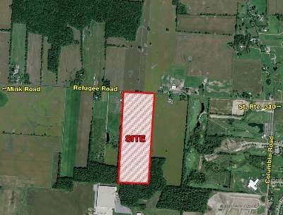


Property Detail
Refugee Rd Sw
Columbus, OH
60.54 AC SEC 1 R20 T16
010-017562-00.000
LICKING
Industrialacreage
Ohio
B and X Area of moderate flood hazard, usually the area between the limits of the 100-year and 500-year floods.
60.54 AC
2025
Licking County
2025
Columbus
756500
NEARBY LISTINGS FOR SALE OR LEASE
DEMOGRAPHICS near Refugee Rd Sw
1 mile
3 mile
5 mile
2025 Total Population
1,400
21,979
87,027
2030 Population
1,464
22,694
89,801
Pop Growth 2025-2030
+ 4.57%
+ 3.25%
+ 3.19%
Average Age
34
39
39
2025 Total Households
453
7,871
30,914
HH Growth 2025-2030
+ 4.42%
+ 3.15%
+ 3.22%
Median Household Inc
$118,837
$95,175
$98,421
Avg Household Size
3.10
2.70
2.80
2025 Avg HH Vehicles
2.00
2.00
2.00
Median Home Value
$368,464
$312,957
$312,355
Median Year Built
2010
1995
1996
Nearby Places
Map Layers
Map Styles
 Street
 Aerial
Layers
 Traffic
 Biking
Places
Listings with unknown addresses are not visible on the map
- Restaurants
- Banks
- Shops
- Fitness
- Groceries
PUBLIC TRANSPORTATION
AIRPORT
John Glenn Columbus International
Drive
Walk
Distance
John Glenn Columbus International
25 min
13.9 mi
Rickenbacker International
Drive
Walk
Distance
Rickenbacker International
34 min
20.7 mi
Freight Ports
Port of Toledo
Drive
Walk
Distance
Port of Toledo
201 min
157.2 mi
SALE & LEASE HISTORY
LISTING DATE
SALE/LEASE

Sep 24, 2016
For Sale
Aug 24, 2020
For Sale
Nearby Properties
Address
Land Use
TOTAL SIZE
Lot Size
Zoning
Address
Land Use
TOTAL SIZE
Lot Size
Zoning
2,556 SF
89.32 AC
Address
Land Use
TOTAL SIZE
Lot Size
Zoning
1,430,005 SF
101.26 AC
Address
Land Use
TOTAL SIZE
Lot Size
Zoning
946,400 SF
80.92 AC
Address
Land Use
TOTAL SIZE
Lot Size
Zoning
1,230,350 SF
78.26 AC
Address
Land Use
TOTAL SIZE
Lot Size
Zoning
1,191,656 SF
56.97 AC
Address
Land Use
TOTAL SIZE
Lot Size
Zoning
1,078,230 SF
63.12 AC
Address
Land Use
TOTAL SIZE
Lot Size
Zoning
1,091,997 SF
49.37 AC
Address
Land Use
TOTAL SIZE
Lot Size
Zoning
855,000 SF
96 AC
Address
Land Use
TOTAL SIZE
Lot Size
Zoning
588,910 SF
52.23 AC
Address
Land Use
TOTAL SIZE
Lot Size
Zoning
437,569 SF
33 AC
Address
Land Use
TOTAL SIZE
Lot Size
Zoning
700,491 SF
92.80 AC
Address
Land Use
TOTAL SIZE
Lot Size
Zoning
699,016 SF
43.57 AC
Address
Land Use
TOTAL SIZE
Lot Size
Zoning
Address
Land Use
TOTAL SIZE
Lot Size
Zoning
756,333 SF
44.37 AC
Address
Land Use
TOTAL SIZE
Lot Size
Zoning
179.65 AC
Address
Land Use
TOTAL SIZE
Lot Size
Zoning
51,958 SF
48.39 AC
Address
Land Use
TOTAL SIZE
Lot Size
Zoning
524,490 SF
25.40 AC
Address
Land Use
TOTAL SIZE
Lot Size
Zoning
410,332 SF
21.81 AC
Address
Land Use
TOTAL SIZE
Lot Size
Zoning
524,494 SF
25.67 AC
Address
Land Use
TOTAL SIZE
Lot Size
Zoning
512,267 SF
22.36 AC
Address
Land Use
TOTAL SIZE
Lot Size
Zoning
4,208 SF
15.91 AC
Address
Land Use
TOTAL SIZE
Lot Size
Zoning
303,408 SF
29.74 AC
Address
Land Use
TOTAL SIZE
Lot Size
Zoning
2,594 SF
20.38 AC
Address
Land Use
TOTAL SIZE
Lot Size
Zoning
47.69 AC
Address
Land Use
TOTAL SIZE
Lot Size
Zoning
252,322 SF
17.77 AC
Address
Land Use
TOTAL SIZE
Lot Size
Zoning
89.41 AC
Address
Land Use
TOTAL SIZE
Lot Size
Zoning
83,892 SF
15.04 AC
Address
Land Use
TOTAL SIZE
Lot Size
Zoning
105,628 SF
17.72 AC
Address
Land Use
TOTAL SIZE
Lot Size
Zoning
9,408 SF
12.53 AC
Address
Land Use
TOTAL SIZE
Lot Size
Zoning
78,136 SF
7.46 AC
The World's #1 Commercial Real Estate Marketplace
Connect with us
© 2026 CoStar Group
The information above has been obtained from sources believed reliable. While we do not doubt its accuracy we have not verified it and make no guarantee, warranty or representation about it. It is your responsibility to independently confirm its accuracy and completeness. Any projections, opinions, assumptions, or estimates used are for example only and do not represent the current or future performance of the property. The value of this transaction to you depends on tax and other factors which should be evaluated by your tax, financial, and legal advisors. You and your advisors should conduct a careful, independent investigation of the property to determine to your satisfaction the suitability of the property for your needs.