Property Record
Reimer Rd, Barberton, OH 44203
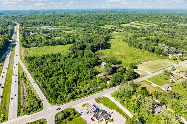
Property Detail
Reimer Rd
Akron, OH
LOT 13 ME 321.19FT ON RD 5.320A
46-08956
SUMMIT
Residentialacreage
Ohio
B and X Area of moderate flood hazard, usually the area between the limits of the 100-year and 500-year floods.
13
2023
46.17 AC
2025
Akron
510100
Cleveland
NEARBY LISTINGS FOR SALE OR LEASE
DEMOGRAPHICS near Reimer Rd
1 mile
3 mile
5 mile
2025 Total Population
1,893
16,186
83,937
2030 Population
1,873
16,225
84,136
Pop Growth 2025-2030
(1.06%)
+ 0.24%
+ 0.24%
Average Age
44
43
42
2025 Total Households
753
6,628
35,097
HH Growth 2025-2030
(1.06%)
+ 0.24%
+ 0.21%
Median Household Inc
$81,250
$83,689
$67,312
Avg Household Size
2.50
2.40
2.30
2025 Avg HH Vehicles
2.00
2.00
2.00
Median Home Value
$190,115
$214,405
$195,679
Median Year Built
1964
1967
1965
Nearby Places
Map Layers
Map Styles
 Street
 Aerial
Transit
 Traffic
 Biking
Places
Listings with unknown addresses are not visible on the map
- Restaurants
- Banks
- Shops
- Fitness
- Groceries
PUBLIC TRANSPORTATION
COMMUTER RAIL
Akron Northside (National Park Scenic Railway - Cuyahoga Valley Scenic Railroad)
Drive
Walk
Distance
Akron Northside (National Park Scenic Railway - Cuyahoga Valley Scenic Railroad)
19 min
9.7 mi
AIRPORT
Akron-Canton Regional
Drive
Walk
Distance
Akron-Canton Regional
26 min
18.9 mi
Cleveland-Hopkins International
Drive
Walk
Distance
Cleveland-Hopkins International
53 min
34.9 mi
Freight Ports
Port of Toledo
Drive
Walk
Distance
Port of Toledo
157 min
132.8 mi
SALE & LEASE HISTORY
LISTING DATE
SALE/LEASE

May 16, 2024
For Sale
Nearby Properties
Address
Land Use
TOTAL SIZE
Lot Size
Zoning
Address
Land Use
TOTAL SIZE
Lot Size
Zoning
148,344 SF
40.32 AC
Address
Land Use
TOTAL SIZE
Lot Size
Zoning
3,832 SF
56.46 AC
Address
Land Use
TOTAL SIZE
Lot Size
Zoning
87,486 SF
7.25 AC
Address
Land Use
TOTAL SIZE
Lot Size
Zoning
204,276 SF
28.95 AC
Address
Land Use
TOTAL SIZE
Lot Size
Zoning
29,161 SF
15.94 AC
Address
Land Use
TOTAL SIZE
Lot Size
Zoning
29,256 SF
25.13 AC
Address
Land Use
TOTAL SIZE
Lot Size
Zoning
99,931 SF
16.82 AC
Address
Land Use
TOTAL SIZE
Lot Size
Zoning
253,690 SF
12.18 AC
Address
Land Use
TOTAL SIZE
Lot Size
Zoning
138,251 SF
15.17 AC
Address
Land Use
TOTAL SIZE
Lot Size
Zoning
832 SF
16.75 AC
Address
Land Use
TOTAL SIZE
Lot Size
Zoning
17.87 AC
Address
Land Use
TOTAL SIZE
Lot Size
Zoning
121,395 SF
10.63 AC
Address
Land Use
TOTAL SIZE
Lot Size
Zoning
144,162 SF
17.39 AC
Address
Land Use
TOTAL SIZE
Lot Size
Zoning
15,439 SF
3.27 AC
Address
Land Use
TOTAL SIZE
Lot Size
Zoning
91,962 SF
15.90 AC
Address
Land Use
TOTAL SIZE
Lot Size
Zoning
75,284 SF
5 AC
Address
Land Use
TOTAL SIZE
Lot Size
Zoning
87,953 SF
8.78 AC
Address
Land Use
TOTAL SIZE
Lot Size
Zoning
15,960 SF
3.40 AC
Address
Land Use
TOTAL SIZE
Lot Size
Zoning
24,666 SF
162.52 AC
Address
Land Use
TOTAL SIZE
Lot Size
Zoning
17.74 AC
Address
Land Use
TOTAL SIZE
Lot Size
Zoning
23,145 SF
31.40 AC
Address
Land Use
TOTAL SIZE
Lot Size
Zoning
7,040 SF
0.95 AC
Address
Land Use
TOTAL SIZE
Lot Size
Zoning
55,078 SF
4.66 AC
Address
Land Use
TOTAL SIZE
Lot Size
Zoning
121,710 SF
11.59 AC
Address
Land Use
TOTAL SIZE
Lot Size
Zoning
112,924 SF
9.51 AC
Address
Land Use
TOTAL SIZE
Lot Size
Zoning
38,559 SF
15.37 AC
Address
Land Use
TOTAL SIZE
Lot Size
Zoning
23,921 SF
9.95 AC
Address
Land Use
TOTAL SIZE
Lot Size
Zoning
23,750 SF
3.14 AC
Address
Land Use
TOTAL SIZE
Lot Size
Zoning
44,270 SF
4.95 AC
Address
Land Use
TOTAL SIZE
Lot Size
Zoning
8,480 SF
1.23 AC
The World's #1 Commercial Real Estate Marketplace
Connect with us
© 2026 CoStar Group
The information above has been obtained from sources believed reliable. While we do not doubt its accuracy we have not verified it and make no guarantee, warranty or representation about it. It is your responsibility to independently confirm its accuracy and completeness. Any projections, opinions, assumptions, or estimates used are for example only and do not represent the current or future performance of the property. The value of this transaction to you depends on tax and other factors which should be evaluated by your tax, financial, and legal advisors. You and your advisors should conduct a careful, independent investigation of the property to determine to your satisfaction the suitability of the property for your needs.