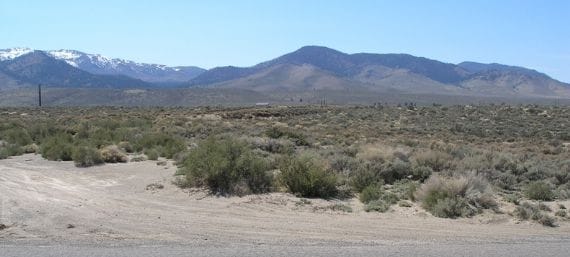
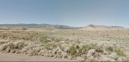
Property Record
Reno Park Blvd, Reno, NV 89508
NEARBY LISTINGS FOR SALE OR LEASE
Property Detail
Reno Park Blvd
Reno, NV
_Unspecified
081-131-42
PM 1152 FR LT 2A
Residentialacreage
Washoe
X
Nevada
32031C2825H
2a
0
1.16 AC
2026
N Outlying Washoe County
002613
Reno/Sparks
DEMOGRAPHICS near Reno Park Blvd
1 Mile
3 Mile
5 Mile
2024 Total Population
830
9,658
12,154
2029 Population
862
10,118
12,749
Pop Growth 2024-2029
+ 3.86%
+ 4.76%
+ 4.90%
Average Age
44
40
40
2024 Total Households
311
3,401
4,311
HH Growth 2024-2029
+ 3.86%
+ 4.88%
+ 5.03%
Median Household Inc
$102,011
$77,588
$80,698
Avg Household Size
2.60
2.80
2.80
2024 Avg HH Vehicles
3.00
3.00
3.00
Median Home Value
$364,953
$363,746
$376,830
Median Year Built
2003
2002
2001
Nearby Places
Map Layers
Map Styles
 Street
 Aerial
- Restaurants
- Banks
- Shops
- Fitness
- Groceries
PUBLIC TRANSPORTATION
AIRPORT
Reno/Tahoe International
DRIVE
WALK
Distance
Reno/Tahoe International
41 min
21.4 mi
Freight Ports
Port of Stockton
DRIVE
WALK
Distance
Port of Stockton
226 min
195.7 mi
SALE & LEASE HISTORY
LISTING DATE
SALE/LEASE

Sep 24, 2016
For Sale
Jun 03, 2019
For Sale
Nearby Properties
Address
Land Use
TOTAL SIZE
Lot Size
Zoning
Address
Land Use
TOTAL SIZE
Lot Size
Zoning
139,843 SF
20.90 AC
PSP 95% /
Address
Land Use
TOTAL SIZE
Lot Size
Zoning
86,134 SF
10.07 AC
MDS
Address
Land Use
TOTAL SIZE
Lot Size
Zoning
994 SF
73.47 AC
PSP
Address
Land Use
TOTAL SIZE
Lot Size
Zoning
21,189 SF
12.37 AC
TC
Address
Land Use
TOTAL SIZE
Lot Size
Zoning
41,962 SF
10 AC
PSP
Address
Land Use
TOTAL SIZE
Lot Size
Zoning
79,500 SF
16 AC
I
Address
Land Use
TOTAL SIZE
Lot Size
Zoning
1,695 SF
336.91 AC
A1
Address
Land Use
TOTAL SIZE
Lot Size
Zoning
8,020 SF
1.42 AC
NC
Address
Land Use
TOTAL SIZE
Lot Size
Zoning
58 AC
I 73% / GR
Address
Land Use
TOTAL SIZE
Lot Size
Zoning
32.67 AC
I
Address
Land Use
TOTAL SIZE
Lot Size
Zoning
10.27 AC
I
Address
Land Use
TOTAL SIZE
Lot Size
Zoning
7,261 SF
2.01 AC
PF
Address
Land Use
TOTAL SIZE
Lot Size
Zoning
16,896 SF
13.13 AC
I
Address
Land Use
TOTAL SIZE
Lot Size
Zoning
18.94 AC
NC 21% / I
Address
Land Use
TOTAL SIZE
Lot Size
Zoning
2,236 SF
86.32 AC
AGPRES
Address
Land Use
TOTAL SIZE
Lot Size
Zoning
8,000 SF
1 AC
NC
Address
Land Use
TOTAL SIZE
Lot Size
Zoning
15.29 AC
GC
Address
Land Use
TOTAL SIZE
Lot Size
Zoning
672.53 AC
GF
Address
Land Use
TOTAL SIZE
Lot Size
Zoning
99.28 AC
SPD
Address
Land Use
TOTAL SIZE
Lot Size
Zoning
13.03 AC
PR
Address
Land Use
TOTAL SIZE
Lot Size
Zoning
12,240 SF
4.23 AC
NC 71%/ PS
Address
Land Use
TOTAL SIZE
Lot Size
Zoning
3,515 SF
13.46 AC
PR
Address
Land Use
TOTAL SIZE
Lot Size
Zoning
2,400 SF
0.90 AC
NC
Address
Land Use
TOTAL SIZE
Lot Size
Zoning
9.74 AC
NC
Address
Land Use
TOTAL SIZE
Lot Size
Zoning
0.92 AC
PSP
Address
Land Use
TOTAL SIZE
Lot Size
Zoning
14.38 AC
I
Address
Land Use
TOTAL SIZE
Lot Size
Zoning
Address
Land Use
TOTAL SIZE
Lot Size
Zoning
2,400 SF
0.97 AC
GC
Address
Land Use
TOTAL SIZE
Lot Size
Zoning
7,400 SF
159.20 AC
SF3
Address
Land Use
TOTAL SIZE
Lot Size
Zoning
160 AC
SF3
The World's #1 Commercial Real Estate Marketplace
Connect with us
© 2025 CoStar Group
The information above has been obtained from sources believed reliable. While we do not doubt its accuracy we have not verified it and make no guarantee, warranty or representation about it. It is your responsibility to independently confirm its accuracy and completeness. Any projections, opinions, assumptions, or estimates used are for example only and do not represent the current or future performance of the property. The value of this transaction to you depends on tax and other factors which should be evaluated by your tax, financial, and legal advisors. You and your advisors should conduct a careful, independent investigation of the property to determine to your satisfaction the suitability of the property for your needs.