Property Record
Reno Park Blvd, Reno, NV 89508
Save to a Folder
{{folder.Name}}
{{folder.ListingIds.length}} Properties
{{folder.ListingIds.length}} Property
Create a New Folder
This Property Is For Sale
Property Detail
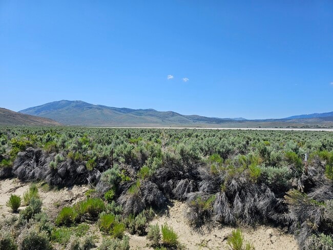
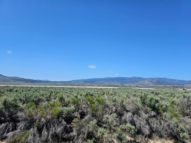
Reno Park Blvd
087-010-10
FRAC SEC 28 TWP 21N RGE 21E
Residentialacreage
WASHOE
PGOS
Nevada
AE The base floodplain where base flood elevations are provided. AE Zones are now used on new format FIRMs instead of A1-A30 Zones.
320 AC
0
N Outlying Washoe County
2026
Reno/Sparks
002613
Reno, NV
NEARBY LISTINGS FOR SALE OR LEASE
DEMOGRAPHICS near Reno Park Blvd
1 mile
3 mile
5 mile
2025 Total Population
1,498
11,672
22,561
2030 Population
1,519
11,947
22,963
Pop Growth 2025-2030
+ 1.40%
+ 2.36%
+ 1.78%
Average Age
42
41
39
2025 Total Households
547
4,142
7,796
HH Growth 2025-2030
+ 1.28%
+ 2.51%
+ 1.95%
Median Household Inc
$80,888
$86,640
$84,283
Avg Household Size
2.70
2.70
2.80
2025 Avg HH Vehicles
3.00
3.00
2.00
Median Home Value
$323,863
$444,029
$425,802
Median Year Built
1986
2002
1999
Nearby Places
Map Layers
Map Styles
 Street
 Aerial
Layers
 Traffic
 Biking
Places
Listings with unknown addresses are not visible on the map
- Restaurants
- Banks
- Shops
- Fitness
- Groceries
PUBLIC TRANSPORTATION
AIRPORT
Reno/Tahoe International
Drive
Walk
Distance
Reno/Tahoe International
39 min
19.7 mi
Freight Ports
Port of Stockton
Drive
Walk
Distance
Port of Stockton
224 min
194.1 mi
Nearby Properties
Address
Land Use
TOTAL SIZE
Lot Size
Zoning
Address
Land Use
TOTAL SIZE
Lot Size
Zoning
139,843 SF
20.90 AC
PSP 95% /
Address
Land Use
TOTAL SIZE
Lot Size
Zoning
86,134 SF
10.07 AC
MDS
Address
Land Use
TOTAL SIZE
Lot Size
Zoning
994 SF
73.47 AC
PSP
Address
Land Use
TOTAL SIZE
Lot Size
Zoning
21,189 SF
12.37 AC
TC
Address
Land Use
TOTAL SIZE
Lot Size
Zoning
41,962 SF
10 AC
PSP
Address
Land Use
TOTAL SIZE
Lot Size
Zoning
79,500 SF
16 AC
I
Address
Land Use
TOTAL SIZE
Lot Size
Zoning
13,453 SF
4.66 AC
LDS
Address
Land Use
TOTAL SIZE
Lot Size
Zoning
8,020 SF
1.42 AC
NC
Address
Land Use
TOTAL SIZE
Lot Size
Zoning
58 AC
I 73% / GR
Address
Land Use
TOTAL SIZE
Lot Size
Zoning
32.67 AC
I
Address
Land Use
TOTAL SIZE
Lot Size
Zoning
10.27 AC
I
Address
Land Use
TOTAL SIZE
Lot Size
Zoning
7,261 SF
2.01 AC
PF
Address
Land Use
TOTAL SIZE
Lot Size
Zoning
1.24 AC
PSP
Address
Land Use
TOTAL SIZE
Lot Size
Zoning
16,896 SF
13.13 AC
I
Address
Land Use
TOTAL SIZE
Lot Size
Zoning
18.94 AC
NC 21% / I
Address
Land Use
TOTAL SIZE
Lot Size
Zoning
2,236 SF
86.32 AC
AGPRES
Address
Land Use
TOTAL SIZE
Lot Size
Zoning
8,000 SF
1 AC
NC
Address
Land Use
TOTAL SIZE
Lot Size
Zoning
308.60 AC
SP
Address
Land Use
TOTAL SIZE
Lot Size
Zoning
15.29 AC
GC
Address
Land Use
TOTAL SIZE
Lot Size
Zoning
1,140.97 AC
OS
Address
Land Use
TOTAL SIZE
Lot Size
Zoning
99.28 AC
SPD
Address
Land Use
TOTAL SIZE
Lot Size
Zoning
13.03 AC
PR
Address
Land Use
TOTAL SIZE
Lot Size
Zoning
12,240 SF
4.23 AC
NC 71%/ PS
Address
Land Use
TOTAL SIZE
Lot Size
Zoning
243.02 AC
LDS
Address
Land Use
TOTAL SIZE
Lot Size
Zoning
3,515 SF
13.46 AC
PR
Address
Land Use
TOTAL SIZE
Lot Size
Zoning
2,400 SF
0.90 AC
NC
Address
Land Use
TOTAL SIZE
Lot Size
Zoning
9.74 AC
NC
Address
Land Use
TOTAL SIZE
Lot Size
Zoning
0.92 AC
PSP
Address
Land Use
TOTAL SIZE
Lot Size
Zoning
14.38 AC
I
Address
Land Use
TOTAL SIZE
Lot Size
Zoning
The World's #1 Commercial Real Estate Marketplace
Connect with us
© 2026 CoStar Group
The information above has been obtained from sources believed reliable. While we do not doubt its accuracy we have not verified it and make no guarantee, warranty or representation about it. It is your responsibility to independently confirm its accuracy and completeness. Any projections, opinions, assumptions, or estimates used are for example only and do not represent the current or future performance of the property. The value of this transaction to you depends on tax and other factors which should be evaluated by your tax, financial, and legal advisors. You and your advisors should conduct a careful, independent investigation of the property to determine to your satisfaction the suitability of the property for your needs.