Property Record
Reynolds Rd, Lakeland, FL 33803


This Property Is For Sale
NEARBY LISTINGS FOR SALE OR LEASE
Property Detail
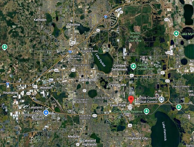
Reynolds Rd
Lakeland-Winter Haven, FL
Alameda Heights
24-28-35-000000-033030
COMM NW COR OF NW1/4 OF SEC RUN E 50 FT RUN S 133 FT TO POB RUN E 1925.09 FT RUN S 45 DEG 1414E 70.99 FT RUN S 335.80 FT W 825.56 FT S 140 FT W 450 FT N 45.08 FT W 697.94 FT TO POINT ON E R/W LINE REYNOLDS RD RUN N 480.93 FT TO POB
Industrialacreage
Polk
A
Florida
12105C0320G
20.39 AC
2024
Polk County
2025
Tampa/St Petersburg
010502
DEMOGRAPHICS near Reynolds Rd
1 Mile
3 Mile
5 Mile
2024 Total Population
3,596
32,749
109,904
2029 Population
4,284
39,105
130,631
Pop Growth 2024-2029
+ 19.13%
+ 19.41%
+ 18.86%
Average Age
40
38
39
2024 Total Households
1,373
12,450
41,621
HH Growth 2024-2029
+ 19.23%
+ 19.45%
+ 19.23%
Median Household Inc
$34,130
$51,015
$59,411
Avg Household Size
2.50
2.40
2.40
2024 Avg HH Vehicles
2.00
2.00
2.00
Median Home Value
$88,699
$164,346
$206,159
Median Year Built
1977
1979
1979
Nearby Places
Map Layers
Map Styles
 Street
 Aerial
- Restaurants
- Banks
- Shops
- Fitness
- Groceries
PUBLIC TRANSPORTATION
COMMUTER RAIL
Lakeland (Silver Star - Amtrak)
DRIVE
WALK
Distance
Lakeland (Silver Star - Amtrak)
12 min
5.2 mi
Freight Ports
Port of Tampa Bay
DRIVE
WALK
Distance
Port of Tampa Bay
54 min
41.0 mi
Nearby Properties
Address
Land Use
TOTAL SIZE
Lot Size
Zoning
Address
Land Use
TOTAL SIZE
Lot Size
Zoning
480,363 SF
40.15 AC
Address
Land Use
TOTAL SIZE
Lot Size
Zoning
465,802 SF
17.50 AC
Address
Land Use
TOTAL SIZE
Lot Size
Zoning
389,868 SF
130.50 AC
Address
Land Use
TOTAL SIZE
Lot Size
Zoning
282,596 SF
27.51 AC
RA3
Address
Land Use
TOTAL SIZE
Lot Size
Zoning
341,795 SF
37.28 AC
Address
Land Use
TOTAL SIZE
Lot Size
Zoning
132,716 SF
20.62 AC
Address
Land Use
TOTAL SIZE
Lot Size
Zoning
148,182 SF
24.15 AC
Address
Land Use
TOTAL SIZE
Lot Size
Zoning
109,883 SF
12.40 AC
C4
Address
Land Use
TOTAL SIZE
Lot Size
Zoning
130,375 SF
14.51 AC
Address
Land Use
TOTAL SIZE
Lot Size
Zoning
218,911 SF
39.21 AC
Address
Land Use
TOTAL SIZE
Lot Size
Zoning
106,312 SF
22.64 AC
RC
Address
Land Use
TOTAL SIZE
Lot Size
Zoning
225,389 SF
37.49 AC
Address
Land Use
TOTAL SIZE
Lot Size
Zoning
123,700 SF
4.24 AC
Address
Land Use
TOTAL SIZE
Lot Size
Zoning
95,955 SF
14.37 AC
Address
Land Use
TOTAL SIZE
Lot Size
Zoning
84,129 SF
336.67 AC
Address
Land Use
TOTAL SIZE
Lot Size
Zoning
21,571 SF
154.48 AC
Address
Land Use
TOTAL SIZE
Lot Size
Zoning
73,090 SF
5.81 AC
PUD
Address
Land Use
TOTAL SIZE
Lot Size
Zoning
131,741 SF
17.34 AC
Address
Land Use
TOTAL SIZE
Lot Size
Zoning
76,643 SF
34.20 AC
R3
Address
Land Use
TOTAL SIZE
Lot Size
Zoning
98,793 SF
2.76 AC
Address
Land Use
TOTAL SIZE
Lot Size
Zoning
75,958 SF
11.28 AC
RA3
Address
Land Use
TOTAL SIZE
Lot Size
Zoning
71,967 SF
12.35 AC
RA3
Address
Land Use
TOTAL SIZE
Lot Size
Zoning
72,853 SF
6.78 AC
C3
Address
Land Use
TOTAL SIZE
Lot Size
Zoning
61,474 SF
8.18 AC
PUD
Address
Land Use
TOTAL SIZE
Lot Size
Zoning
103,481 SF
14.31 AC
PUD
Address
Land Use
TOTAL SIZE
Lot Size
Zoning
113,317 SF
21.89 AC
PUD
Address
Land Use
TOTAL SIZE
Lot Size
Zoning
133,836 SF
15.64 AC
Address
Land Use
TOTAL SIZE
Lot Size
Zoning
20,231 SF
44.52 AC
Address
Land Use
TOTAL SIZE
Lot Size
Zoning
117,592 SF
10.02 AC
GI
Address
Land Use
TOTAL SIZE
Lot Size
Zoning
90,046 SF
13.88 AC
The World's #1 Commercial Real Estate Marketplace
Connect with us
© 2025 CoStar Group
The information above has been obtained from sources believed reliable. While we do not doubt its accuracy we have not verified it and make no guarantee, warranty or representation about it. It is your responsibility to independently confirm its accuracy and completeness. Any projections, opinions, assumptions, or estimates used are for example only and do not represent the current or future performance of the property. The value of this transaction to you depends on tax and other factors which should be evaluated by your tax, financial, and legal advisors. You and your advisors should conduct a careful, independent investigation of the property to determine to your satisfaction the suitability of the property for your needs.