Property Record
2304 Furnace Ave, Linthicum Heights, MD 21090


This Property Is For Sale
NEARBY LISTINGS FOR SALE OR LEASE
Property Detail
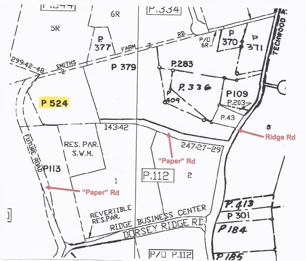
2304 Furnace Ave
Baltimore-Columbia-Towson, MD
Raynor Heights
05-000-90022508
867.496 ACRES PATAPSCO STATE PARK RAYNOR HEIGHTS
Commercialnec
Anne Arundel
AE
Maryland
2400100510H
1
2023
867.49 AC
2025
BWI/Anne Arundel
751200
Baltimore
DEMOGRAPHICS near 2304 Furnace Ave
1 mile
3 mile
5 mile
2024 Total Population
1,542
50,499
172,342
2029 Population
1,677
52,246
176,976
Pop Growth 2024-2029
+ 8.75%
+ 3.46%
+ 2.69%
Average Age
39
38
37
2024 Total Households
727
18,731
61,626
HH Growth 2024-2029
+ 8.94%
+ 3.59%
+ 2.75%
Median Household Inc
$104,852
$119,289
$113,612
Avg Household Size
2.10
2.60
2.70
2024 Avg HH Vehicles
2.00
2.00
2.00
Median Home Value
$394,117
$412,607
$378,769
Median Year Built
2010
1997
1991
Nearby Places
Map Layers
Map Styles
 Street
 Aerial
Transit
 Traffic
 Biking
Places
Listings with unknown addresses are not visible on the map
- Restaurants
- Banks
- Shops
- Fitness
- Groceries
PUBLIC TRANSPORTATION
COMMUTER RAIL
Dorsey Marc Nb (CAMDEN - WASHINGTON - Maryland Transit Administration)
Drive
Walk
Distance
Dorsey Marc Nb (CAMDEN - WASHINGTON - Maryland Transit Administration)
6 min
2.5 mi
Bwi Airport (Penn Line - Maryland Area Regional Commuter Trains (The MARC))
Drive
Walk
Distance
Bwi Airport (Penn Line - Maryland Area Regional Commuter Trains (The MARC))
9 min
3.5 mi
AIRPORT
Baltimore/Washington International Thurgood Marshall
Drive
Walk
Distance
Baltimore/Washington International Thurgood Marshall
10 min
4.2 mi
Ronald Reagan Washington Ntl
Drive
Walk
Distance
Ronald Reagan Washington Ntl
53 min
33.8 mi
Freight Ports
Port of Baltimore
Drive
Walk
Distance
Port of Baltimore
21 min
11.6 mi
Nearby Properties
Address
Land Use
TOTAL SIZE
Lot Size
Zoning
Address
Land Use
TOTAL SIZE
Lot Size
Zoning
1,593,623 SF
176.09 AC
W1
Address
Land Use
TOTAL SIZE
Lot Size
Zoning
2,583,263 SF
12.57 AC
W1
Address
Land Use
TOTAL SIZE
Lot Size
Zoning
732,668 SF
13.26 AC
MXDE
Address
Land Use
TOTAL SIZE
Lot Size
Zoning
430,940 SF
18.81 AC
MXDT
Address
Land Use
TOTAL SIZE
Lot Size
Zoning
14.68 AC
C2
Address
Land Use
TOTAL SIZE
Lot Size
Zoning
120,108 SF
28.23 AC
TOD
Address
Land Use
TOTAL SIZE
Lot Size
Zoning
305,483 SF
11.38 AC
MXDT
Address
Land Use
TOTAL SIZE
Lot Size
Zoning
332,190 SF
21.80 AC
W1-BW
Address
Land Use
TOTAL SIZE
Lot Size
Zoning
560,407 SF
3.82 AC
Address
Land Use
TOTAL SIZE
Lot Size
Zoning
154,666 SF
27.65 AC
M1
Address
Land Use
TOTAL SIZE
Lot Size
Zoning
5.34 AC
Address
Land Use
TOTAL SIZE
Lot Size
Zoning
454,684 SF
6.88 AC
W1B
Address
Land Use
TOTAL SIZE
Lot Size
Zoning
87,344 SF
5.46 AC
CECLI
Address
Land Use
TOTAL SIZE
Lot Size
Zoning
60,200 SF
778.66 AC
R1
Address
Land Use
TOTAL SIZE
Lot Size
Zoning
221,100 SF
1.75 AC
MXD-E
Address
Land Use
TOTAL SIZE
Lot Size
Zoning
11.09 AC
C2
Address
Land Use
TOTAL SIZE
Lot Size
Zoning
21,240 SF
20.31 AC
RA 15
Address
Land Use
TOTAL SIZE
Lot Size
Zoning
778.66 AC
R1
Address
Land Use
TOTAL SIZE
Lot Size
Zoning
490,875 SF
9.52 AC
MXD-E
Address
Land Use
TOTAL SIZE
Lot Size
Zoning
292,269 SF
15.86 AC
W1-BW
Address
Land Use
TOTAL SIZE
Lot Size
Zoning
202,692 SF
4.28 AC
TOD
Address
Land Use
TOTAL SIZE
Lot Size
Zoning
359,185 SF
3.63 AC
TOD
Address
Land Use
TOTAL SIZE
Lot Size
Zoning
231,128 SF
8.30 AC
W1-BW
Address
Land Use
TOTAL SIZE
Lot Size
Zoning
1,489,438 SF
74.22 AC
W2
Address
Land Use
TOTAL SIZE
Lot Size
Zoning
1,555.10 AC
R1
Address
Land Use
TOTAL SIZE
Lot Size
Zoning
79,448 SF
8.11 AC
TOD
Address
Land Use
TOTAL SIZE
Lot Size
Zoning
307,032 SF
4.35 AC
TOD
Address
Land Use
TOTAL SIZE
Lot Size
Zoning
53,024 SF
10.02 AC
CACLI
Address
Land Use
TOTAL SIZE
Lot Size
Zoning
271,600 SF
30.43 AC
M1
Address
Land Use
TOTAL SIZE
Lot Size
Zoning
259,502 SF
16.17 AC
W1B
The World's #1 Commercial Real Estate Marketplace
Connect with us
© 2026 CoStar Group
The information above has been obtained from sources believed reliable. While we do not doubt its accuracy we have not verified it and make no guarantee, warranty or representation about it. It is your responsibility to independently confirm its accuracy and completeness. Any projections, opinions, assumptions, or estimates used are for example only and do not represent the current or future performance of the property. The value of this transaction to you depends on tax and other factors which should be evaluated by your tax, financial, and legal advisors. You and your advisors should conduct a careful, independent investigation of the property to determine to your satisfaction the suitability of the property for your needs.