Property Record
Ring Rd, Clinton, SC 29325

Property Detail
Ring Rd
901-29-01-005
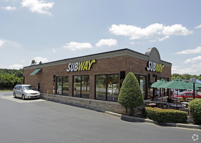
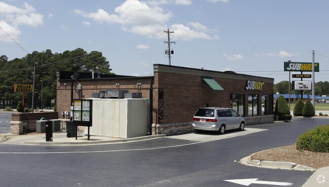
SUBWAY
Commercialnec
LAURENS
CL
South Carolina
B and X Area of moderate flood hazard, usually the area between the limits of the 100-year and 500-year floods.
0.80 AC
2025
Laurens County
2025
Greenville/Spartanburg
920800
Greenville-Anderson-Greer, SC
NEARBY LISTINGS FOR SALE OR LEASE
DEMOGRAPHICS near Ring Rd
1 mile
3 mile
5 mile
2025 Total Population
2,693
11,947
15,950
2030 Population
2,813
12,536
16,713
Pop Growth 2025-2030
+ 4.46%
+ 4.93%
+ 4.78%
Average Age
40
40
40
2025 Total Households
956
4,489
6,044
HH Growth 2025-2030
+ 4.92%
+ 5.37%
+ 5.18%
Median Household Inc
$68,029
$53,291
$52,543
Avg Household Size
2.40
2.40
2.40
2025 Avg HH Vehicles
2.00
2.00
2.00
Median Home Value
$255,803
$158,501
$158,326
Median Year Built
1971
1972
1973
Nearby Places
Map Layers
Map Styles
 Street
 Aerial
Transit
 Traffic
 Biking
Places
Listings with unknown addresses are not visible on the map
- Restaurants
- Banks
- Shops
- Fitness
- Groceries
PUBLIC TRANSPORTATION
AIRPORT
Greenville Spartanburg International
Drive
Walk
Distance
Greenville Spartanburg International
60 min
50.0 mi
Nearby Properties
Address
Land Use
TOTAL SIZE
Lot Size
Zoning
Address
Land Use
TOTAL SIZE
Lot Size
Zoning
2,002 AC
CL
Address
Land Use
TOTAL SIZE
Lot Size
Zoning
0.51 AC
CL
Address
Land Use
TOTAL SIZE
Lot Size
Zoning
0.58 AC
CL
Address
Land Use
TOTAL SIZE
Lot Size
Zoning
8.94 AC
CL
Address
Land Use
TOTAL SIZE
Lot Size
Zoning
99.37 AC
CL
Address
Land Use
TOTAL SIZE
Lot Size
Zoning
52.06 AC
Address
Land Use
TOTAL SIZE
Lot Size
Zoning
5.33 AC
CL
Address
Land Use
TOTAL SIZE
Lot Size
Zoning
3.34 AC
CL
Address
Land Use
TOTAL SIZE
Lot Size
Zoning
0.44 AC
CL
Address
Land Use
TOTAL SIZE
Lot Size
Zoning
3.25 AC
CL
Address
Land Use
TOTAL SIZE
Lot Size
Zoning
1.16 AC
CL
Address
Land Use
TOTAL SIZE
Lot Size
Zoning
1.03 AC
CL
Address
Land Use
TOTAL SIZE
Lot Size
Zoning
10.18 AC
CL
Address
Land Use
TOTAL SIZE
Lot Size
Zoning
75.47 AC
CL
Address
Land Use
TOTAL SIZE
Lot Size
Zoning
6.16 AC
CL
Address
Land Use
TOTAL SIZE
Lot Size
Zoning
31.16 AC
CL
Address
Land Use
TOTAL SIZE
Lot Size
Zoning
29.42 AC
Address
Land Use
TOTAL SIZE
Lot Size
Zoning
0.31 AC
CL
Address
Land Use
TOTAL SIZE
Lot Size
Zoning
1.21 AC
CL
Address
Land Use
TOTAL SIZE
Lot Size
Zoning
0.66 AC
CL
Address
Land Use
TOTAL SIZE
Lot Size
Zoning
0.84 AC
CL
Address
Land Use
TOTAL SIZE
Lot Size
Zoning
16.25 AC
CL
Address
Land Use
TOTAL SIZE
Lot Size
Zoning
0.43 AC
CL
Address
Land Use
TOTAL SIZE
Lot Size
Zoning
8.19 AC
CL
Address
Land Use
TOTAL SIZE
Lot Size
Zoning
0.07 AC
CL
Address
Land Use
TOTAL SIZE
Lot Size
Zoning
19.92 AC
CL
The World's #1 Commercial Real Estate Marketplace
Connect with us
© 2026 CoStar Group
The information above has been obtained from sources believed reliable. While we do not doubt its accuracy we have not verified it and make no guarantee, warranty or representation about it. It is your responsibility to independently confirm its accuracy and completeness. Any projections, opinions, assumptions, or estimates used are for example only and do not represent the current or future performance of the property. The value of this transaction to you depends on tax and other factors which should be evaluated by your tax, financial, and legal advisors. You and your advisors should conduct a careful, independent investigation of the property to determine to your satisfaction the suitability of the property for your needs.