Property Record
River Rd, Johns Island, SC 29455
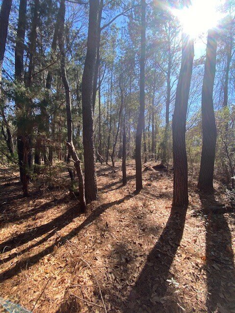


This Property Is For Sale
Property Detail
River Rd
Charleston-North Charleston, SC
SUBDIVISION NAME -WHITE DESCRIPTION -TRACT A SITE NAME -S SIDE APPROX 8330 FT S W BRIAN DAIRY RD
259-00-00-042
CHARLESTON
Residentialacreage
South Carolina
AE The base floodplain where base flood elevations are provided. AE Zones are now used on new format FIRMs instead of A1-A30 Zones.
23.10 AC
2025
West Islands
2024
Charleston/N Charleston
002103
NEARBY LISTINGS FOR SALE OR LEASE
DEMOGRAPHICS near River Rd
1 mile
3 mile
5 mile
2025 Total Population
160
2,906
15,347
2030 Population
171
3,134
17,085
Pop Growth 2025-2030
+ 6.88%
+ 7.85%
+ 11.32%
Average Age
48
51
53
2025 Total Households
65
1,221
6,836
HH Growth 2025-2030
+ 6.15%
+ 8.27%
+ 12.17%
Median Household Inc
$117,045
$124,507
$137,541
Avg Household Size
2.40
2.30
2.20
2025 Avg HH Vehicles
2.00
2.00
2.00
Median Home Value
$558,823
$789,521
$961,969
Median Year Built
2002
2002
1995
Nearby Places
Map Layers
Map Styles
 Street
 Aerial
Layers
 Traffic
 Biking
Places
Listings with unknown addresses are not visible on the map
- Restaurants
- Banks
- Shops
- Fitness
- Groceries
PUBLIC TRANSPORTATION
AIRPORT
Charleston AFB/International
Drive
Walk
Distance
Charleston AFB/International
62 min
29.5 mi
Freight Ports
Columbus Street Terminal
Drive
Walk
Distance
Columbus Street Terminal
49 min
18.6 mi
Nearby Properties
Address
Land Use
TOTAL SIZE
Lot Size
Zoning
Address
Land Use
TOTAL SIZE
Lot Size
Zoning
12.45 AC
Address
Land Use
TOTAL SIZE
Lot Size
Zoning
1,952 SF
22.30 AC
Address
Land Use
TOTAL SIZE
Lot Size
Zoning
2,050 SF
3.71 AC
Address
Land Use
TOTAL SIZE
Lot Size
Zoning
0.43 AC
Address
Land Use
TOTAL SIZE
Lot Size
Zoning
2,184 SF
14 AC
Address
Land Use
TOTAL SIZE
Lot Size
Zoning
6,442 SF
205.81 AC
Address
Land Use
TOTAL SIZE
Lot Size
Zoning
2,955 SF
0.35 AC
Address
Land Use
TOTAL SIZE
Lot Size
Zoning
5,576 SF
8.56 AC
Address
Land Use
TOTAL SIZE
Lot Size
Zoning
2,308 SF
270.14 AC
Address
Land Use
TOTAL SIZE
Lot Size
Zoning
0.17 AC
Address
Land Use
TOTAL SIZE
Lot Size
Zoning
0.18 AC
Address
Land Use
TOTAL SIZE
Lot Size
Zoning
0.15 AC
Address
Land Use
TOTAL SIZE
Lot Size
Zoning
0.21 AC
Address
Land Use
TOTAL SIZE
Lot Size
Zoning
0.32 AC
Address
Land Use
TOTAL SIZE
Lot Size
Zoning
6,504 SF
11.37 AC
Address
Land Use
TOTAL SIZE
Lot Size
Zoning
6.69 AC
Address
Land Use
TOTAL SIZE
Lot Size
Zoning
3,693 SF
0.50 AC
Address
Land Use
TOTAL SIZE
Lot Size
Zoning
1,173 SF
0.91 AC
Address
Land Use
TOTAL SIZE
Lot Size
Zoning
0.16 AC
Address
Land Use
TOTAL SIZE
Lot Size
Zoning
0.15 AC
Address
Land Use
TOTAL SIZE
Lot Size
Zoning
3.43 AC
Address
Land Use
TOTAL SIZE
Lot Size
Zoning
Address
Land Use
TOTAL SIZE
Lot Size
Zoning
Address
Land Use
TOTAL SIZE
Lot Size
Zoning
Address
Land Use
TOTAL SIZE
Lot Size
Zoning
3,501 SF
0.22 AC
Address
Land Use
TOTAL SIZE
Lot Size
Zoning
672 SF
11.50 AC
Address
Land Use
TOTAL SIZE
Lot Size
Zoning
3,734 SF
0.28 AC
Address
Land Use
TOTAL SIZE
Lot Size
Zoning
Address
Land Use
TOTAL SIZE
Lot Size
Zoning
3,952 SF
0.26 AC
Address
Land Use
TOTAL SIZE
Lot Size
Zoning
The World's #1 Commercial Real Estate Marketplace
Connect with us
© 2026 CoStar Group
The information above has been obtained from sources believed reliable. While we do not doubt its accuracy we have not verified it and make no guarantee, warranty or representation about it. It is your responsibility to independently confirm its accuracy and completeness. Any projections, opinions, assumptions, or estimates used are for example only and do not represent the current or future performance of the property. The value of this transaction to you depends on tax and other factors which should be evaluated by your tax, financial, and legal advisors. You and your advisors should conduct a careful, independent investigation of the property to determine to your satisfaction the suitability of the property for your needs.