Property Record
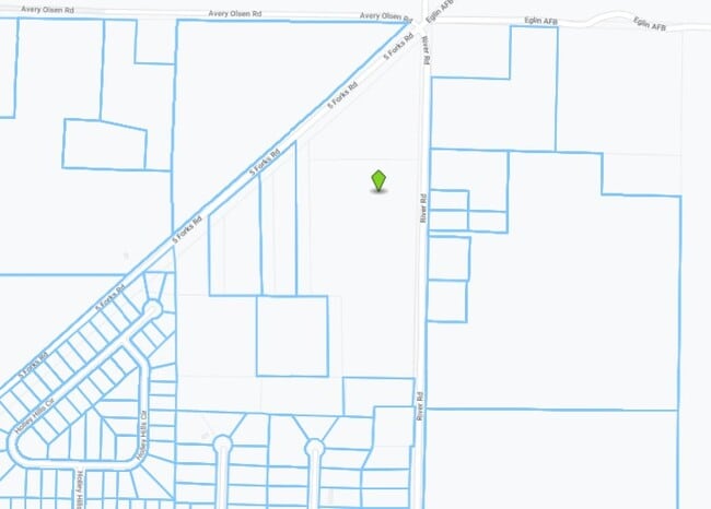
River Rd, Navarre, FL 32566
Property Detail
River Rd
05-2S-26-0000-00109-0000
COM NE COR SEC 5 T2S R26W THN S 48*04'00 W ALONG SLY R/W FOREST RD FOR 1676.87 FT THN S 00*31'00 W 269.48 FT ALONG US TRACT 520 MNMTD BNDRY THN S 89*29'00 E 418 FT FOR POB; THN S 89*29'00 E 313.50 FT THN S 00*31'00 W 418 FT THN N 89*29'00 W 313.50 FT
Miningfacilityoilgasmineralpreciousmetals
SANTA ROSA
M1
Florida
B and X Area of moderate flood hazard, usually the area between the limits of the 100-year and 500-year floods.
30.76 AC
2024
Navarre
2025
Pensacola
010802
Pensacola-Ferry Pass-Brent, FL
NEARBY LISTINGS FOR SALE OR LEASE
-
-
View all Navarre listings for sale on LoopNet.com
DEMOGRAPHICS near River Rd
1 mile
3 mile
5 mile
2025 Total Population
547
13,464
45,335
2030 Population
602
14,640
49,301
Pop Growth 2025-2030
+ 10.05%
+ 8.73%
+ 8.75%
Average Age
38
38
40
2025 Total Households
198
4,886
16,771
HH Growth 2025-2030
+ 9.60%
+ 8.51%
+ 8.67%
Median Household Inc
$95,404
$93,265
$94,594
Avg Household Size
2.80
2.70
2.70
2025 Avg HH Vehicles
2.00
2.00
2.00
Median Home Value
$399,037
$371,338
$387,911
Median Year Built
1998
2000
2000
Nearby Places
Map Layers
Map Styles
 Street
 Aerial
Layers
 Traffic
 Biking
Places
Listings with unknown addresses are not visible on the map
- Restaurants
- Banks
- Shops
- Fitness
- Groceries
PUBLIC TRANSPORTATION
AIRPORT
Eglin AFB/Destin-Ft Walton Beach
Drive
Walk
Distance
Eglin AFB/Destin-Ft Walton Beach
58 min
30.1 mi
Pensacola International
Drive
Walk
Distance
Pensacola International
54 min
37.8 mi
Freight Ports
Port of Panama City
Drive
Walk
Distance
Port of Panama City
124 min
76.8 mi
Nearby Properties
Address
Land Use
TOTAL SIZE
Lot Size
Zoning
Address
Land Use
TOTAL SIZE
Lot Size
Zoning
85,562 SF
36.21 AC
PBD
Address
Land Use
TOTAL SIZE
Lot Size
Zoning
26,192 SF
3.82 AC
HCD
Address
Land Use
TOTAL SIZE
Lot Size
Zoning
29,973 SF
3.82 AC
HCD
Address
Land Use
TOTAL SIZE
Lot Size
Zoning
16,887 SF
2.90 AC
HCD
Address
Land Use
TOTAL SIZE
Lot Size
Zoning
29,159 SF
5.45 AC
HCD
Address
Land Use
TOTAL SIZE
Lot Size
Zoning
10,694 SF
1.70 AC
HCD
Address
Land Use
TOTAL SIZE
Lot Size
Zoning
8,891 SF
7.50 AC
HCD
Address
Land Use
TOTAL SIZE
Lot Size
Zoning
4,600 SF
44.10 AC
R1
Address
Land Use
TOTAL SIZE
Lot Size
Zoning
40 AC
R1
Address
Land Use
TOTAL SIZE
Lot Size
Zoning
31,073 SF
2.13 AC
HCD
Address
Land Use
TOTAL SIZE
Lot Size
Zoning
9,784 SF
1.85 AC
HCD
Address
Land Use
TOTAL SIZE
Lot Size
Zoning
17,896 SF
7.03 AC
R1
Address
Land Use
TOTAL SIZE
Lot Size
Zoning
13,420 SF
0.95 AC
R2M
Address
Land Use
TOTAL SIZE
Lot Size
Zoning
5,956 SF
7.52 AC
HCD
Address
Land Use
TOTAL SIZE
Lot Size
Zoning
12,060 SF
0.92 AC
R2M
Address
Land Use
TOTAL SIZE
Lot Size
Zoning
28.25 AC
AG-RR
Address
Land Use
TOTAL SIZE
Lot Size
Zoning
13,174 SF
1.27 AC
HCD
Address
Land Use
TOTAL SIZE
Lot Size
Zoning
12,767 SF
0.92 AC
HCD
Address
Land Use
TOTAL SIZE
Lot Size
Zoning
21,477 SF
2.25 AC
R1M
Address
Land Use
TOTAL SIZE
Lot Size
Zoning
15,827 SF
1.81 AC
R1
Address
Land Use
TOTAL SIZE
Lot Size
Zoning
2,282 SF
59.69 AC
M1
Address
Land Use
TOTAL SIZE
Lot Size
Zoning
9,750 SF
1.13 AC
R2
Address
Land Use
TOTAL SIZE
Lot Size
Zoning
11,942 SF
0.84 AC
HCD
Address
Land Use
TOTAL SIZE
Lot Size
Zoning
11,565 SF
0.84 AC
HCD
Address
Land Use
TOTAL SIZE
Lot Size
Zoning
9,118 SF
0.97 AC
HCD
Address
Land Use
TOTAL SIZE
Lot Size
Zoning
20,362 SF
1.35 AC
R1
Address
Land Use
TOTAL SIZE
Lot Size
Zoning
7,134 SF
0.95 AC
HCD
Address
Land Use
TOTAL SIZE
Lot Size
Zoning
10,009 SF
0.78 AC
R1
The World's #1 Commercial Real Estate Marketplace
Connect with us
© 2026 CoStar Group
The information above has been obtained from sources believed reliable. While we do not doubt its accuracy we have not verified it and make no guarantee, warranty or representation about it. It is your responsibility to independently confirm its accuracy and completeness. Any projections, opinions, assumptions, or estimates used are for example only and do not represent the current or future performance of the property. The value of this transaction to you depends on tax and other factors which should be evaluated by your tax, financial, and legal advisors. You and your advisors should conduct a careful, independent investigation of the property to determine to your satisfaction the suitability of the property for your needs.