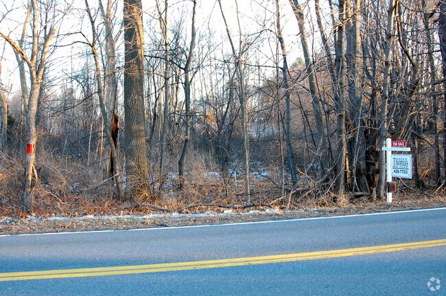
Property Record
River Rd, Selkirk, NY 12158
Save to a Folder
{{folder.Name}}
{{folder.ListingIds.length}} Properties
{{folder.ListingIds.length}} Property
Create a New Folder
Property Detail
River Rd
Albany-Schenectady-Troy, NY
SELKIRK
012200-134-000-0002-019-000-0000
ALBANY
Miscresidentialimprovement
New York
RR
19.000
AE The base floodplain where base flood elevations are provided. AE Zones are now used on new format FIRMs instead of A1-A30 Zones.
103.10 AC
2025
W Outer Albany County
2025
Albany/Schenectady/Troy
014304
NEARBY LISTINGS FOR SALE OR LEASE
DEMOGRAPHICS near River Rd
1 mile
3 mile
5 mile
2025 Total Population
335
6,008
19,427
2030 Population
341
6,104
19,742
Pop Growth 2025-2030
+ 1.79%
+ 1.60%
+ 1.62%
Average Age
41
42
42
2025 Total Households
140
2,472
7,932
HH Growth 2025-2030
+ 2.14%
+ 1.66%
+ 1.70%
Median Household Inc
$103,704
$88,090
$92,769
Avg Household Size
2.40
2.30
2.40
2025 Avg HH Vehicles
2.00
2.00
2.00
Median Home Value
$250,000
$239,982
$266,851
Median Year Built
1954
1964
1974
Nearby Places
Map Layers
Map Styles
 Street
 Aerial
Layers
 Traffic
 Biking
Places
Listings with unknown addresses are not visible on the map
- Restaurants
- Banks
- Shops
- Fitness
- Groceries
PUBLIC TRANSPORTATION
AIRPORT
Albany International
Drive
Walk
Distance
Albany International
33 min
21.7 mi
Freight Ports
Albany, NY Port
Drive
Walk
Distance
Albany, NY Port
12 min
8.1 mi
Nearby Properties
Address
Land Use
TOTAL SIZE
Lot Size
Zoning
Address
Land Use
TOTAL SIZE
Lot Size
Zoning
4,880 SF
3,188.61 AC
I-1
Address
Land Use
TOTAL SIZE
Lot Size
Zoning
168.80 AC
Address
Land Use
TOTAL SIZE
Lot Size
Zoning
102,995 SF
153.50 AC
RR
Address
Land Use
TOTAL SIZE
Lot Size
Zoning
112,306 SF
54.40 AC
R-2
Address
Land Use
TOTAL SIZE
Lot Size
Zoning
250,000 SF
23.39 AC
I-1
Address
Land Use
TOTAL SIZE
Lot Size
Zoning
Address
Land Use
TOTAL SIZE
Lot Size
Zoning
10,288 SF
17.20 AC
RLI
Address
Land Use
TOTAL SIZE
Lot Size
Zoning
96,024 SF
10.70 AC
R-2
Address
Land Use
TOTAL SIZE
Lot Size
Zoning
1,140 SF
127.59 AC
I
Address
Land Use
TOTAL SIZE
Lot Size
Zoning
77,626 SF
54.30 AC
R
Address
Land Use
TOTAL SIZE
Lot Size
Zoning
57.32 AC
R-4 P
Address
Land Use
TOTAL SIZE
Lot Size
Zoning
3,682 SF
61.40 AC
C-1 P
Address
Land Use
TOTAL SIZE
Lot Size
Zoning
57.24 AC
R
Address
Land Use
TOTAL SIZE
Lot Size
Zoning
22,640 SF
4.52 AC
I
Address
Land Use
TOTAL SIZE
Lot Size
Zoning
10,374 SF
7.44 AC
R
Address
Land Use
TOTAL SIZE
Lot Size
Zoning
44,430 SF
11.86 AC
R
Address
Land Use
TOTAL SIZE
Lot Size
Zoning
1,594 SF
11.38 AC
R
Address
Land Use
TOTAL SIZE
Lot Size
Zoning
924 SF
36.80 AC
RLI
Address
Land Use
TOTAL SIZE
Lot Size
Zoning
30,276 SF
26.52 AC
ME
Address
Land Use
TOTAL SIZE
Lot Size
Zoning
31,078 SF
7.50 AC
R
Address
Land Use
TOTAL SIZE
Lot Size
Zoning
6.35 AC
RLI
Address
Land Use
TOTAL SIZE
Lot Size
Zoning
26.80 AC
R-4 P
Address
Land Use
TOTAL SIZE
Lot Size
Zoning
2,088 SF
165.25 AC
I-3 P
Address
Land Use
TOTAL SIZE
Lot Size
Zoning
101.26 AC
Address
Land Use
TOTAL SIZE
Lot Size
Zoning
1,848 SF
5.70 AC
R
Address
Land Use
TOTAL SIZE
Lot Size
Zoning
7,547 SF
87.90 AC
R
Address
Land Use
TOTAL SIZE
Lot Size
Zoning
1,456 SF
35.44 AC
C-1 P
Address
Land Use
TOTAL SIZE
Lot Size
Zoning
26,940 SF
25.20 AC
RLI
Address
Land Use
TOTAL SIZE
Lot Size
Zoning
35,000 SF
7.09 AC
I-1
Address
Land Use
TOTAL SIZE
Lot Size
Zoning
30.30 AC
I-3P
The World's #1 Commercial Real Estate Marketplace
Connect with us
© 2026 CoStar Group
The information above has been obtained from sources believed reliable. While we do not doubt its accuracy we have not verified it and make no guarantee, warranty or representation about it. It is your responsibility to independently confirm its accuracy and completeness. Any projections, opinions, assumptions, or estimates used are for example only and do not represent the current or future performance of the property. The value of this transaction to you depends on tax and other factors which should be evaluated by your tax, financial, and legal advisors. You and your advisors should conduct a careful, independent investigation of the property to determine to your satisfaction the suitability of the property for your needs.