Property Record
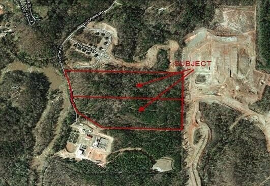
Riverfront Rd, Covington, GA 30014


Property Detail
Riverfront Rd
Atlanta-Sandy Springs-Roswell, GA
19.88AC TR 24-C RIVER RD
P045000000093A00
NEWTON
Governmentalpublicusegeneral
Georgia
AE The base floodplain where base flood elevations are provided. AE Zones are now used on new format FIRMs instead of A1-A30 Zones.
19.88 AC
0
Newton County
2025
Atlanta
100302
NEARBY LISTINGS FOR SALE OR LEASE
-
-
View all Covington listings for sale on LoopNet.com
DEMOGRAPHICS near Riverfront Rd
1 mile
3 mile
5 mile
2024 Total Population
2,175
31,343
70,812
2029 Population
2,340
34,261
77,190
Pop Growth 2024-2029
+ 7.59%
+ 9.31%
+ 9.01%
Average Age
38
38
37
2024 Total Households
872
11,490
24,962
HH Growth 2024-2029
+ 7.68%
+ 9.42%
+ 9.14%
Median Household Inc
$70,214
$70,177
$72,774
Avg Household Size
2.40
2.70
2.70
2024 Avg HH Vehicles
2.00
2.00
2.00
Median Home Value
$207,868
$249,885
$258,703
Median Year Built
1957
1998
1998
Nearby Places
Map Layers
Map Styles
 Street
 Aerial
Transit
 Traffic
 Biking
Places
Listings with unknown addresses are not visible on the map
- Restaurants
- Banks
- Shops
- Fitness
- Groceries
SALE & LEASE HISTORY
LISTING DATE
SALE/LEASE

Sep 24, 2016
For Sale
Nearby Properties
Address
Land Use
TOTAL SIZE
Lot Size
Zoning
Address
Land Use
TOTAL SIZE
Lot Size
Zoning
258,254 SF
15.08 AC
C1
Address
Land Use
TOTAL SIZE
Lot Size
Zoning
14,624 SF
26.09 AC
C1
Address
Land Use
TOTAL SIZE
Lot Size
Zoning
19,292 SF
8.20 AC
H1
Address
Land Use
TOTAL SIZE
Lot Size
Zoning
88,944 SF
0.98 AC
E1
Address
Land Use
TOTAL SIZE
Lot Size
Zoning
92,162 SF
11.21 AC
R2
Address
Land Use
TOTAL SIZE
Lot Size
Zoning
5,160 SF
45.17 AC
C1
Address
Land Use
TOTAL SIZE
Lot Size
Zoning
10,000 SF
0.01 AC
Address
Land Use
TOTAL SIZE
Lot Size
Zoning
1,627 SF
16.62 AC
C1
Address
Land Use
TOTAL SIZE
Lot Size
Zoning
14,080 SF
10 AC
C1
Address
Land Use
TOTAL SIZE
Lot Size
Zoning
222,056 SF
13.35 AC
Address
Land Use
TOTAL SIZE
Lot Size
Zoning
3,888 SF
7.17 AC
C1
Address
Land Use
TOTAL SIZE
Lot Size
Zoning
28,790 SF
3.70 AC
E1
Address
Land Use
TOTAL SIZE
Lot Size
Zoning
64,799 SF
19.10 AC
E6
Address
Land Use
TOTAL SIZE
Lot Size
Zoning
4,768 SF
263.26 AC
C1
Address
Land Use
TOTAL SIZE
Lot Size
Zoning
31,376 SF
3.50 AC
PUD
Address
Land Use
TOTAL SIZE
Lot Size
Zoning
6,936 SF
8.88 AC
C1
Address
Land Use
TOTAL SIZE
Lot Size
Zoning
28,512 SF
0.52 AC
Address
Land Use
TOTAL SIZE
Lot Size
Zoning
99,686 SF
11.50 AC
C1
Address
Land Use
TOTAL SIZE
Lot Size
Zoning
38,120 SF
155.15 AC
E1
Address
Land Use
TOTAL SIZE
Lot Size
Zoning
54,712 SF
54.54 AC
E6
Address
Land Use
TOTAL SIZE
Lot Size
Zoning
27,492 SF
0.47 AC
Address
Land Use
TOTAL SIZE
Lot Size
Zoning
74,713 SF
2.83 AC
Address
Land Use
TOTAL SIZE
Lot Size
Zoning
101,010 SF
42.72 AC
E6
Address
Land Use
TOTAL SIZE
Lot Size
Zoning
61,638 SF
0.64 AC
Address
Land Use
TOTAL SIZE
Lot Size
Zoning
63,914 SF
7.04 AC
COMMERCIAL
Address
Land Use
TOTAL SIZE
Lot Size
Zoning
150,006 SF
8.89 AC
Address
Land Use
TOTAL SIZE
Lot Size
Zoning
5,226 SF
8.13 AC
C1
Address
Land Use
TOTAL SIZE
Lot Size
Zoning
84,356 SF
10.12 AC
Address
Land Use
TOTAL SIZE
Lot Size
Zoning
61,534 SF
7.08 AC
C1
Address
Land Use
TOTAL SIZE
Lot Size
Zoning
85,560 SF
10.26 AC
C1
The World's #1 Commercial Real Estate Marketplace
Connect with us
© 2026 CoStar Group
The information above has been obtained from sources believed reliable. While we do not doubt its accuracy we have not verified it and make no guarantee, warranty or representation about it. It is your responsibility to independently confirm its accuracy and completeness. Any projections, opinions, assumptions, or estimates used are for example only and do not represent the current or future performance of the property. The value of this transaction to you depends on tax and other factors which should be evaluated by your tax, financial, and legal advisors. You and your advisors should conduct a careful, independent investigation of the property to determine to your satisfaction the suitability of the property for your needs.