No Photo
Property Record
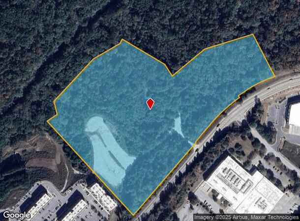
Riverside Pkwy, Lithia Springs, GA 30122


NEARBY LISTINGS FOR SALE OR LEASE
Property Detail
Riverside Pkwy
Atlanta-Sandy Springs-Roswell, GA
Pineview S/D
2015-01-6-0-001
V/PARCEL 5/ 20.561AC, TRIBUTARY COMMERCIAL PA
Commercialnec
Douglas
X
Georgia
13121C0309F
162
2024
20.56 AC
2024
Douglasville/Lithia Springs
080104
Atlanta
DEMOGRAPHICS near Riverside Pkwy
1 Mile
3 Mile
5 Mile
2024 Total Population
1,357
19,099
76,126
2029 Population
1,429
20,132
79,564
Pop Growth 2024-2029
+ 5.31%
+ 5.41%
+ 4.52%
Average Age
39
37
37
2024 Total Households
491
6,758
27,611
HH Growth 2024-2029
+ 5.50%
+ 5.56%
+ 4.50%
Median Household Inc
$121,464
$90,044
$79,336
Avg Household Size
2.80
2.80
2.70
2024 Avg HH Vehicles
2.00
2.00
2.00
Median Home Value
$333,673
$265,992
$248,897
Median Year Built
2004
2002
2000
Nearby Places
Map Layers
Map Styles
 Street
 Aerial
- Restaurants
- Banks
- Shops
- Fitness
- Groceries
PUBLIC TRANSPORTATION
AIRPORT
Hartsfield - Jackson Atlanta International
DRIVE
WALK
Distance
Hartsfield - Jackson Atlanta International
35 min
22.9 mi
Freight Ports
Georgia Ports - Savannah
DRIVE
WALK
Distance
Georgia Ports - Savannah
297 min
260.2 mi
SALE & LEASE HISTORY
LISTING DATE
SALE/LEASE

Sep 24, 2016
For Sale
Mar 02, 2018
For Sale
Nearby Properties
Address
Land Use
TOTAL SIZE
Lot Size
Zoning
Address
Land Use
TOTAL SIZE
Lot Size
Zoning
312,984 SF
19.88 AC
Address
Land Use
TOTAL SIZE
Lot Size
Zoning
1,128,400 SF
76.60 AC
AG1
Address
Land Use
TOTAL SIZE
Lot Size
Zoning
1,045,610 SF
110.63 AC
SUBA
Address
Land Use
TOTAL SIZE
Lot Size
Zoning
652,500 SF
52.87 AC
LI-R
Address
Land Use
TOTAL SIZE
Lot Size
Zoning
75,628 SF
290.39 AC
DCD
Address
Land Use
TOTAL SIZE
Lot Size
Zoning
709,289 SF
112.06 AC
DCD
Address
Land Use
TOTAL SIZE
Lot Size
Zoning
359,608 SF
29.73 AC
DCD
Address
Land Use
TOTAL SIZE
Lot Size
Zoning
799,971 SF
68.45 AC
LI-R
Address
Land Use
TOTAL SIZE
Lot Size
Zoning
728,121 SF
48.95 AC
LI
Address
Land Use
TOTAL SIZE
Lot Size
Zoning
295,590 SF
10.25 AC
MIX
Address
Land Use
TOTAL SIZE
Lot Size
Zoning
602,400 SF
30.91 AC
DCD
Address
Land Use
TOTAL SIZE
Lot Size
Zoning
340,131 SF
24.60 AC
DCD
Address
Land Use
TOTAL SIZE
Lot Size
Zoning
546,600 SF
32.19 AC
M1
Address
Land Use
TOTAL SIZE
Lot Size
Zoning
1,262,965 SF
24.15 AC
AG1
Address
Land Use
TOTAL SIZE
Lot Size
Zoning
498,420 SF
26.70 AC
M1
Address
Land Use
TOTAL SIZE
Lot Size
Zoning
453,106 SF
36.69 AC
DCD
Address
Land Use
TOTAL SIZE
Lot Size
Zoning
540,000 SF
35.76 AC
DCD
Address
Land Use
TOTAL SIZE
Lot Size
Zoning
457,703 SF
72.15 AC
DCD
Address
Land Use
TOTAL SIZE
Lot Size
Zoning
611,500 SF
37.74 AC
M2
Address
Land Use
TOTAL SIZE
Lot Size
Zoning
623,968 SF
35.87 AC
M1
Address
Land Use
TOTAL SIZE
Lot Size
Zoning
459,006 SF
21.49 AC
M1
Address
Land Use
TOTAL SIZE
Lot Size
Zoning
314,792 SF
51.29 AC
DCD
Address
Land Use
TOTAL SIZE
Lot Size
Zoning
500,400 SF
41.39 AC
M2
Address
Land Use
TOTAL SIZE
Lot Size
Zoning
448,314 SF
32.13 AC
DCD
Address
Land Use
TOTAL SIZE
Lot Size
Zoning
592,677 SF
27.63 AC
MIA
Address
Land Use
TOTAL SIZE
Lot Size
Zoning
283,585 SF
22.75 AC
LI
Address
Land Use
TOTAL SIZE
Lot Size
Zoning
310,689 SF
36.51 AC
LI
Address
Land Use
TOTAL SIZE
Lot Size
Zoning
477,317 SF
37 AC
M1
Address
Land Use
TOTAL SIZE
Lot Size
Zoning
545,000 SF
31.57 AC
M1A
The World's #1 Commercial Real Estate Marketplace
Connect with us
© 2026 CoStar Group
The information above has been obtained from sources believed reliable. While we do not doubt its accuracy we have not verified it and make no guarantee, warranty or representation about it. It is your responsibility to independently confirm its accuracy and completeness. Any projections, opinions, assumptions, or estimates used are for example only and do not represent the current or future performance of the property. The value of this transaction to you depends on tax and other factors which should be evaluated by your tax, financial, and legal advisors. You and your advisors should conduct a careful, independent investigation of the property to determine to your satisfaction the suitability of the property for your needs.