Property Record
Riverside Pkwy, Villa Rica, GA 30180

NEARBY LISTINGS FOR SALE OR LEASE
Property Detail
Riverside Pkwy
Atlanta-Sandy Springs-Roswell, GA
Pineview S/D
9015-01-6-0-004
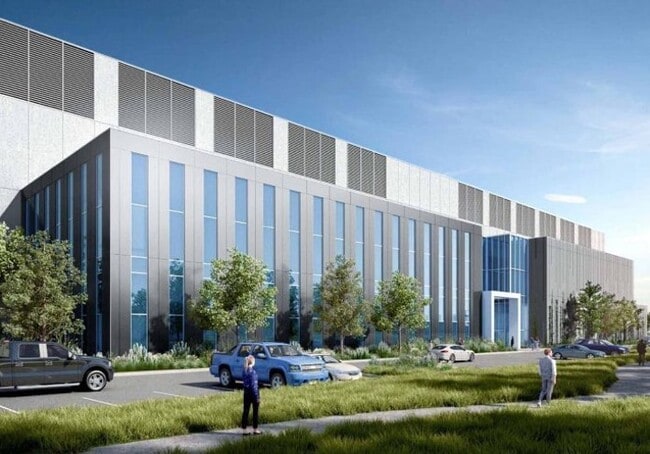
V/95.052 ACRES, RIVERSIDE PKWY
Industrialacreage
Douglas
AE
Georgia
13121C0328F
95.05 AC
2024
I-20 W/Douglasville
2024
Atlanta
910101
DEMOGRAPHICS near Riverside Pkwy
1 Mile
3 Mile
5 Mile
2024 Total Population
664
20,321
73,461
2029 Population
697
21,302
76,333
Pop Growth 2024-2029
+ 4.97%
+ 4.83%
+ 3.91%
Average Age
40
37
38
2024 Total Households
241
7,190
26,465
HH Growth 2024-2029
+ 4.98%
+ 4.98%
+ 3.83%
Median Household Inc
$121,499
$101,629
$81,905
Avg Household Size
2.80
2.80
2.70
2024 Avg HH Vehicles
2.00
2.00
2.00
Median Home Value
$331,818
$281,190
$256,432
Median Year Built
2004
2004
2001
Nearby Places
Map Layers
Map Styles
 Street
 Aerial
- Restaurants
- Banks
- Shops
- Fitness
- Groceries
PUBLIC TRANSPORTATION
AIRPORT
Hartsfield - Jackson Atlanta International
DRIVE
WALK
Distance
Hartsfield - Jackson Atlanta International
35 min
22.2 mi
Freight Ports
Georgia Ports - Savannah
DRIVE
WALK
Distance
Georgia Ports - Savannah
297 min
259.5 mi
SALE & LEASE HISTORY
LISTING DATE
SALE/LEASE

Aug 22, 2024
For Lease
Nearby Properties
Address
Land Use
TOTAL SIZE
Lot Size
Zoning
Address
Land Use
TOTAL SIZE
Lot Size
Zoning
312,984 SF
19.88 AC
Address
Land Use
TOTAL SIZE
Lot Size
Zoning
1,128,400 SF
76.60 AC
AG1
Address
Land Use
TOTAL SIZE
Lot Size
Zoning
1,045,610 SF
110.63 AC
SUBA
Address
Land Use
TOTAL SIZE
Lot Size
Zoning
652,500 SF
52.87 AC
LI-R
Address
Land Use
TOTAL SIZE
Lot Size
Zoning
75,628 SF
290.39 AC
DCD
Address
Land Use
TOTAL SIZE
Lot Size
Zoning
709,289 SF
112.06 AC
DCD
Address
Land Use
TOTAL SIZE
Lot Size
Zoning
359,608 SF
29.73 AC
DCD
Address
Land Use
TOTAL SIZE
Lot Size
Zoning
799,971 SF
68.45 AC
LI-R
Address
Land Use
TOTAL SIZE
Lot Size
Zoning
728,121 SF
48.95 AC
LI
Address
Land Use
TOTAL SIZE
Lot Size
Zoning
295,590 SF
10.25 AC
MIX
Address
Land Use
TOTAL SIZE
Lot Size
Zoning
602,400 SF
30.91 AC
DCD
Address
Land Use
TOTAL SIZE
Lot Size
Zoning
205,390 SF
24.28 AC
Address
Land Use
TOTAL SIZE
Lot Size
Zoning
340,131 SF
24.60 AC
DCD
Address
Land Use
TOTAL SIZE
Lot Size
Zoning
546,600 SF
32.19 AC
M1
Address
Land Use
TOTAL SIZE
Lot Size
Zoning
1,262,965 SF
24.15 AC
AG1
Address
Land Use
TOTAL SIZE
Lot Size
Zoning
498,420 SF
26.70 AC
M1
Address
Land Use
TOTAL SIZE
Lot Size
Zoning
453,106 SF
36.69 AC
DCD
Address
Land Use
TOTAL SIZE
Lot Size
Zoning
540,000 SF
35.76 AC
DCD
Address
Land Use
TOTAL SIZE
Lot Size
Zoning
457,703 SF
72.15 AC
DCD
Address
Land Use
TOTAL SIZE
Lot Size
Zoning
611,500 SF
37.74 AC
M2
Address
Land Use
TOTAL SIZE
Lot Size
Zoning
623,968 SF
35.87 AC
M1
Address
Land Use
TOTAL SIZE
Lot Size
Zoning
459,006 SF
21.49 AC
M1
Address
Land Use
TOTAL SIZE
Lot Size
Zoning
314,792 SF
51.29 AC
DCD
Address
Land Use
TOTAL SIZE
Lot Size
Zoning
279,840 SF
44 AC
DCD
Address
Land Use
TOTAL SIZE
Lot Size
Zoning
500,400 SF
41.39 AC
M2
Address
Land Use
TOTAL SIZE
Lot Size
Zoning
448,314 SF
32.13 AC
DCD
Address
Land Use
TOTAL SIZE
Lot Size
Zoning
592,677 SF
27.63 AC
MIA
Address
Land Use
TOTAL SIZE
Lot Size
Zoning
1,333,625 SF
15.28 AC
A1
Address
Land Use
TOTAL SIZE
Lot Size
Zoning
283,585 SF
22.75 AC
LI
The World's #1 Commercial Real Estate Marketplace
Connect with us
© 2026 CoStar Group
The information above has been obtained from sources believed reliable. While we do not doubt its accuracy we have not verified it and make no guarantee, warranty or representation about it. It is your responsibility to independently confirm its accuracy and completeness. Any projections, opinions, assumptions, or estimates used are for example only and do not represent the current or future performance of the property. The value of this transaction to you depends on tax and other factors which should be evaluated by your tax, financial, and legal advisors. You and your advisors should conduct a careful, independent investigation of the property to determine to your satisfaction the suitability of the property for your needs.