Property Record
Riverside Rd, Lancaster, SC 29720


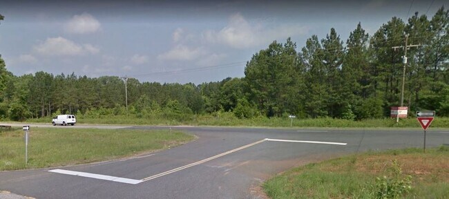
This Property Is For Sale
Property Detail
Riverside Rd
0066-00-025.00
LANCASTER
Agriculturalland
South Carolina
LI
482.90 AC
B and X Area of moderate flood hazard, usually the area between the limits of the 100-year and 500-year floods.
Lancaster County
2024
Charlotte
2025
Charlotte-Concord-Gastonia, NC-SC
011002
NEARBY LISTINGS FOR SALE OR LEASE
-
-
View all Lancaster listings for sale on LoopNet.com
DEMOGRAPHICS near Riverside Rd
1 mile
3 mile
5 mile
2025 Total Population
634
7,370
24,680
2030 Population
721
8,268
27,609
Pop Growth 2025-2030
+ 13.72%
+ 12.18%
+ 11.87%
Average Age
41
41
41
2025 Total Households
261
2,994
10,083
HH Growth 2025-2030
+ 13.79%
+ 12.42%
+ 12.07%
Median Household Inc
$39,761
$48,977
$46,328
Avg Household Size
2.50
2.40
2.40
2025 Avg HH Vehicles
2.00
2.00
2.00
Median Home Value
$282,050
$232,669
$205,892
Median Year Built
1990
1978
1977
Nearby Places
Map Layers
Map Styles
 Street
 Aerial
Layers
 Traffic
 Biking
Places
Listings with unknown addresses are not visible on the map
- Restaurants
- Banks
- Shops
- Fitness
- Groceries
Nearby Properties
Address
Land Use
TOTAL SIZE
Lot Size
Zoning
Address
Land Use
TOTAL SIZE
Lot Size
Zoning
38,652 SF
83.76 AC
CITY
Address
Land Use
TOTAL SIZE
Lot Size
Zoning
17,808 SF
51.99 AC
LI
Address
Land Use
TOTAL SIZE
Lot Size
Zoning
329,748 SF
20 AC
CITY
Address
Land Use
TOTAL SIZE
Lot Size
Zoning
3,249 SF
300.75 AC
INS
Address
Land Use
TOTAL SIZE
Lot Size
Zoning
469.30 AC
RN
Address
Land Use
TOTAL SIZE
Lot Size
Zoning
228.68 AC
OSP
Address
Land Use
TOTAL SIZE
Lot Size
Zoning
6,750 SF
4.08 AC
INS
Address
Land Use
TOTAL SIZE
Lot Size
Zoning
87.44 AC
INS
Address
Land Use
TOTAL SIZE
Lot Size
Zoning
50,800 SF
2.90 AC
CITY
Address
Land Use
TOTAL SIZE
Lot Size
Zoning
2,384 SF
2.49 AC
PB
Address
Land Use
TOTAL SIZE
Lot Size
Zoning
4,800 SF
0.71 AC
CITY
Address
Land Use
TOTAL SIZE
Lot Size
Zoning
4,396 SF
0.98 AC
NB
Address
Land Use
TOTAL SIZE
Lot Size
Zoning
7,764 SF
11.63 AC
MDR
Address
Land Use
TOTAL SIZE
Lot Size
Zoning
6,375 SF
214 AC
CITY
Address
Land Use
TOTAL SIZE
Lot Size
Zoning
33,745 SF
5.59 AC
LI
Address
Land Use
TOTAL SIZE
Lot Size
Zoning
3,392 SF
6.79 AC
CITY
Address
Land Use
TOTAL SIZE
Lot Size
Zoning
5,294 SF
1.21 AC
PB
Address
Land Use
TOTAL SIZE
Lot Size
Zoning
8,272 SF
3.85 AC
CITY
Address
Land Use
TOTAL SIZE
Lot Size
Zoning
105,057 SF
13.54 AC
CITY
Address
Land Use
TOTAL SIZE
Lot Size
Zoning
34,680 SF
6.79 AC
Address
Land Use
TOTAL SIZE
Lot Size
Zoning
6,592 SF
2.35 AC
INS
Address
Land Use
TOTAL SIZE
Lot Size
Zoning
1,604 SF
6.19 AC
GB
Address
Land Use
TOTAL SIZE
Lot Size
Zoning
2,360 SF
22.70 AC
CITY
Address
Land Use
TOTAL SIZE
Lot Size
Zoning
14,820 SF
2.26 AC
CITY
Address
Land Use
TOTAL SIZE
Lot Size
Zoning
4,550 SF
1.04 AC
GB
Address
Land Use
TOTAL SIZE
Lot Size
Zoning
143,480 SF
15.46 AC
Address
Land Use
TOTAL SIZE
Lot Size
Zoning
87,383 SF
10.34 AC
CITY
Address
Land Use
TOTAL SIZE
Lot Size
Zoning
60.80 AC
LI
Address
Land Use
TOTAL SIZE
Lot Size
Zoning
4,580 SF
6.24 AC
LDR
Address
Land Use
TOTAL SIZE
Lot Size
Zoning
1,271 SF
1.60 AC
RN
The World's #1 Commercial Real Estate Marketplace
Connect with us
© 2026 CoStar Group
The information above has been obtained from sources believed reliable. While we do not doubt its accuracy we have not verified it and make no guarantee, warranty or representation about it. It is your responsibility to independently confirm its accuracy and completeness. Any projections, opinions, assumptions, or estimates used are for example only and do not represent the current or future performance of the property. The value of this transaction to you depends on tax and other factors which should be evaluated by your tax, financial, and legal advisors. You and your advisors should conduct a careful, independent investigation of the property to determine to your satisfaction the suitability of the property for your needs.