Property Record
Roane St, Harriman, TN 37748


NEARBY LISTINGS FOR SALE OR LEASE
Property Detail
Roane St
036H-C-001.01
DISTRICT: 1
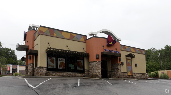
Restaurantdrivein
Roane
X
Tennessee
47145C0087F
0.48 AC
0
Knoxville Area
2025
Other Market Areas
030700
Knoxville, TN
2,442 SF
DEMOGRAPHICS near Roane St
1 Mile
3 Mile
5 Mile
2024 Total Population
1,264
7,403
17,760
2029 Population
1,363
8,011
19,103
Pop Growth 2024-2029
+ 7.83%
+ 8.21%
+ 7.56%
Average Age
42
43
44
2024 Total Households
535
3,193
7,496
HH Growth 2024-2029
+ 7.66%
+ 8.27%
+ 7.59%
Median Household Inc
$43,175
$40,207
$48,784
Avg Household Size
2.40
2.30
2.30
2024 Avg HH Vehicles
2.00
2.00
2.00
Median Home Value
$140,566
$136,585
$152,161
Median Year Built
1967
1969
1972
Nearby Places
Map Layers
Map Styles
 Street
 Aerial
- Restaurants
- Banks
- Shops
- Fitness
- Groceries
Nearby Properties
Address
Land Use
TOTAL SIZE
Lot Size
Zoning
Address
Land Use
TOTAL SIZE
Lot Size
Zoning
142,926 SF
18.42 AC
Address
Land Use
TOTAL SIZE
Lot Size
Zoning
33,263 SF
5.90 AC
Address
Land Use
TOTAL SIZE
Lot Size
Zoning
18,090 SF
0.28 AC
Address
Land Use
TOTAL SIZE
Lot Size
Zoning
43,389 SF
3.11 AC
Address
Land Use
TOTAL SIZE
Lot Size
Zoning
78,950 SF
7.24 AC
Address
Land Use
TOTAL SIZE
Lot Size
Zoning
19,440 SF
0.92 AC
Address
Land Use
TOTAL SIZE
Lot Size
Zoning
44,402 SF
4.63 AC
Address
Land Use
TOTAL SIZE
Lot Size
Zoning
131,903 SF
9.66 AC
Address
Land Use
TOTAL SIZE
Lot Size
Zoning
32,750 SF
1.74 AC
Address
Land Use
TOTAL SIZE
Lot Size
Zoning
42,834 SF
1.83 AC
Address
Land Use
TOTAL SIZE
Lot Size
Zoning
37,419 SF
1.80 AC
Address
Land Use
TOTAL SIZE
Lot Size
Zoning
39,282 SF
7.60 AC
Address
Land Use
TOTAL SIZE
Lot Size
Zoning
7,160 SF
15.39 AC
Address
Land Use
TOTAL SIZE
Lot Size
Zoning
15,352 SF
2.32 AC
Address
Land Use
TOTAL SIZE
Lot Size
Zoning
20.90 AC
Address
Land Use
TOTAL SIZE
Lot Size
Zoning
76,679 SF
7.23 AC
Address
Land Use
TOTAL SIZE
Lot Size
Zoning
35,792 SF
3.10 AC
C2
Address
Land Use
TOTAL SIZE
Lot Size
Zoning
36,688 SF
62.80 AC
Address
Land Use
TOTAL SIZE
Lot Size
Zoning
14,400 SF
1.84 AC
Address
Land Use
TOTAL SIZE
Lot Size
Zoning
8,014 SF
1.70 AC
Address
Land Use
TOTAL SIZE
Lot Size
Zoning
31,566 SF
19.29 AC
C3
Address
Land Use
TOTAL SIZE
Lot Size
Zoning
1,245 AC
Address
Land Use
TOTAL SIZE
Lot Size
Zoning
9,636 SF
1.51 AC
Address
Land Use
TOTAL SIZE
Lot Size
Zoning
6,318 SF
1.39 AC
Address
Land Use
TOTAL SIZE
Lot Size
Zoning
13,405 SF
2.52 AC
Address
Land Use
TOTAL SIZE
Lot Size
Zoning
2,450 SF
6.66 AC
Address
Land Use
TOTAL SIZE
Lot Size
Zoning
3,957 SF
1.09 AC
Address
Land Use
TOTAL SIZE
Lot Size
Zoning
14,386 SF
1.29 AC
Address
Land Use
TOTAL SIZE
Lot Size
Zoning
4,542 SF
1.65 AC
Address
Land Use
TOTAL SIZE
Lot Size
Zoning
9,718 SF
1.23 AC
The World's #1 Commercial Real Estate Marketplace
Connect with us
© 2026 CoStar Group
The information above has been obtained from sources believed reliable. While we do not doubt its accuracy we have not verified it and make no guarantee, warranty or representation about it. It is your responsibility to independently confirm its accuracy and completeness. Any projections, opinions, assumptions, or estimates used are for example only and do not represent the current or future performance of the property. The value of this transaction to you depends on tax and other factors which should be evaluated by your tax, financial, and legal advisors. You and your advisors should conduct a careful, independent investigation of the property to determine to your satisfaction the suitability of the property for your needs.