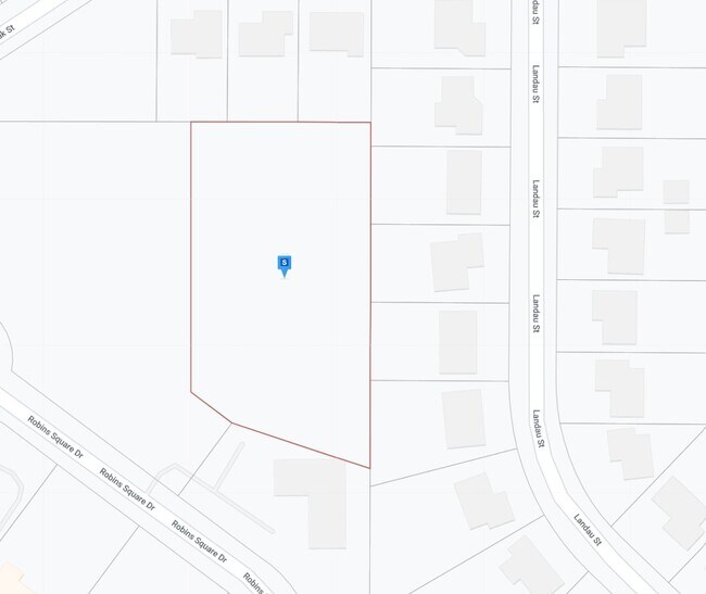
Property Record
Robins Square Dr, Robins, IA 52328
Property Detail
Robins Square Dr
Cedar Rapids, IA
ROBINS SQUARE LOT 4
11223-28002-00000
LINN
Commercialnec
Iowa
B and X Area of moderate flood hazard, usually the area between the limits of the 100-year and 500-year floods.
4
2024
3.31 AC
2025
Iowa City/Waterloo
000210
Other Market Areas
NEARBY LISTINGS FOR SALE OR LEASE
DEMOGRAPHICS near Robins Square Dr
1 mile
3 mile
5 mile
2025 Total Population
3,803
34,535
92,931
2030 Population
3,845
35,340
94,085
Pop Growth 2025-2030
+ 1.10%
+ 2.33%
+ 1.24%
Average Age
42
39
41
2025 Total Households
1,356
13,517
38,774
HH Growth 2025-2030
+ 1.18%
+ 2.40%
+ 1.23%
Median Household Inc
$129,552
$93,667
$79,494
Avg Household Size
2.80
2.50
2.30
2025 Avg HH Vehicles
2.00
2.00
2.00
Median Home Value
$306,039
$277,524
$244,837
Median Year Built
1999
1994
1981
Nearby Places
Map Layers
Map Styles
 Street
 Aerial
Transit
 Traffic
 Biking
Places
Listings with unknown addresses are not visible on the map
- Restaurants
- Banks
- Shops
- Fitness
- Groceries
PUBLIC TRANSPORTATION
AIRPORT
The Eastern Iowa
Drive
Walk
Distance
The Eastern Iowa
29 min
17.3 mi
Freight Ports
Port Milwaukee
Drive
Walk
Distance
Port Milwaukee
293 min
243.1 mi
Nearby Properties
Address
Land Use
TOTAL SIZE
Lot Size
Zoning
Address
Land Use
TOTAL SIZE
Lot Size
Zoning
185,414 SF
40.86 AC
Address
Land Use
TOTAL SIZE
Lot Size
Zoning
743,324 SF
248.76 AC
Address
Land Use
TOTAL SIZE
Lot Size
Zoning
160,822 SF
23.06 AC
Address
Land Use
TOTAL SIZE
Lot Size
Zoning
289,580 SF
280.20 AC
Address
Land Use
TOTAL SIZE
Lot Size
Zoning
1,156,491 SF
137 AC
Address
Land Use
TOTAL SIZE
Lot Size
Zoning
393,375 SF
100.66 AC
Address
Land Use
TOTAL SIZE
Lot Size
Zoning
406,933 SF
61.58 AC
Address
Land Use
TOTAL SIZE
Lot Size
Zoning
596,745 SF
325.50 AC
Address
Land Use
TOTAL SIZE
Lot Size
Zoning
34,710 SF
3.30 AC
Address
Land Use
TOTAL SIZE
Lot Size
Zoning
69,683 SF
24.78 AC
Address
Land Use
TOTAL SIZE
Lot Size
Zoning
155,200 SF
32.40 AC
Address
Land Use
TOTAL SIZE
Lot Size
Zoning
149,826 SF
45 AC
Address
Land Use
TOTAL SIZE
Lot Size
Zoning
44,972 SF
7.03 AC
Address
Land Use
TOTAL SIZE
Lot Size
Zoning
72,227 SF
18.86 AC
Address
Land Use
TOTAL SIZE
Lot Size
Zoning
90,345 SF
40 AC
Address
Land Use
TOTAL SIZE
Lot Size
Zoning
225,076 SF
17.04 AC
Address
Land Use
TOTAL SIZE
Lot Size
Zoning
70,158 SF
3.76 AC
Address
Land Use
TOTAL SIZE
Lot Size
Zoning
173,941 SF
15.45 AC
Address
Land Use
TOTAL SIZE
Lot Size
Zoning
44,544 SF
7.11 AC
Address
Land Use
TOTAL SIZE
Lot Size
Zoning
60,616 SF
8.40 AC
Address
Land Use
TOTAL SIZE
Lot Size
Zoning
61,505 SF
28.08 AC
Address
Land Use
TOTAL SIZE
Lot Size
Zoning
2,041,280 SF
99 AC
Address
Land Use
TOTAL SIZE
Lot Size
Zoning
36,328 SF
4.40 AC
Address
Land Use
TOTAL SIZE
Lot Size
Zoning
98,080 SF
8.09 AC
Address
Land Use
TOTAL SIZE
Lot Size
Zoning
23,800 SF
65.76 AC
Address
Land Use
TOTAL SIZE
Lot Size
Zoning
204,266 SF
17.97 AC
Address
Land Use
TOTAL SIZE
Lot Size
Zoning
130,752 SF
26.02 AC
Address
Land Use
TOTAL SIZE
Lot Size
Zoning
40,936 SF
4.65 AC
Address
Land Use
TOTAL SIZE
Lot Size
Zoning
54,096 SF
13.95 AC
Address
Land Use
TOTAL SIZE
Lot Size
Zoning
7,852 SF
30.03 AC
The World's #1 Commercial Real Estate Marketplace
Connect with us
© 2026 CoStar Group
The information above has been obtained from sources believed reliable. While we do not doubt its accuracy we have not verified it and make no guarantee, warranty or representation about it. It is your responsibility to independently confirm its accuracy and completeness. Any projections, opinions, assumptions, or estimates used are for example only and do not represent the current or future performance of the property. The value of this transaction to you depends on tax and other factors which should be evaluated by your tax, financial, and legal advisors. You and your advisors should conduct a careful, independent investigation of the property to determine to your satisfaction the suitability of the property for your needs.