No Photo
Property Record
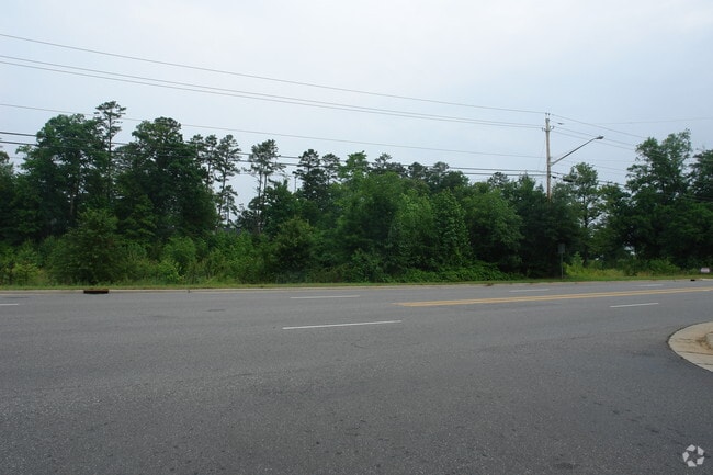
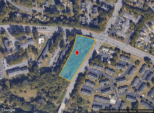
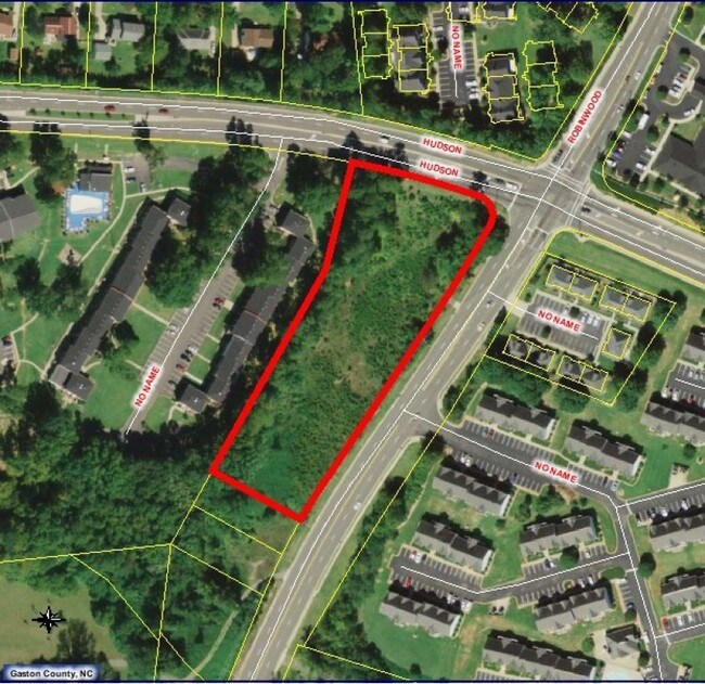
Robinwood Rd, Gastonia, NC 28054
NEARBY LISTINGS FOR SALE OR LEASE
Property Detail
Robinwood Rd
Charlotte-Concord-Gastonia, NC-SC
Vp Ventures Llc
115004
PB 004 257 BLK 00 L 00 01 099 052 00 000
Commercialnec
Gaston
X
North Carolina
3710355400J
2.68 AC
2025
Gaston County
2025
Charlotte
032703
DEMOGRAPHICS near Robinwood Rd
1 mile
3 mile
5 mile
2024 Total Population
8,636
54,696
109,940
2029 Population
9,168
58,243
117,336
Pop Growth 2024-2029
+ 6.16%
+ 6.48%
+ 6.73%
Average Age
42
41
40
2024 Total Households
3,570
22,258
43,857
HH Growth 2024-2029
+ 6.41%
+ 6.64%
+ 6.91%
Median Household Inc
$57,734
$56,531
$52,884
Avg Household Size
2.20
2.30
2.40
2024 Avg HH Vehicles
2.00
2.00
2.00
Median Home Value
$220,254
$228,435
$203,322
Median Year Built
1992
1980
1978
Nearby Places
Map Layers
Map Styles
 Street
 Aerial
Transit
 Traffic
 Biking
Places
Listings with unknown addresses are not visible on the map
- Restaurants
- Banks
- Shops
- Fitness
- Groceries
PUBLIC TRANSPORTATION
COMMUTER RAIL
Drive
Walk
Distance
8 min
3.2 mi
AIRPORT
Charlotte/Douglas International
Drive
Walk
Distance
Charlotte/Douglas International
31 min
16.6 mi
Concord-Padgett Regional
Drive
Walk
Distance
Concord-Padgett Regional
45 min
32.9 mi
SALE & LEASE HISTORY
LISTING DATE
SALE/LEASE

Sep 24, 2016
For Sale
Nearby Properties
Address
Land Use
TOTAL SIZE
Lot Size
Zoning
Address
Land Use
TOTAL SIZE
Lot Size
Zoning
104.72 AC
Address
Land Use
TOTAL SIZE
Lot Size
Zoning
56,000 SF
23.22 AC
GOV01
Address
Land Use
TOTAL SIZE
Lot Size
Zoning
54.70 AC
Address
Land Use
TOTAL SIZE
Lot Size
Zoning
47,625 SF
39.10 AC
SHOP2
Address
Land Use
TOTAL SIZE
Lot Size
Zoning
3,026 SF
32.14 AC
HCAR3
Address
Land Use
TOTAL SIZE
Lot Size
Zoning
7,880 SF
18.35 AC
R1
Address
Land Use
TOTAL SIZE
Lot Size
Zoning
159,263 SF
9.83 AC
GOV01
Address
Land Use
TOTAL SIZE
Lot Size
Zoning
Address
Land Use
TOTAL SIZE
Lot Size
Zoning
28.04 AC
Address
Land Use
TOTAL SIZE
Lot Size
Zoning
30,000 SF
18.87 AC
SHOP2
Address
Land Use
TOTAL SIZE
Lot Size
Zoning
2,066 SF
16.10 AC
Address
Land Use
TOTAL SIZE
Lot Size
Zoning
5,200 SF
22.98 AC
OFF01
Address
Land Use
TOTAL SIZE
Lot Size
Zoning
8,040 SF
18.44 AC
APT01
Address
Land Use
TOTAL SIZE
Lot Size
Zoning
3,120 SF
15.05 AC
OFF01
Address
Land Use
TOTAL SIZE
Lot Size
Zoning
1,886 SF
13.27 AC
APT01
Address
Land Use
TOTAL SIZE
Lot Size
Zoning
1,974 SF
15.50 AC
APT01
Address
Land Use
TOTAL SIZE
Lot Size
Zoning
9,792 SF
14.31 AC
APT01
Address
Land Use
TOTAL SIZE
Lot Size
Zoning
8,960 SF
12.67 AC
Address
Land Use
TOTAL SIZE
Lot Size
Zoning
103,890 SF
8.81 AC
OFF04
Address
Land Use
TOTAL SIZE
Lot Size
Zoning
20.41 AC
Address
Land Use
TOTAL SIZE
Lot Size
Zoning
4,568 SF
24.69 AC
PUB01
Address
Land Use
TOTAL SIZE
Lot Size
Zoning
1,680 SF
19.08 AC
OFF01
Address
Land Use
TOTAL SIZE
Lot Size
Zoning
Address
Land Use
TOTAL SIZE
Lot Size
Zoning
1,868 SF
15.93 AC
OFF01
Address
Land Use
TOTAL SIZE
Lot Size
Zoning
5,120 SF
9.42 AC
Address
Land Use
TOTAL SIZE
Lot Size
Zoning
18,803 SF
9.57 AC
SHOP3
Address
Land Use
TOTAL SIZE
Lot Size
Zoning
33,258 SF
5.51 AC
Address
Land Use
TOTAL SIZE
Lot Size
Zoning
198,897 SF
10.89 AC
RET05
Address
Land Use
TOTAL SIZE
Lot Size
Zoning
1,170 SF
320.29 AC
OFF01
Address
Land Use
TOTAL SIZE
Lot Size
Zoning
22.85 AC
The World's #1 Commercial Real Estate Marketplace
Connect with us
© 2026 CoStar Group
The information above has been obtained from sources believed reliable. While we do not doubt its accuracy we have not verified it and make no guarantee, warranty or representation about it. It is your responsibility to independently confirm its accuracy and completeness. Any projections, opinions, assumptions, or estimates used are for example only and do not represent the current or future performance of the property. The value of this transaction to you depends on tax and other factors which should be evaluated by your tax, financial, and legal advisors. You and your advisors should conduct a careful, independent investigation of the property to determine to your satisfaction the suitability of the property for your needs.