Property Record
Rockaway Beach Blvd, Far Rockaway, NY 11691
NEARBY LISTINGS FOR SALE OR LEASE
Property Detail
Rockaway Beach Blvd
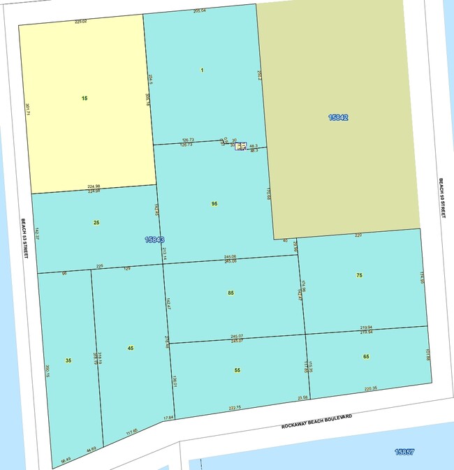
15843-0065
Queens
Commercialnec
New York
X
35
36059C0282G
0.55 AC
2024
South Queens
2025
Long Island (New York)
099801
New York-Jersey City-White Plains, NY-NJ
DEMOGRAPHICS near Rockaway Beach Blvd
1 Mile
3 Mile
5 Mile
2024 Total Population
29,532
115,197
199,397
2029 Population
27,434
108,652
188,930
Pop Growth 2024-2029
(7.10%)
(5.68%)
(5.25%)
Average Age
38
39
40
2024 Total Households
9,620
39,577
66,668
HH Growth 2024-2029
(7.55%)
(5.71%)
(5.38%)
Median Household Inc
$45,926
$54,070
$75,438
Avg Household Size
2.80
2.70
2.80
2024 Avg HH Vehicles
1.00
1.00
1.00
Median Home Value
$591,436
$612,816
$713,309
Median Year Built
1972
1965
1961
Nearby Places
- Restaurants
- Banks
- Shops
- Fitness
- Groceries
PUBLIC TRANSPORTATION
TRANSIT/SUBWAY
Beach 44 Street (A - New York MTA Subway (The Subway))
DRIVE
WALK
Distance
Beach 44 Street (A - New York MTA Subway (The Subway))
1 min
6 min
0.3 mi
Beach 60 Street (A - New York MTA Subway (The Subway))
DRIVE
WALK
Distance
Beach 60 Street (A - New York MTA Subway (The Subway))
1 min
7 min
0.4 mi
Beach 36 Street (A - New York MTA Subway (The Subway))
DRIVE
WALK
Distance
Beach 36 Street (A - New York MTA Subway (The Subway))
2 min
14 min
0.8 mi
Beach 67 Street (A - New York MTA Subway (The Subway))
DRIVE
WALK
Distance
Beach 67 Street (A - New York MTA Subway (The Subway))
2 min
17 min
0.9 mi
COMMUTER RAIL
Far Rockaway Station (Far Rockaway Branch - Long Island Rail Road)
DRIVE
WALK
Distance
Far Rockaway Station (Far Rockaway Branch - Long Island Rail Road)
6 min
2.2 mi
Inwood Station (Far Rockaway Branch - Long Island Rail Road)
DRIVE
WALK
Distance
Inwood Station (Far Rockaway Branch - Long Island Rail Road)
7 min
3.5 mi
AIRPORT
John F Kennedy International
DRIVE
WALK
Distance
John F Kennedy International
23 min
12.2 mi
LaGuardia
DRIVE
WALK
Distance
LaGuardia
33 min
17.9 mi
Newark Liberty International
DRIVE
WALK
Distance
Newark Liberty International
59 min
37.7 mi
Freight Ports
NY - Red Hook Container Terminal
DRIVE
WALK
Distance
NY - Red Hook Container Terminal
37 min
18.4 mi
Nearby Properties
Address
Land Use
TOTAL SIZE
Lot Size
Zoning
Address
Land Use
TOTAL SIZE
Lot Size
Zoning
229.51 AC
PARKUS
Address
Land Use
TOTAL SIZE
Lot Size
Zoning
111.98 AC
PARK
Address
Land Use
TOTAL SIZE
Lot Size
Zoning
72,663 SF
264.48 AC
PARK
Address
Land Use
TOTAL SIZE
Lot Size
Zoning
200.83 AC
PARK
Address
Land Use
TOTAL SIZE
Lot Size
Zoning
42.84 AC
PARK
Address
Land Use
TOTAL SIZE
Lot Size
Zoning
169.01 AC
PARK
Address
Land Use
TOTAL SIZE
Lot Size
Zoning
1,085,148 SF
13.53 AC
R6
Address
Land Use
TOTAL SIZE
Lot Size
Zoning
407,218 SF
34.48 AC
R4
Address
Land Use
TOTAL SIZE
Lot Size
Zoning
52.80 AC
PARK
Address
Land Use
TOTAL SIZE
Lot Size
Zoning
32.47 AC
PARK
Address
Land Use
TOTAL SIZE
Lot Size
Zoning
188,656 SF
5.78 AC
R5
Address
Land Use
TOTAL SIZE
Lot Size
Zoning
820,910 SF
21.03 AC
R4
Address
Land Use
TOTAL SIZE
Lot Size
Zoning
188.92 AC
PARK
Address
Land Use
TOTAL SIZE
Lot Size
Zoning
17.68 AC
PARK
Address
Land Use
TOTAL SIZE
Lot Size
Zoning
661,319 SF
50.43 AC
R5
Address
Land Use
TOTAL SIZE
Lot Size
Zoning
587,170 SF
13.55 AC
R4
Address
Land Use
TOTAL SIZE
Lot Size
Zoning
14.91 AC
C4-4
Address
Land Use
TOTAL SIZE
Lot Size
Zoning
154,051 SF
4.05 AC
R5
Address
Land Use
TOTAL SIZE
Lot Size
Zoning
119,788 SF
3.90 AC
R5
Address
Land Use
TOTAL SIZE
Lot Size
Zoning
72,148 SF
0.44 AC
R6A
Address
Land Use
TOTAL SIZE
Lot Size
Zoning
449,000 SF
5.15 AC
R6
Address
Land Use
TOTAL SIZE
Lot Size
Zoning
128,000 SF
2.52 AC
R5
Address
Land Use
TOTAL SIZE
Lot Size
Zoning
666,256 SF
14.16 AC
R6
Address
Land Use
TOTAL SIZE
Lot Size
Zoning
155,875 SF
0.90 AC
R6
Address
Land Use
TOTAL SIZE
Lot Size
Zoning
145,883 SF
1.29 AC
R6
Address
Land Use
TOTAL SIZE
Lot Size
Zoning
3,120 SF
20.62 AC
PARK
Address
Land Use
TOTAL SIZE
Lot Size
Zoning
120,994 SF
1.71 AC
R6
Address
Land Use
TOTAL SIZE
Lot Size
Zoning
6,077 SF
19.66 AC
PARK
Address
Land Use
TOTAL SIZE
Lot Size
Zoning
358,140 SF
8.13 AC
R5
Address
Land Use
TOTAL SIZE
Lot Size
Zoning
16.49 AC
PARK
The World's #1 Commercial Real Estate Marketplace
Connect with us
© 2025 CoStar Group
The information above has been obtained from sources believed reliable. While we do not doubt its accuracy we have not verified it and make no guarantee, warranty or representation about it. It is your responsibility to independently confirm its accuracy and completeness. Any projections, opinions, assumptions, or estimates used are for example only and do not represent the current or future performance of the property. The value of this transaction to you depends on tax and other factors which should be evaluated by your tax, financial, and legal advisors. You and your advisors should conduct a careful, independent investigation of the property to determine to your satisfaction the suitability of the property for your needs.