Property Record
Rockside Rd, Valley View, OH 44125

NEARBY LISTINGS FOR SALE OR LEASE
Property Detail
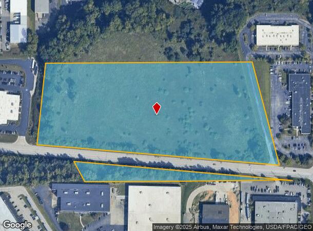
Rockside Rd
Cleveland-Elyria, OH
Independence 03
572-04-001
OL 10 S/L 1197 FF 1194.8 D 890.3 22.28 AC 2005 S/R
Industrialacreage
Cuyahoga
X
Ohio
39035C0213E
1197
2024
22.28 AC
2024
South
192900
Cleveland
DEMOGRAPHICS near Rockside Rd
1 Mile
3 Mile
5 Mile
2024 Total Population
726
50,570
180,851
2029 Population
709
49,107
175,971
Pop Growth 2024-2029
(2.34%)
(2.89%)
(2.70%)
Average Age
45
42
42
2024 Total Households
283
20,854
76,903
HH Growth 2024-2029
(2.47%)
(2.99%)
(2.89%)
Median Household Inc
$73,437
$58,095
$51,630
Avg Household Size
2.60
2.30
2.30
2024 Avg HH Vehicles
2.00
2.00
2.00
Median Home Value
$221,195
$119,416
$122,796
Median Year Built
1960
1956
1954
Nearby Places
Map Layers
Map Styles
 Street
 Aerial
- Restaurants
- Banks
- Shops
- Fitness
- Groceries
PUBLIC TRANSPORTATION
COMMUTER RAIL
Rockside (National Park Scenic Railway - Cuyahoga Valley Scenic Railroad)
DRIVE
WALK
Distance
Rockside (National Park Scenic Railway - Cuyahoga Valley Scenic Railroad)
2 min
14 min
0.7 mi
Canal Exploration Center (National Park Scenic Railway - Cuyahoga Valley Scenic Railroad)
DRIVE
WALK
Distance
Canal Exploration Center (National Park Scenic Railway - Cuyahoga Valley Scenic Railroad)
5 min
2.3 mi
AIRPORT
Cleveland-Hopkins International
DRIVE
WALK
Distance
Cleveland-Hopkins International
24 min
14.2 mi
Freight Ports
Port of Toledo
DRIVE
WALK
Distance
Port of Toledo
138 min
115.1 mi
SALE & LEASE HISTORY
LISTING DATE
SALE/LEASE

Sep 24, 2016
For Sale
Sep 24, 2016
For Sale
Oct 05, 2023
For Sale
Jun 09, 2021
For Sale
Nearby Properties
Address
Land Use
TOTAL SIZE
Lot Size
Zoning
Address
Land Use
TOTAL SIZE
Lot Size
Zoning
162,711 SF
192.04 AC
IG
Address
Land Use
TOTAL SIZE
Lot Size
Zoning
202,152 SF
21.04 AC
U-1
Address
Land Use
TOTAL SIZE
Lot Size
Zoning
436,164 SF
20.01 AC
U-5
Address
Land Use
TOTAL SIZE
Lot Size
Zoning
186,275 SF
17.80 AC
U-8
Address
Land Use
TOTAL SIZE
Lot Size
Zoning
384,714 SF
4.75 AC
U-5-HR
Address
Land Use
TOTAL SIZE
Lot Size
Zoning
307,703 SF
47.05 AC
U-5
Address
Land Use
TOTAL SIZE
Lot Size
Zoning
279,200 SF
37.19 AC
IG
Address
Land Use
TOTAL SIZE
Lot Size
Zoning
129,112 SF
24.11 AC
U-8
Address
Land Use
TOTAL SIZE
Lot Size
Zoning
248,498 SF
14.31 AC
U-8
Address
Land Use
TOTAL SIZE
Lot Size
Zoning
227,141 SF
23.76 AC
U-4
Address
Land Use
TOTAL SIZE
Lot Size
Zoning
475,286 SF
5.81 AC
U-5-HR
Address
Land Use
TOTAL SIZE
Lot Size
Zoning
46,250 SF
16.36 AC
U-5
Address
Land Use
TOTAL SIZE
Lot Size
Zoning
239,000 SF
6.29 AC
U-6A
Address
Land Use
TOTAL SIZE
Lot Size
Zoning
60,989 SF
9.31 AC
U-4
Address
Land Use
TOTAL SIZE
Lot Size
Zoning
225,593 SF
4.79 AC
U-6A
Address
Land Use
TOTAL SIZE
Lot Size
Zoning
205,724 SF
6.54 AC
U-8
Address
Land Use
TOTAL SIZE
Lot Size
Zoning
32,400 SF
52.29 AC
U-4
Address
Land Use
TOTAL SIZE
Lot Size
Zoning
189,156 SF
24.49 AC
IG
Address
Land Use
TOTAL SIZE
Lot Size
Zoning
168,322 SF
14.44 AC
Address
Land Use
TOTAL SIZE
Lot Size
Zoning
49,998 SF
19.72 AC
U-6
Address
Land Use
TOTAL SIZE
Lot Size
Zoning
260,000 SF
38.18 AC
U-5A
Address
Land Use
TOTAL SIZE
Lot Size
Zoning
137,795 SF
37.09 AC
R-4
Address
Land Use
TOTAL SIZE
Lot Size
Zoning
277,049 SF
24.15 AC
2F
Address
Land Use
TOTAL SIZE
Lot Size
Zoning
347,218 SF
0.23 AC
O/I
Address
Land Use
TOTAL SIZE
Lot Size
Zoning
86,900 SF
18.01 AC
U-5
Address
Land Use
TOTAL SIZE
Lot Size
Zoning
65,108 SF
24.93 AC
I/O
Address
Land Use
TOTAL SIZE
Lot Size
Zoning
124,224 SF
25.99 AC
U-1
Address
Land Use
TOTAL SIZE
Lot Size
Zoning
133,913 SF
18.36 AC
U-11B
Address
Land Use
TOTAL SIZE
Lot Size
Zoning
116,373 SF
13.28 AC
U-3
Address
Land Use
TOTAL SIZE
Lot Size
Zoning
350,592 SF
25.29 AC
O/I
The World's #1 Commercial Real Estate Marketplace
Connect with us
© 2026 CoStar Group
The information above has been obtained from sources believed reliable. While we do not doubt its accuracy we have not verified it and make no guarantee, warranty or representation about it. It is your responsibility to independently confirm its accuracy and completeness. Any projections, opinions, assumptions, or estimates used are for example only and do not represent the current or future performance of the property. The value of this transaction to you depends on tax and other factors which should be evaluated by your tax, financial, and legal advisors. You and your advisors should conduct a careful, independent investigation of the property to determine to your satisfaction the suitability of the property for your needs.